Eruption at Concepción volcano ejects ash 5.5 km (18 000 feet) high, blankets nearby areas, Nicaragua
A new eruption took place at Concepción volcano in Nicaragua shortly after 14:00 LT (20:00 UTC) on May 16, 2024, producing a thick column of ash and causing notable ashfall in nearby areas. This is the first eruption at Concepción since March 2011.
Ashfall was expected to affect the surrounding communities of Los Ramos, Santa Teresa, La Unión, Los Ángeles, La Flor, Urbaite, and Las Pilas.
“This event does not imply greater danger for the population,” INETER said in a bulletin posted after the eruption. “However, there is the possibility that, over the course of hours or days, small explosions of gases and ashes may occur, with characteristics less than the current one or similar.”
The agency added they maintain permanent surveillance of the volcano.
#Volcano eruption #Concepción (#Nicaragua). pic.twitter.com/cvJBaLvaPI
— Andrey (@Andrej78069591) May 17, 2024
#Volcano #Concepcion #eruption about an hour ago (#Nicaragua). pic.twitter.com/CTSNdtAZvv
— Andrey (@Andrej78069591) May 17, 2024
#Pepla fallout due to #explosion of #Concepcion volcano (#Nicaragua, 05/16/2024). pic.twitter.com/4uNppB8SmZ
— Andrey (@Andrej78069591) May 17, 2024
According to the Washington VAAC, volcanic ash was observed rising up to 5.5 km (18 000 feet) above sea level at 21:20 UTC.
The last eruptive episode at this volcano lasted from December 11, 2009 to March 12, 2011 (VEI 1).
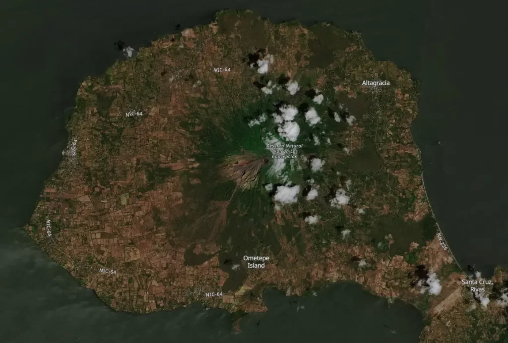
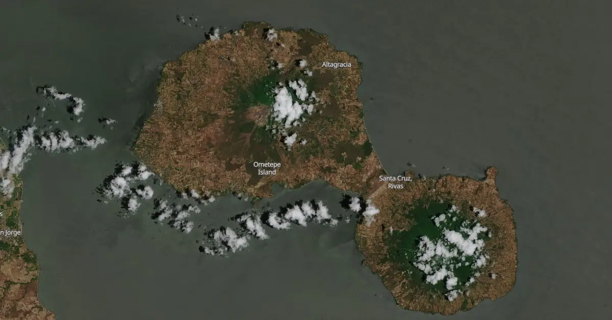
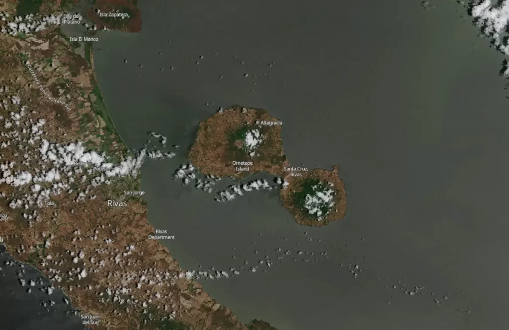
Concepción, one of Nicaragua’s highest and most active volcanoes, is a prominent basaltic-to-dacitic stratovolcano. It forms the northwestern half of the dumbbell-shaped island of Ometepe in Lake Nicaragua, connected to the neighboring Madera volcano by a narrow isthmus.
The symmetrical volcano features a steep-walled summit crater that is 250 m (820 feet) deep, with a higher western rim.
The flanks of Concepción are marked by north-south trending fractures that have produced chains of spatter cones, cinder cones, lava domes, and maars. These features are located on the northwestern, northeastern, southeastern, and southern sides of the volcano, extending in some cases down to Lake Nicaragua.
Concepción was constructed above a basement of lake sediments, and its modern cone grew above a largely buried caldera, a small remnant of which is visible as a break in slope about halfway up the northern flank.
Frequent explosive eruptions over the past half-century have significantly increased the height of the summit, making it higher than what is depicted on current topographic maps. These eruptions have kept the upper part of the volcano largely unvegetated.
References:
1 Boletin Informativo Volcan Concepción – INETER – May 16, 2024
2 Concepción – Geological summary – GVP
Featured image: Satellite image of Concepción volcano on April 2, 2024. Credit: Copernicus EU/Sentinel-2, The Watchers
Commenting rules and guidelines
We value the thoughts and opinions of our readers and welcome healthy discussions on our website. In order to maintain a respectful and positive community, we ask that all commenters follow these rules.