
Bad weather disrupts seismic monitoring, magma volume at Svartsengi increasing, Iceland
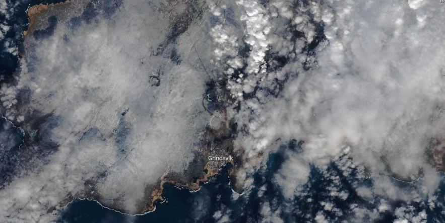
Image credit: Copernicus EU/Sentinel-2, The Watchers. Acquired on March 4, 2024
Unfavorable weather conditions have disrupted the earthquake monitoring system on Reykjanes Peninsula by dampening small events, resulting in a lower number of detected earthquakes since Saturday, March 2, 2024. Nevertheless, the volume of magma beneath Svartsengi continues to increase, which could result in a new dike intrusion and possibly an eruption with very short notice.
Seismic activity associated with the volcanic unrest has been decreasing since Saturday, March 2, with very few earthquakes detected in the past few days, the Icelandic Met Office (IMO) reported on March 7. “However, unfavorable weather conditions have disrupted seismic monitoring by dampening small events, so there have likely been additional minor earthquakes that could not be detected.”
Bad weather was expected to continue over the next 24 hours and likely continue affecting the earthquake monitoring system. “The forecast indicates that Reykjanes will experience strong winds from the southeast accompanied by rain and limited visibility, especially in mountainous regions. Precipitation will decrease in the early morning, with occasional showers coinciding with reduced visibility expected tomorrow and the following days. Winds are expected to decrease over the weekend, coming from the southeast or northwest on Sunday.”
Model calculations based on GNSS data from March 3 to 6, indicated that approximately 1.2 million m3 (42.4 million ft3) of magma has been injected into the magma chamber during this period.
This brings the total magma volume accumulated since the last eruption to approximately 10 million m3 (353 million ft3). The volume threshold that previously led to eruptions is between 8 to 13 million m³ (282.5 million to 459.1 million ft³).
“An eruption could occur with very short notice, possibly less than 30 minutes,” IMO said, adding that the most likely eruption site is between Stóra-Skógafell and Hagafell.
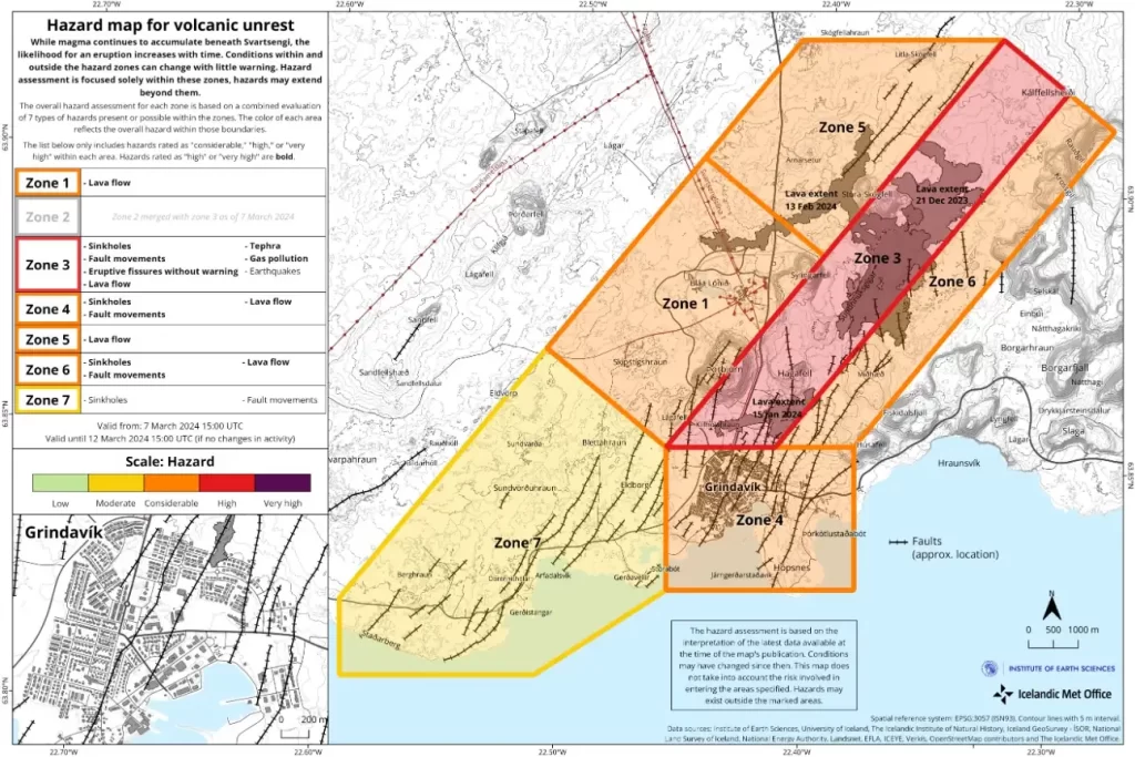
In addition, the Meteorological Office has updated the hazard assessment map on March 7. The hazard level remains unchanged from the last map, but Zones 2 and 3 have been merged into one single zone. “Given the development of the activity, there is no longer a reason to assess the risk in these areas separately,” IMO said.
This hazard assessment is valid until March 12, barring any changes to the situation.
References:
1 Increased likelihood of volcanic eruption – Updated hazard assessment. Zones 2 and 3 have been merged into one zone – IMO – March 7, 2024
I'm a dedicated researcher, journalist, and editor at The Watchers. With over 20 years of experience in the media industry, I specialize in hard science news, focusing on extreme weather, seismic and volcanic activity, space weather, and astronomy, including near-Earth objects and planetary defense strategies. You can reach me at teo /at/ watchers.news.
Commenting rules and guidelines
We value the thoughts and opinions of our readers and welcome healthy discussions on our website. In order to maintain a respectful and positive community, we ask that all commenters follow these rules.