
Magma volume under Svartsengi approaches eruption threshold, Iceland
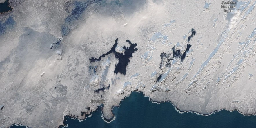
Image credit: IMO
Updated modeling shows Svartsengi’s magma volume reached 7.6 million m³ (268.3 million ft³) on February 26, 2024, and is now near or at the eruption threshold. With seismic activity increasing, particularly east of Sýlingarfell, the Norwegian Meteorological Agency has raised risk assessments, marking the Sundhnjúka crater series at high risk and adjusting other zones accordingly.
As of February 26, 2024, the volume of magma at Svartsengi has reached 7.6 million m³ (268.3 million ft³), approaching the threshold that previously led to eruptions — between 8 to 13 million m³ (282.5 million to 459.1 million ft³).
“If magma accumulation continues at this rate, the magma volume will reach the lower threshold of volume needed to trigger a dyke propagation and even an eruption on Tuesday, February 27,” the Icelandic Met Office (IMO) reported.
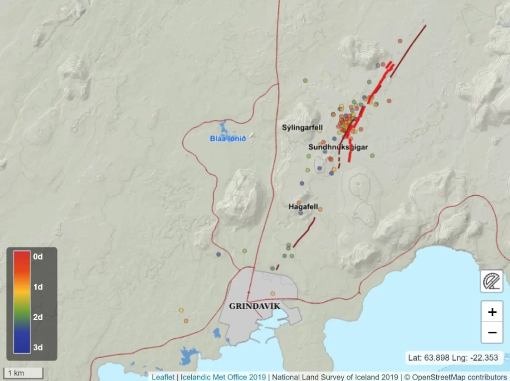
Seismic activity has intensified over the weekend, particularly just east of Sýlingarfell, in patterns that resemble those observed prior to past eruptions. This area is believed to overlay the eastern end of the magma intrusion beneath Svartsengi, further indicating a possible imminent eruption.
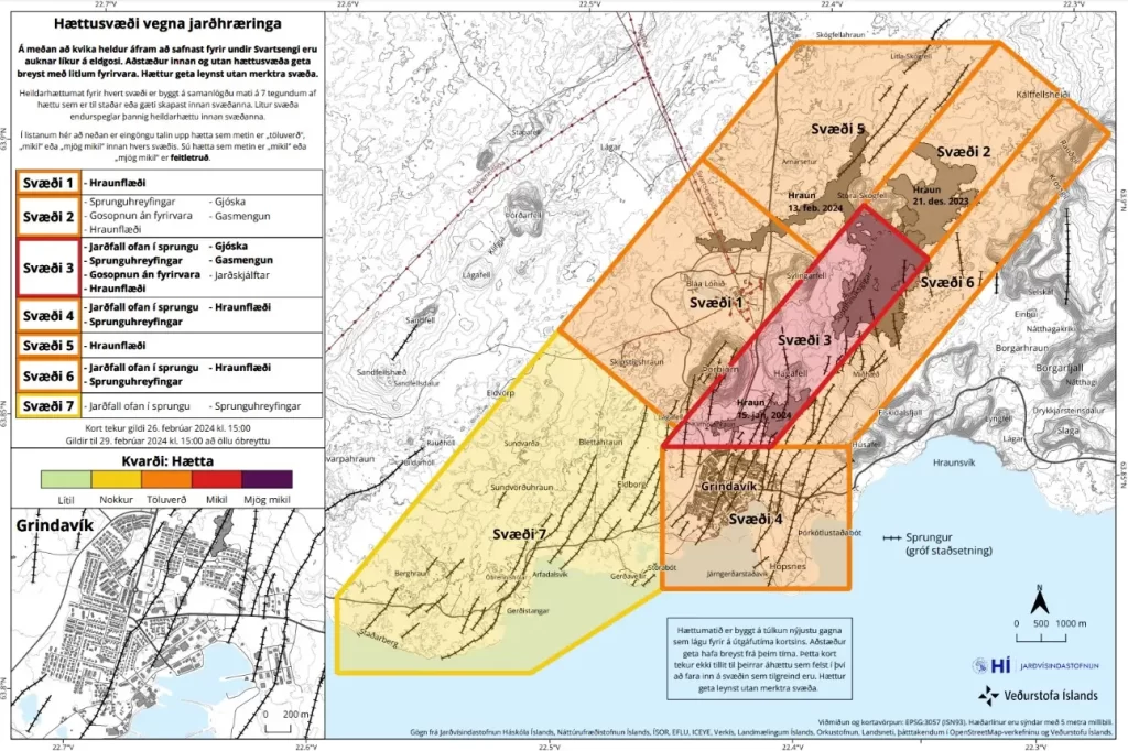
In response to these developments, the Norwegian Meteorological Agency has updated the volcanic risk assessment for the Reykjanes Peninsula.
The Sundhnjúka crater series, identified as Zone 3, has been elevated to a high risk (red), indicating eruptions could occur without warning. Zone 1, known as Black Bed, now faces considerable risk (orange) due to potential lava flows. Similarly, Grindavík, or Zone 4, maintains its orange alert but with an emphasized risk of the lava flow.
No significant land changes have been detected in Grindavík through GPS or satellite imagery. However, the emergence of new surface cracks, potentially hidden by snow or obscured by recent soil movements, remains a concern, especially with the anticipated melting snow or rainfall.
Scientists maintain that in the event of an eruption, it’s most probable for magma to traverse from Svartsengi towards the Sundhnúksgíga series, with the eruption anticipated to occur between Stóra-Skógfell and Hagafell.
The precursor to magma surfacing is characterized by sudden, intense, and localized micro-seismic activities. Drawing from historical eruption patterns in the region, the onset of an eruption could unfold with minimal warning, potentially less than 30 minutes, particularly contingent on the magma’s emergence point along the Sundhnúks crater series.
During a community meeting in Grindvík on February 26, the Norwegian Meteorological Agency unveiled lava flow projections based on the latest likely eruption scenarios. These projections, devised from a steady lava emission rate of 600 cubic meters per second (21 189 cubic feet per second), outline the potential spread and width of lava after a 6-hour duration.
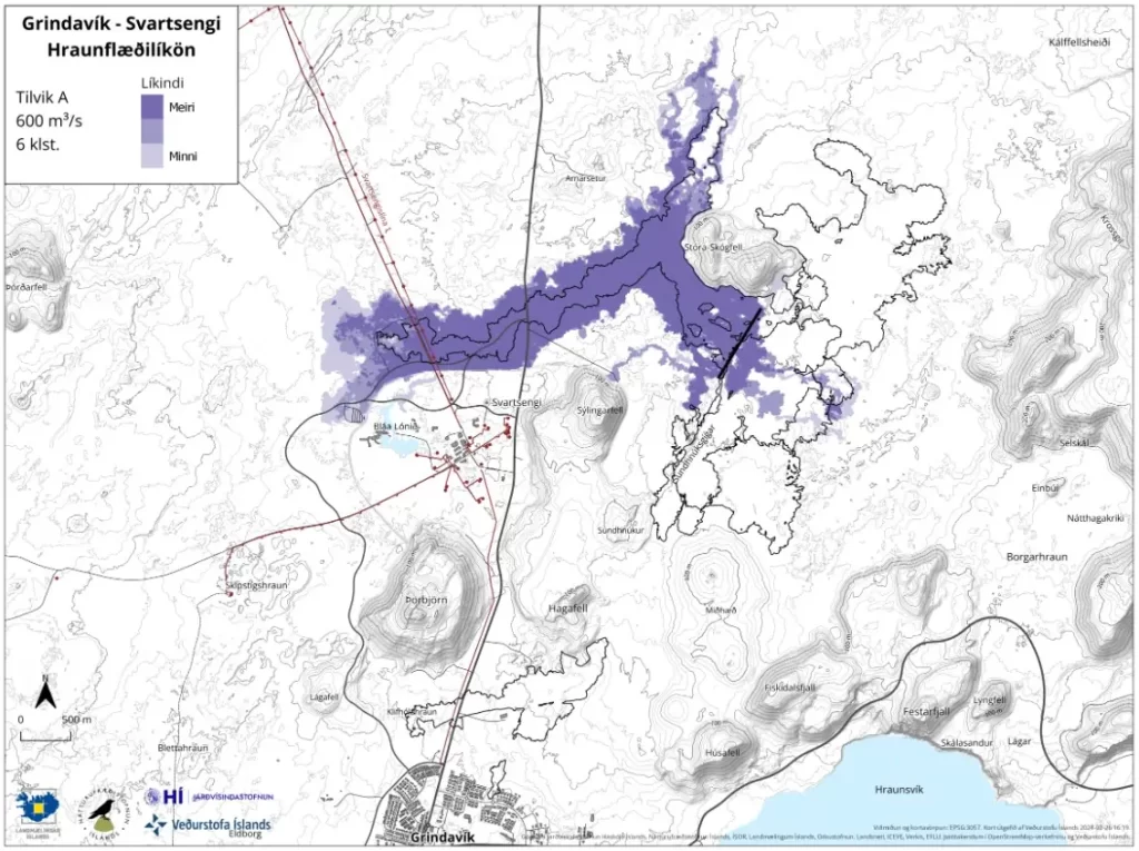
The presented models, estimating lava flow trajectories from various potential eruption sites within the Sundhnúks crater series, presuppose an eruption fissure extending 800 m (2 625 feet). These fissures are delineated with a black line on the models.
Although only a selection of scenarios were shared, the dynamics of lava flow can drastically vary, heavily dependent on the precise location of the fissure’s opening in the terrain. A minor shift in volcanic fissures could significantly broaden the scope of lava dispersion.
One such scenario involves an eruption between Sýlingarfell and Stóra-Skógfell, reminiscent of the events on December 18, 2023, and February 8, 2024. This scenario is marked by abrupt, localized, and intense micro-seismic activity, alongside deformation across the magma conduit. Given the terrain’s predisposition to magma ascent due to prior geological disturbances, an eruption notice might be exceedingly brief, under 30 minutes. Under these conditions, lava is projected to reach Grindavíkurvegi within a mere 4 hours.
References:
1 Auknar líkur á eldgosi næstu daga – Aukið hættustig í uppfærðu hættumati – IMO – February 26, 2024
I'm a dedicated researcher, journalist, and editor at The Watchers. With over 20 years of experience in the media industry, I specialize in hard science news, focusing on extreme weather, seismic and volcanic activity, space weather, and astronomy, including near-Earth objects and planetary defense strategies. You can reach me at teo /at/ watchers.news.
Commenting rules and guidelines
We value the thoughts and opinions of our readers and welcome healthy discussions on our website. In order to maintain a respectful and positive community, we ask that all commenters follow these rules.