
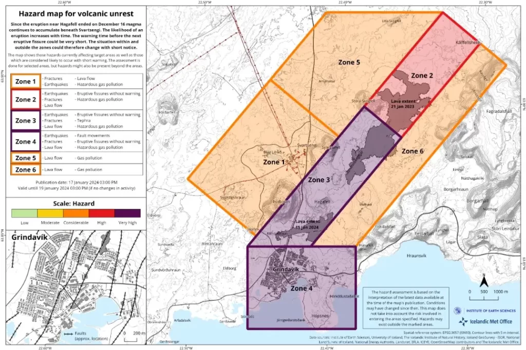
Grindavik faces significant risk of ground collapse due to fissures, Iceland
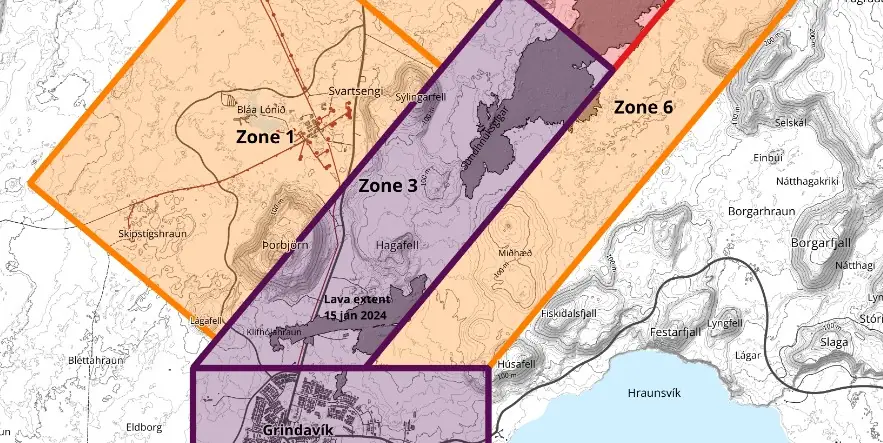
Image credit: IMO
Recent volcanic activity in the Svartsengi area has led to continuous land uplift, although the exact rate is still being determined through GNSS measurements. Around 200 earthquakes, the largest measuring M1.4, have been recorded near the magma conduit since yesterday. Despite a reduction in earthquake frequency, significant risks, including ground collapse, remain for the nearby Grindavík area.
The Svartsengi area, known for its recent volcanic activity, continues to exhibit clear signs of land rise, the Icelandic Met Office reported at 15:30 UTC on January 18, 2024.
While the precise rate of uplift is yet to be established, ongoing GNSS (Global Navigation Satellite System) measurements are being conducted to provide a comprehensive evaluation of the geological changes in the area. This follows similar deformation patterns observed after the volcanic eruption on December 18.
In the latest seismic updates, approximately 200 earthquakes have been detected near the magma conduit since yesterday. The largest of these earthquakes measured 1.4 in magnitude. Since midnight, the area has experienced around 70 smaller seismic events, indicating a decrease in frequency compared to the previous day. It’s important to note that the recent weather conditions have influenced the detection of earthquakes, but the overall trend suggests a decrease in seismic activity.
Despite the reduction in earthquake frequency, the town of Grindavík, situated in proximity to Svartsengi, faces significant risks associated with the current geological activity. The primary concern is the potential for ground collapse into the fissures that have formed in the region.
One of the GNSS meters, which was located north of Grindavík, went under lava after the second eruption in the region started on January 14, but over 20 GNSS stations are in the area and are being used.
According to computational models, magma lies shallow at the southern end of the conduit, where the land appears to be heavily fractured, making it easier for the magma to reach the surface. Therefore, there is a continued likelihood that new eruptive fissures may open without warning.
Significant deformation has occurred in connection with the graben in the eastern part of Grindavík. These movements were mostly along the fissures that formed on November 10 and had already been mapped.
References:
1 Land rise continues near Svartsengi High risk remains within Grindavík – IMO – January 18, 2024
I'm a dedicated researcher, journalist, and editor at The Watchers. With over 20 years of experience in the media industry, I specialize in hard science news, focusing on extreme weather, seismic and volcanic activity, space weather, and astronomy, including near-Earth objects and planetary defense strategies. You can reach me at teo /at/ watchers.news.
Commenting rules and guidelines
We value the thoughts and opinions of our readers and welcome healthy discussions on our website. In order to maintain a respectful and positive community, we ask that all commenters follow these rules.