
Short-lived phreatomagmatic eruption at Taal volcano, Alert Level remains at 3 (Magmatic Unrest), Philippines
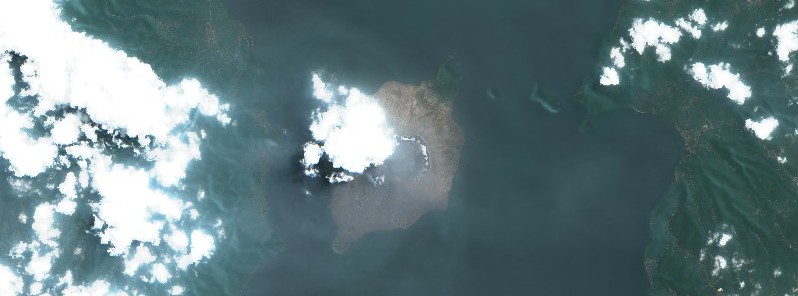
Featured image: Taal Volcano on July 1, 2021. Image credit: Copernicus EU/Sentinel-2, Sentinel Playground, TW
A short-lived phreatomagmatic eruption took place at Taal's Main Crater at 21:18 UTC on July 6, 2021 (05:18 LT, July 7), generating a grayish plume that rose 300 m (985 feet) before drifting southeast. On July 4, sulfur dioxide (SO2) gas emission reached an average of 22 628 tonnes/day, breaking the previous all-time record (for the volcano) of 14 326 tonnes/day.
In 24 hours to 00:00 UTC on July 7, the Taal Volcano Network recorded 55 volcanic earthquakes, including 1 explosion-type earthquake, 44 low-frequency volcanic earthquakes, 5 volcanic tremor events having durations of 2 to 5 minutes, 5 hybrid earthquakes, and low-level background tremor that has persisted since April 8, 2021.
High levels of volcanic sulfur dioxide or SO2 gas emissions and steam-rich plumes that rose 1 500 m (4 900 feet) before drifting southwest were generated from the Taal Main Crater.
Sulfur dioxide (SO2) emission averaged 7 560 tonnes/day on July 6, 2021.
Based on ground deformation parameters from electronic tilt, continuous GPS, and InSAR monitoring, Taal Volcano Island has begun deflating in April 2021 while the Taal region continues to undergo very slow extension since 2020, PHIVOLCS reports.
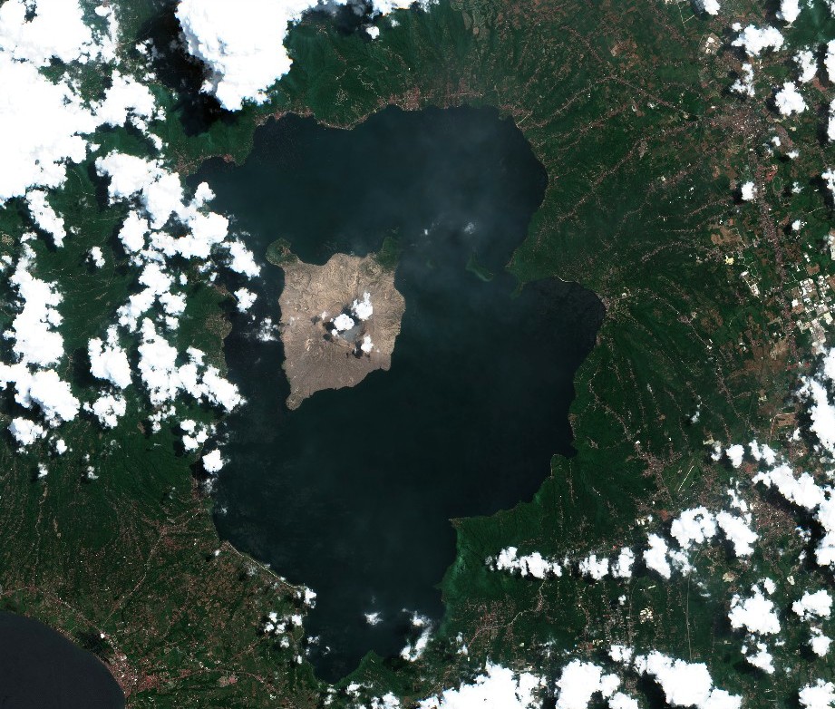
Taal Volcano on June 26, 2021. Image credit: Copernicus EU/Sentinel-2, Sentinel Playground, TW
Alert Level 3 (Magmatic Unrest) prevails over Taal Volcano. At Alert Level 3, magma extruding from the Main Crater could drive explosive eruption.
"The public is reminded that the entire Taal Volcano Island is a Permanent Danger Zone (PDZ), and entry into the island as well as into the high-risk barangays of Agoncillo and Laurel must be prohibited due to the hazards of pyroclastic density currents and volcanic tsunami should strong eruptions occur," PHIVOLCS said.
All activities on Taal Lake should not be allowed at this time, it added.
"Communities around the Taal Lake shores are advised to remain vigilant, take precautionary measures against possible airborne ash and vog and calmly prepare for possible evacuation should unrest intensify."
Pilots are reminded to avoid flying over Taal Volcano Island as airborne ash and ballistic fragments from sudden explosions and pyroclastic density currents such as base surges may pose hazards to aircraft.
The highest levels of volcanic sulfur dioxide or SO2 gas emission at Taal volcano were recorded on July 4, 2021, at an average of 22 628 tonnes/day — representing the highest ever recorded over the volcano.
The previous record was set on June 28, 2021, with 14 326 tonnes/day.
A major eruption at Taal in January 2020 ejected volcanic ash up to 16.7 km (55 000 feet) above sea level, according to data provided by the Tokyo VAAC. The volcano produced powerful pyroclastic and lava flows, destroying scores of homes, killing livestock, and forcing more than 135 000 people to evacuate.
Taal has produced some of the Philippines' most powerful eruptions. Large pyroclastic flows and surges from historical eruptions have caused many fatalities.
[From our archives: Taal]
July 1, 2021, phreatomagmatic eruption at Taal volcano. Credit: PHIVOLCS
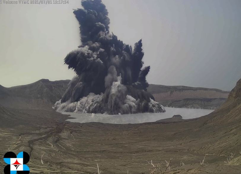
Image credit: PHIVOLCS
Geological summary
Taal is one of the most active volcanoes in the Philippines and has produced some of its most powerful historical eruptions. Though not topographically prominent, its prehistorical eruptions have greatly changed the topography of SW Luzon.
The 15 x 20 km (9 x 12 miles) Talisay (Taal) caldera is largely filled by Lake Taal, whose 267 km2 (103 mi2) surface lies only 3 m (9.8 feet) above sea level.
The maximum depth of the lake is 160 m (525 feet), and several eruptive centers lie submerged beneath the lake. The 5 km (3.1 miles) wide Volcano Island in north-central Lake Taal is the location of all historical eruptions.
The island is composed of coalescing small stratovolcanoes, tuff rings, and scoria cones that have grown about 25% in the area during historical time. Powerful pyroclastic flows and surges from historical eruptions have caused many fatalities. (GVP)
I'm a dedicated researcher, journalist, and editor at The Watchers. With over 20 years of experience in the media industry, I specialize in hard science news, focusing on extreme weather, seismic and volcanic activity, space weather, and astronomy, including near-Earth objects and planetary defense strategies. You can reach me at teo /at/ watchers.news.
Commenting rules and guidelines
We value the thoughts and opinions of our readers and welcome healthy discussions on our website. In order to maintain a respectful and positive community, we ask that all commenters follow these rules.