Increased volcanic activity reported near Fagradalsfjall, Iceland
An increase in volcanic activity was reported near the Fagradalsfjall eruption site in Southwest Iceland on Saturday, June 26, 2021. If the development continues, authorities said lava will flow sooner than expected over Suðurstrandarvegur road, a key road that connects Grindavik and South Iceland.
After lying dormant for 800 years, the volcano in the Fagradalsfjall eruption site erupted on March 19, 2021, and has continued erupting ever since.
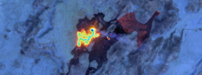
A satellite image taken June 26 showed increased volcanic activity at the Fagradalsfjall eruption site. The picture, taken using near-infrared light, display heat distribution in the lava, where the active lava flow is red and yellow and the white areas indicate the vent and lava channels.
"There is much more activity [at the eruption site] than before," said Þorvaldur Þórðarson, professor of volcanology at the University of Iceland. "Most of the surface flow from the crater flows into Geldingadalur valley."
The yellow dots near the center indicate lava lakes. In Meradalur valley, the crust looks thick but underneath it is burning lava, he added.
Some change is also taking place in Geldingadalir valley, which will possibly increase stress on a protective wall toward the south. The wall, which was completed last week, stands 5 m (16 feet) and is 200 m (656 feet) long.
"If more is flowing into Geldingadalir valleys, it is a reason for worry, since it means that the course of events will be faster," said Þorvaldur.
If the volcanic activity continues, lava will flow sooner than expected from Nátthagakriki valley over Suðurstrandarvegur road, which is a major road that links the town of Grindavik and South Iceland.
After crossing the road, the lava could continue flowing toward the ocean.
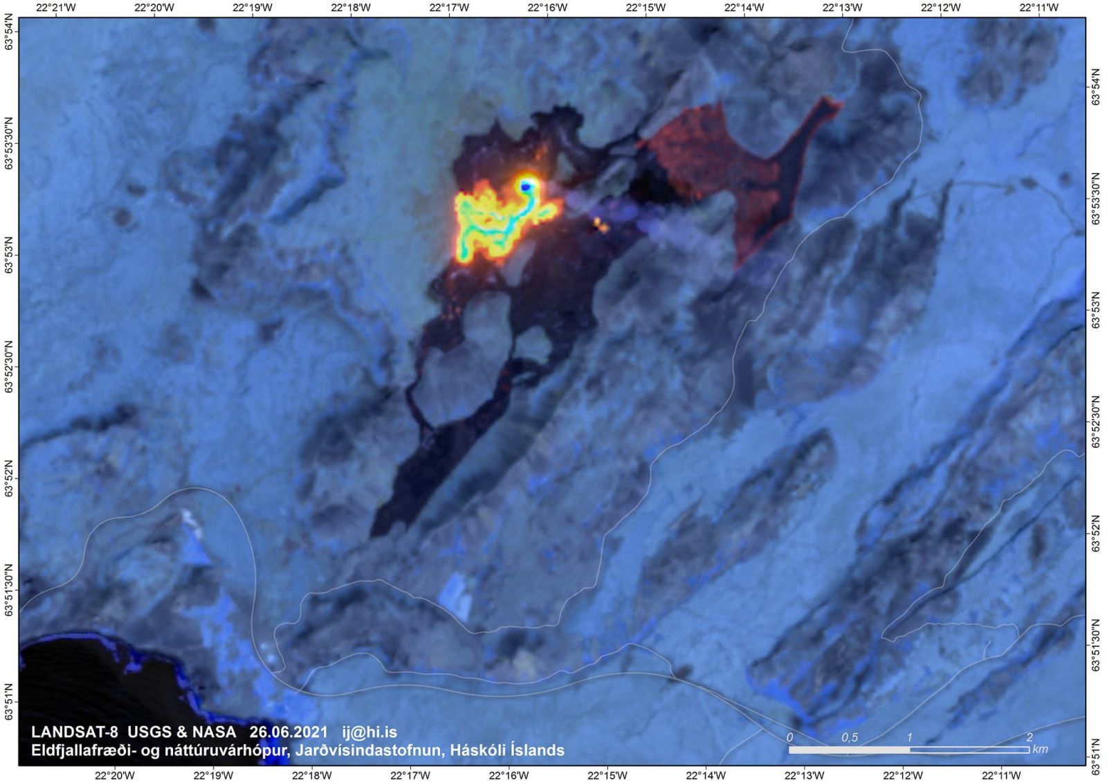
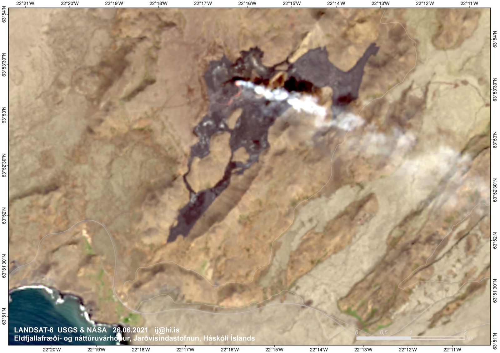
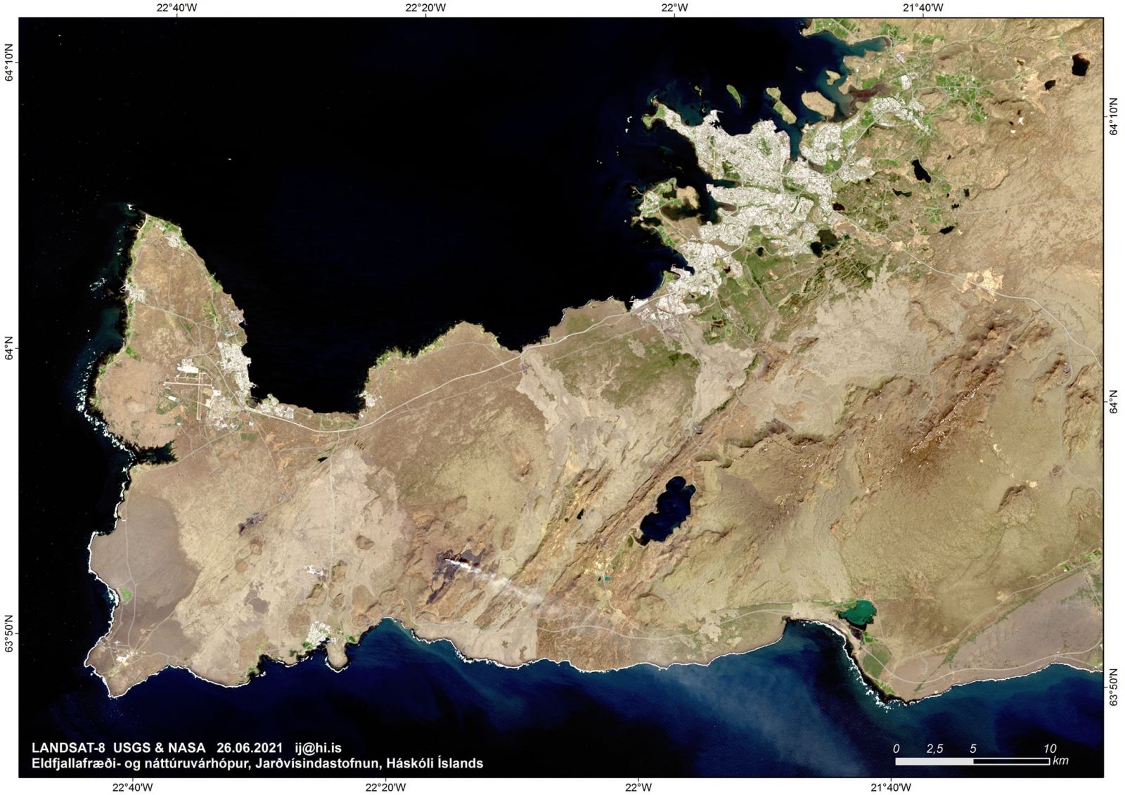
Image credit: Landsat-8, USGS & NASA
Geological summary
The Krýsuvík-Trölladyngja volcanic system is described by the Catalogue of Icelandic Volcanoes as an approximately 50 km (31 miles) long composite fissure swarm trending about N38°E, including a 30 km (18 miles) long swarm of fissures, with no central volcano.
It is one of the volcanic systems arranged en-echelon along the Reykjanes Peninsula west of Kleifarvatn lake.
The Fagradalsfjall and Krýsuvík fissure swarms are considered splits or secondary swarms of the Krýsuvík–Trölladyngja volcanic system.
Small shield volcanoes have produced a large portion of the erupted volume within the system.
Several eruptions have taken place since the settlement of Iceland, including the eruption of a large basaltic lava flow from the Ogmundargigar crater row around the 12th century.
The latest eruption, identified through tephrochronology, took place during the 14th century. (GVP)
Featured image credit: Landsat-8, USGS & NASA
Some one reported that this is not a volcano eruption, but rather a Plate Boundary rupture. I felt a large shift west to east in California at 11:00 P.M. on Feb 23, 2021, then again three hours later at 2:05 A.M. on the morning of the 24th. The large quake in Greenland occurred at 2:05 A.M. California time. The shifting felt different than a regular earth quake. I know this sounds like unbelievable, but it is true. A rupture in the Plate boundary is a major event, and this looks to be just that.