
Tropical Cyclone “Imogen” to hit Queensland with strong winds, dangerous storm tide and heavy rain, Australia
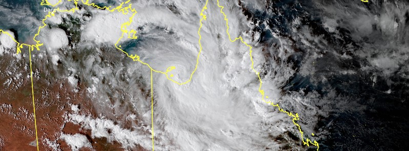
Featured image: Tropical Cyclone "Imogen" at 07:40 UTC on January 3, 2021. Credit: JMA/Himawari-8, RAMMB/CIRA/ TW
Tropical Cyclone "Imogen" formed in the Gulf of Carpentaria, Australia at 06:00 UTC on January 3, 2021, as the first named storm of the 2020/21 Australian region cyclone season.
- The forecast track takes Imogen ESE and over the southeast Gulf coast near Karuimba tonight, January 3, or early Monday morning, January 4 (LT!).
- BOM urged people living between Mornington Island and Kowanyama, including Burketown, to remain inside until the cyclone has passed and follow official channels.
- Gales with wind gusts to 110 km/h (68 mph) extend out to about 100 km (62 miles) from the center of the cyclone. These winds are already occurring on Mornington Island and are likely to develop about the coastal and island communities between Mornington Island and Kowanyama, including Burketown, from this evening and overnight until the cyclone makes landfall.
- Coastal residents between Mornington Island and Kowanyama are specifically warned of the dangerous STORM TIDE as the cyclone crosses the coast on tonight's high tide. The sea is likely to rise steadily up to a level well above the normal tide, with damaging waves and flooding of some low-lying areas close to the shoreline. People living in areas likely to be affected by this flooding should take measures to protect their property as much as possible and be prepared to follow instructions regarding evacuation of the area if advised to do so by the authorities.
A tropical low formed on January 1 near Groote Eylandt in the western Gulf of Carpentaria, about 635 km (395 miles) ESE of Darwin in favorable environmental conditions, characterized by very warm sea surface temperatures of up to 31 °C (88 °F), low to moderate vertical wind shear and established poleward outflow channel in the upper levels.
A Tropical Cyclone Watch was issued by the Australian Bureau of Meteorology (BOM) at 00:00 UTC on January 2 for parts of the northwestern Queensland coast.
Tropical Cyclone "Imogen" at 07:40 UTC on January 3, 2021. Credit: JMA/Himawari-8, RAMMB/CIRA/ TW
The low continued intensifying and was named Imogen at 06:00 UTC today. At the time, the system had maximum 10-minute winds of 65 km/h (40 mph), maximum 3-second wind gusts up to 100 km/h (62 mph), and a central pressure of 991 hPa. It was moving SE at 12 km/h (7 mph).
"System organization had continued to improve during the day with deep convection concentrating near the center over the past 6 hours. Dvorak analysis based on a persistent convective band wrapped 0.6 to 0.8 degrees giving a DT=3.0 over the last 6 hours," BOM said in a bulletin released 07:25 UTC.
The cyclone remains in a favorable environment with deep moisture inflow, weak wind shear, and favorable outflow channels.
Under these conditions, further development would be forecast, however, given the sustained southeastwards movement, the system will run out of spending enough time over water to intensify any stronger than a category 1 cyclone.
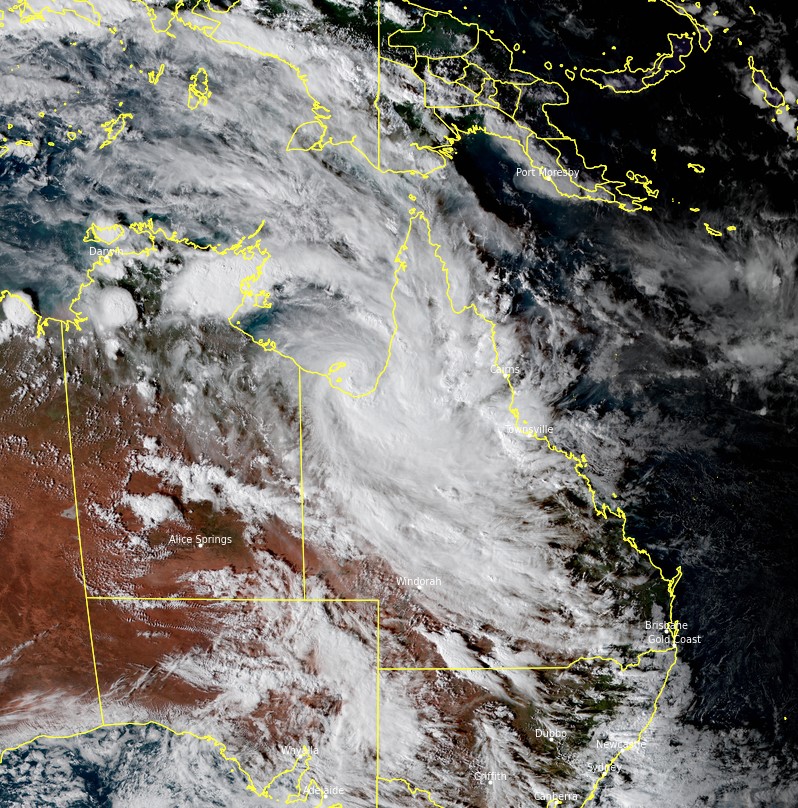
.png)
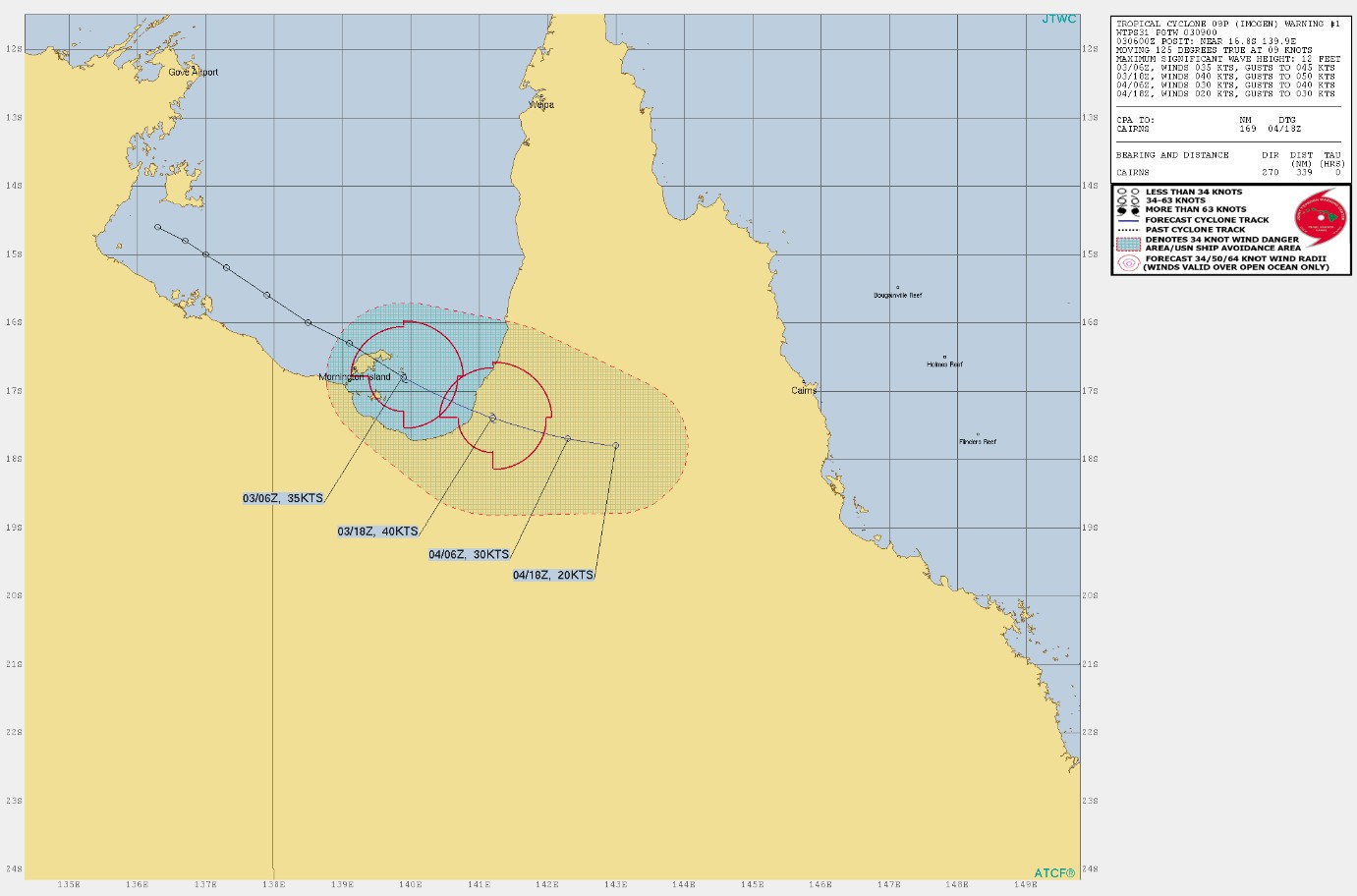
As of 16:40 AEST on January 3, 2021, the center of Imogen was located about 130 km (80 miles) N of Burketown and 165 km (102 miles) NW of Karumba. It was moving SE at 12 km/h (7 mph).
The latest forecast track takes it ESE and over the southeast Gulf coast near Karuimba tonight, or early Monday morning (LT!).
Once it makes landfall, it will become slow-moving over the southern Cape York Peninsula as a tropical low.
Mornington Island to Kowanyama, including Burketown and inland areas to Croydon, are under Warning Zone.
Gales with wind gusts to 110 km/h (68 mph) extend out to about 100 km (62 miles) from the center of the cyclone. These winds are already occurring on Mornington Island and are likely to develop about the coastal and island communities between Mornington Island and Kowanyama, including Burketown, from this evening and overnight until the cyclone makes landfall.
Coastal residents between Mornington Island and Kowanyama are specifically warned of the dangerous STORM TIDE as the cyclone crosses the coast on tonight's high tide.
The sea is likely to rise steadily up to a level well above the normal tide, with damaging waves and flooding of some low-lying areas close to the shoreline.
People living in areas likely to be affected by this flooding should take measures to protect their property as much as possible and be prepared to follow instructions regarding evacuation of the area if advised to do so by the authorities.
HEAVY RAINFALL that is likely to lead to flash flooding, flooding of low lying areas and riverine flooding is likely about the southeast Gulf of Carpentaria coast and adjacent inland this afternoon.
Heavy rainfall is likely to spread to the remaining areas of southern Cape York Peninsula on Monday as the low or tropical cyclone moves onto the coast and further inland. A separate severe weather warning is current for damaging wind gusts and heavy rainfall elsewhere.
BOM urged people living between Mornington Island and Kowanyama, including Burketown, to remain inside until the cyclone has passed and follow official channels for the latest information and advice.
I'm a dedicated researcher, journalist, and editor at The Watchers. With over 20 years of experience in the media industry, I specialize in hard science news, focusing on extreme weather, seismic and volcanic activity, space weather, and astronomy, including near-Earth objects and planetary defense strategies. You can reach me at teo /at/ watchers.news.
Commenting rules and guidelines
We value the thoughts and opinions of our readers and welcome healthy discussions on our website. In order to maintain a respectful and positive community, we ask that all commenters follow these rules.