
Arctic cold arrives, bringing early spring snow and extremely low temperatures to much of Europe
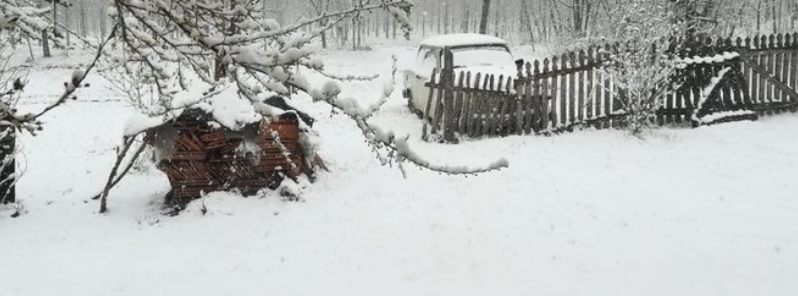
Image credit: @Zdeneknejedly/Twitter
A major Arctic cold outbreak has arrived in Europe over the weekend, dumping snow to much of the continent following unusually warm winter. Meteoalarm has issued heavy snow, strong wind, and extremely cold temperature warnings for many countries.
The cold is expected to create hazardous frost conditions which may affect blossoming trees, and most importantly, it could potentially aggravate the ongoing coronavirus pandemic, especially in Italy where the cases have soared to more than 60 000.
European weather services Meteoalarm has issued the following warnings: snow, winds, and extremely cold temperatures in Slovakia, Bosnia and Herzegovina, Bulgaria; snow in Croatia, Serbia, Romania, North Macedonia, as well as France, Greece, and Hungary; winds and extremely low temperature in Germany; extremely low temperatures in Poland, Montenegro, and Austria; lastly, snow and winds in Italy.
"We are just seeing a pretty strong outbreak of cold air mass into east-central Europe this week, there is more coming soon," said Severe Weather Europe (SWE).
"It appears likely another very powerful ridge/high-pressure system will form over North Atlantic and introduce a significant cold outbreak into western and potentially also southwestern Europe through the final days of March. Even snowfall will be possible," it added.
"Although the air mass is indeed coming from the Arctic region, it does not mean the cold will be very extreme. But the last days of March will be much colder than normal, that’s pretty much likely to expect based on the global ensemble model guidance."
On Tuesday, some parts of the central and eastern region already saw heavy snow and intense blizzard conditions.
"Spring snowfall also reached south into North Macedonia," SWE wrote, sharing a photo taken by a local. Whiteout conditions were observed as well in Sofia, Bulgaria, as snow blanketed the roads.
Spring snowfall, today in Sofia, Bulgaria.
Thanks to Nick Vasilkovski for sending the video. Posted with permission. pic.twitter.com/VqK72bKtSf
— severe-weather.EU (@severeweatherEU) March 23, 2020
"Meanwhile, in Belgrade, Serbia, snow-covered flowers and they look even more beautiful now," said one user on Facebook. "We have a lot of snow here," she added.
About 10 to 20 cm (4 to 8 inches) of snow fell in some locations in Slovenia, while powerful blizzard conditions were felt in the northeastern region, particularly on the south slope of Pohorje Massif. Higher amounts were reported across mountainous areas.
Serbia today with 10-20 cm of fresh snow
Kragujevac (p. 1, 173 m) 24 cm
Krusevac (163 m) 22 cm
Belgrade 9 cmhttps://t.co/L9QjZj2q01 pic.twitter.com/xt0VNr1gde— Zdenek Nejedly (@ZdenekNejedly) March 24, 2020
Citizens in Croatia were greeted by the rare sight of spring snow, after a mild winter and almost no snow. "In fact, the weather has been unusually warm throughout winter, with very little snow at all," said author Paul Bradbury of Total Croatia News.
"I remember clearing the drive-in temperatures of -18 °C (-0.4 °F) last winter in Varazdin, but I didn't need to get my shovel out this year, and it only snowed twice."
Very rare snow was even reported in Dubrovnik, southern Croatia, although not that much to stick to the ground.
Poland just received its first heavy frost this year, which has caused damage to produce. The extent of the damage is yet to be determined.
Vorst in Polen pic.twitter.com/xNWCUhtcoj
— Fruitteeltonline (@Fruitteelt_onl) March 24, 2020
Meanwhile, parts of southern Italy woke up to snow and hail on Tuesday morning as temperatures plummeted across the country. Areas in the higher altitudes of central Italy reported snow as well.
The frosty weather is expected to continue in the country until Thursday, March 26, which is "decidedly unusual for this time of year," said the nation's meteorological services.
"Particularly on Wednesday and Thursday, temperatures will remain below normal, while the snow will fall again on low altitudes in the inland areas of the center-south, and also in the Alps."
It was snowing like that over Roseto Valforte (FG), north Apulia, #Italy, just a couple of hours ago. Thanks to #meteopugliainfoto and Vito Giannini for the report #snow #apulia pic.twitter.com/FgnDqg36qL
— Paolo Saracino (@PaoloSaracino10) March 24, 2020
Because things aren't weird enough already, this morning it's snowing heavily here in Bari. (We were sunbathing on the balcony this weekend…) pic.twitter.com/myyxFVOwCJ
— Clare Speak (@ClareinItaly) March 24, 2020
Residents in Hungary shared photos and videos of fresh snow across the country, with some areas also seeing up to 10 cm (4 inches).
"[I] live in Hungary, and it’s really uncommon to see snow towards the end of March, especially when a few days ago I only needed a hoodie when went outside to see the spring flowers, and now it’s like this," wrote one Twitter user.
Up to 10 cm of fresh snow also in Southern Hungary. https://t.co/yn2WAfM2PH pic.twitter.com/3uWIZO2DAF
— Zdenek Nejedly (@ZdenekNejedly) March 23, 2020
بعرف زهقتوا الثلج بس والله فشي غير هالموضوع نحكي فيه #COVID2019 #QuarantineLife #Hungary #Pécs #Snow pic.twitter.com/Jw13CasXdu
— Haneen R. Atallah (@HaneenAtallah) March 24, 2020
Let it snow… #letitsnow #snow #stayhome #Takecareofeachother #openthewindow #almostspring #hungary pic.twitter.com/84XhfDHLQD
— Melinda90 (@Melinda908) March 24, 2020
For the Balkans, AccuWeather meteorologist Tyler Roys said up to 8 cm (3 inches) of snow may fall in the middle of this week, including areas in lower elevations.
SWE noted as well that the last days of March will be much colder than usual. The cold advection is expected to begin Friday night, March 27, following the faster-rising pressure of the North Atlantic high-pressure system.
A very cold air mass then collects over the Greenland Sea, spreading directly south towards the North Sea, Scandinavia, and the UK by Saturday, March 28.
On Sunday, March 20, as the upper-ridge becomes powerful and the related trough deepens over western Europe, the cold advection strengthens and continues further south into France and Iberia, said SWE.
"The last days of March will, therefore, be quite cold across western Europe, with potentially frosty mornings across UK, Ireland, and Wales. Also over Benelux and northern France."
Looks like the atmosphere is trying to heal now that commercial aviation has grounded the majority of planes. Global Aviation “admits” to only 8% of Global emissions…BUT they are only counting 10% of their total emissions, only those 3000 feet and lower. Ninety percent of aviation’s emissions are above 3000feet…WHAT IS AVIATION’S TRUE GLOBAL EMISSIONS? Perhaps “clearing the air” should be something we pay EXTREME attention to. Looks like the Arctic is trying to heal and if we can STOP lying about flying and keep the planes grounded may be we can stop destroying the planet! Reverse global warming and Arctic sea ice melt and methane hydrate releases. Ground based emissions do not travel very far from their sources, unlike aviation that loads the jet stream with emissions and the world tries to blame cattle. Are we really that ridiculous?