
Massive glacier collapse and catastrophic mudflow near Machu Picchu, Peru
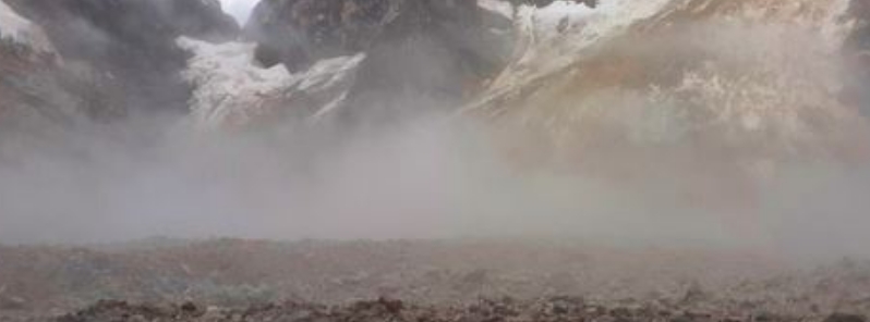
Image credit: Benito Moncado, Diario Correo
A massive glacier collapse took place near Machu Picchu (Cusco Region, Urubamba Province) on February 23, 2020, resulting in a catastrophic debris flow that claimed the lives of at least four people and left 13 others missing.
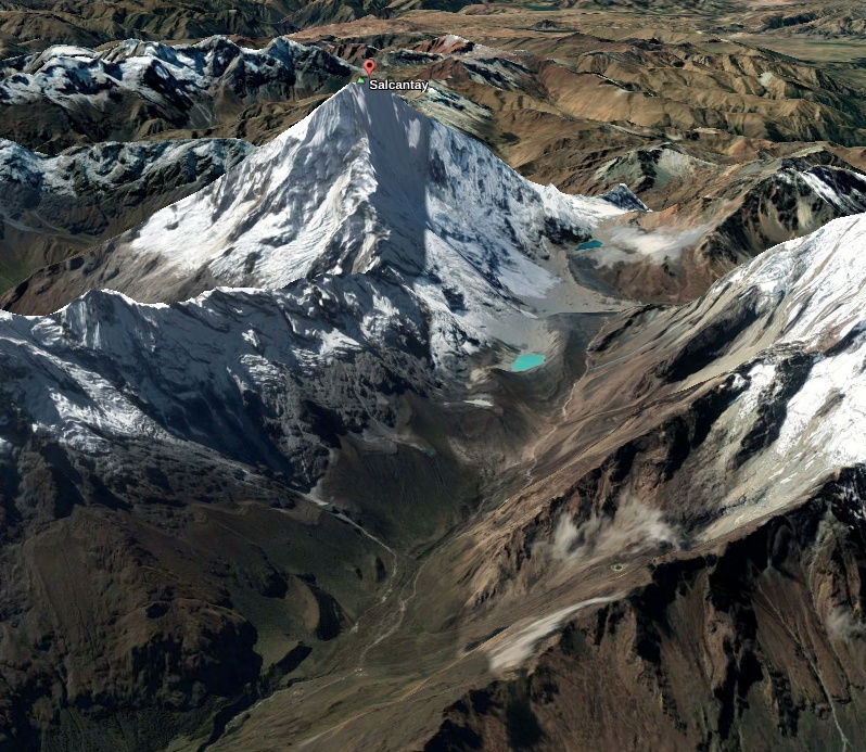
Diario Correo reported that the event was caused by a glacial collapse on Salkantay mountain, based on a hypothesis by hydrology and glaciology specialist Oscar Vilca Gomez.
Gomez said he had visited the site of the detachment as part of a research team from the National Institute for Glacier Research of the Ministry of Environment.
An estimated 400 000 m3 (14 million ft3) of ice, rocks and other material fell off the west face of the mountain into Salkanraycocha lagoon, drastically increasing the flow of the Salkantay River.
The debris flow affected at least 15 villages on both sides of the river bed, claiming the lives of at least 4 people and leaving 13 missing, as of February 27.
The total figures are uncertain given the magnitude of the flow.
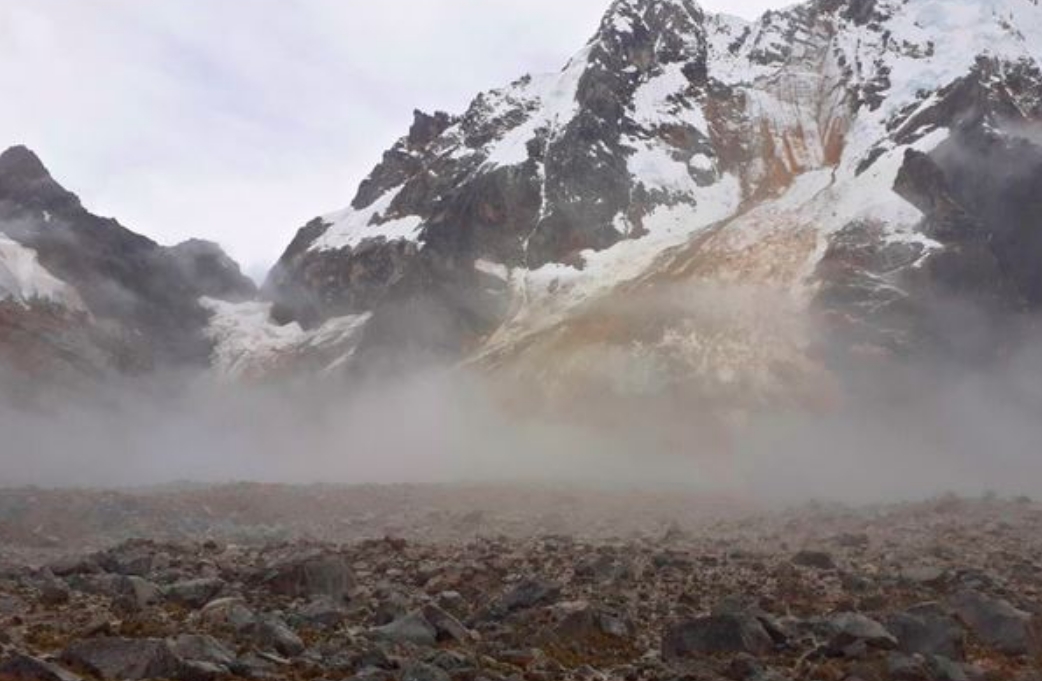
Image credit: Benito Moncado, Diario Correo
Local, regional and national authorities provided help to isolated communities, and are still searching for the missing people.
According to the initial assessment by Dr. Dave Peley of The Landslide Blog, there appears to be a wedge failure in the rock mass that has fragmented and caused the ice avalanche. As of writing, it is yet to be cleared as to which slope has failed to generate the avalanche.
The event can be compared to the 2012 Gayari avalanche in Pakistan and the 2017 Villa Santa Lucia landslide in Chile, Petley noted.
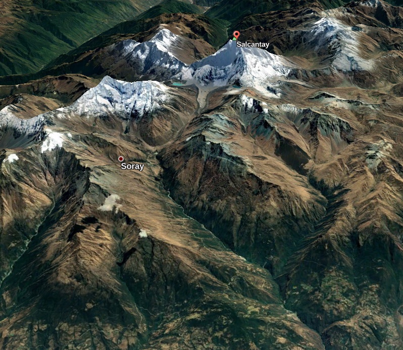
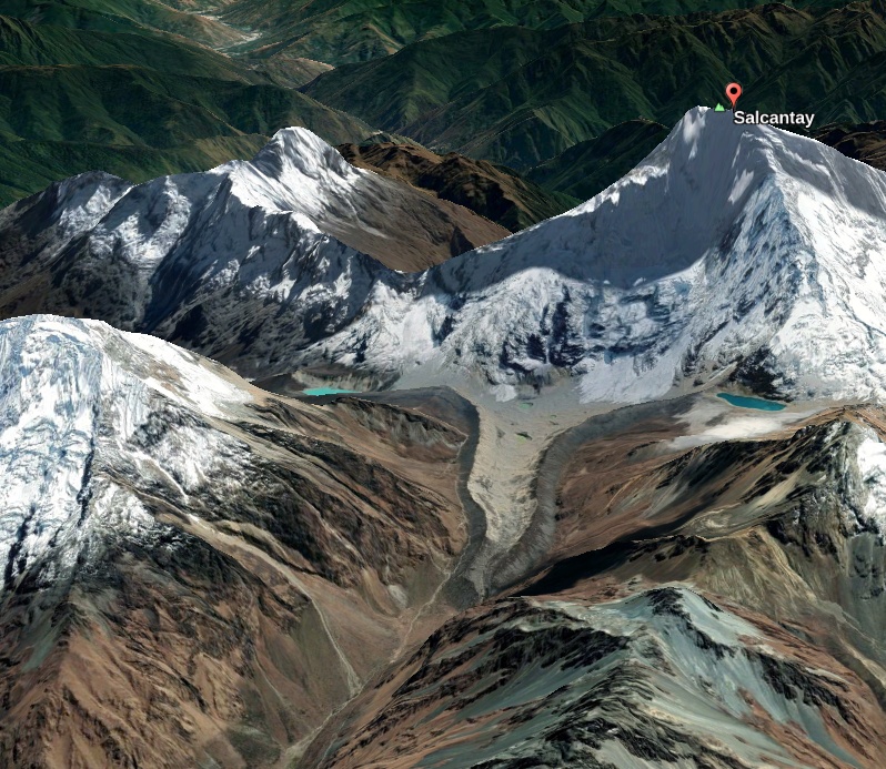
Images courtesy Google Earth, TW
Update
February 28, 11:18 UTC
Peru Tourism posted an image apparently showing the scar of the initial failure:
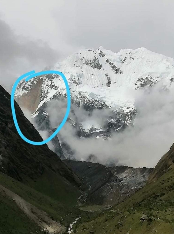
Image credit: @PeruTravelExpe/Twitter
"If this is indeed the scar then my interpretation is that this is a classic wedge failure in the rock mass, with a near-vertical fall onto the ice and moraine at the toe of the slope," Petley noted on February 28.
He added that the rock slope would have been a combination of rock and ice, both on the surface and within fractures.
The mass likely fragmented on impact, forming an ice or rock avalanche. This then caught debris and ice or water, eventually becoming the mudflow seen on the footage.
The mudflow moved in a manner similar to a lahar, with a huge volume, high velocity, and long-runout.
Meanwhile, a water scientist and civil engineer Julio Montenegro posted his interpretation of the event on his social media account, based on an image of the scar traced on pre-event imagery.
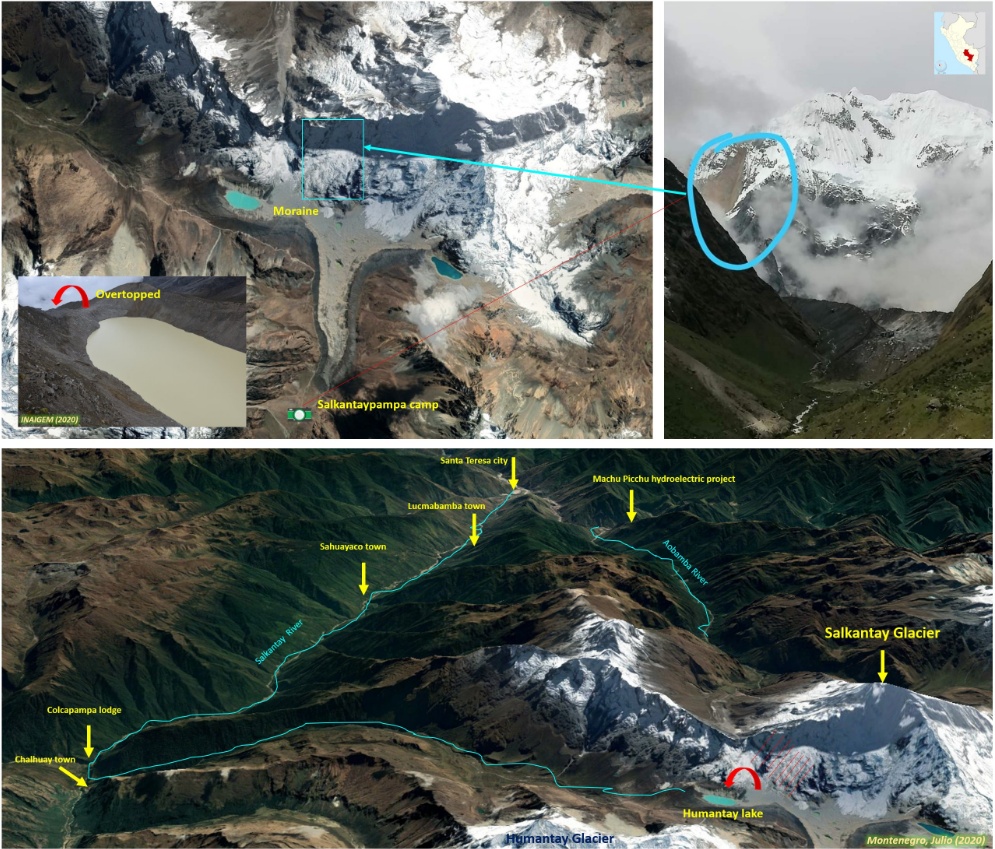
Image credit: Julio Montenegro G.
As of early February 28, the confirmed death toll stands at 5, the number of missing people at 10, and injured at 13.
Global warming may be a player in this sort of event.
McGuire, 2010, Potential for a hazardous geospheric response to projected future climate changes
http://rsta.royalsocietypublishing.org/content/368/1919/2317.abstract
Good reporting Julie. Can we have some followup once the point of failure is established and possibly some sat imagery before / after showing extent and path of flow.
Kind Regards
Peter Rigney
Hi, Mr. Peter Rigney. Thank you very much for the feedback. We just did an update with the available information we have so far. Unfortunately, we weren’t able to take clear satellite images yet of the aftermath due to clouds. Will wait for a cloudless day.