
Taal volcano alert down to level 3, PHIVOLCS warns the threat of a dangerous explosion is not over, Philippines
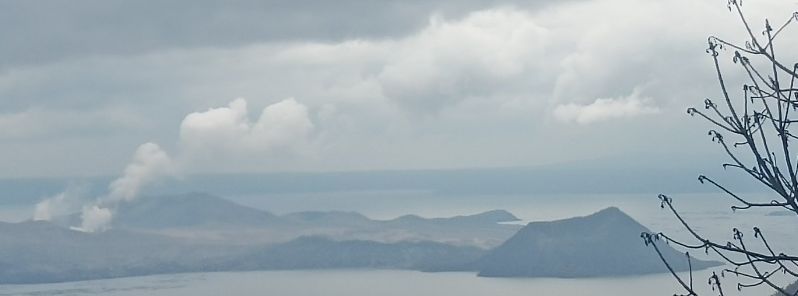
Image credit: @lennah_chan/Twitter
Taal Volcano in Batangas province, Philippines, was downgraded from Alert Level 4 to 3 on Sunday morning, January 26, 2020– two weeks after its devastating ash eruption on January 12. However, PHIVOLCS warned that this does not indicate that the threat of a dangerous explosion is over.
According to a bulletin posted by PHIVOLCS on Monday, January 27 at 08:00 LT (12:00 UTC), activity in the main crater during the last 24 hours had weak to moderate emission of white plumes 50 to 800 m (164 to 2 625 feet) high which drifted northeast. 170 volcanic quakes including 4 low-frequency tremors were also recorded.
As level 3 is maintained over the volcano, the agency reminded people that sudden explosions, volcanic quakes, ashfall, and gas expulsions can still take place and threaten areas within Taal Volcano Island and lakeshores nearby.
Areas within a 7 km (4 miles) from the main crater remains off-limits, down from a 14 km (9 miles) radius implemented when the volcano was on Alert Level 4.
Moreover, the agency advised local government units to assess areas outside the radius for "damages and road accessibilities and to strengthen preparedness, contingency, and communication measures in case of renewed unrest."
"People are also advised to observe precautions due to ground displacement across fissures, frequent ashfall, and minor earthquakes. Communities beside active river channels particularly where ash from the main eruption phase has been thickly deposited should increase vigilance when there is heavy and prolonged rainfall since the ash can be washed away and form lahars along the channels."
TAAL VOLCANO BULLETIN 26 January 2020 8:00 AM
This serves as a notice for the lowering of Taal Volcano’s status from Alert Level 4 (hazardous eruption imminent) to Alert Level 3 (decreased tendency towards hazardous eruption). #TaalVolcano pic.twitter.com/VMu7d5hLek— PHIVOLCS-DOST (@phivolcs_dost) January 26, 2020
Taal Volcano downgraded to alert level 3. pic.twitter.com/lOZk8vLlbX
— Mark Salazar (@MarkSalazarGMA7) January 26, 2020
LOOK: Part of the roofing caved in at the chapel of San Bartolome in Bgy. Pamiga. A village official said over 90 percent of the houses & structures there suffered damage during & after the #TaalVolcano eruption pic.twitter.com/XBWhOnaWOg
— Anjo Bagaoisan (ᜀᜈ᜔ᜇᜒᜌᜓ ᜊᜄᜏᜒᜐᜈ᜔) (@anjo_bagaoisan) January 27, 2020
The towns of Agoncillo and Laurel in the province have lifted their lockdown orders, except in some villages within the danger zone including Bilibinwang, Subic Ilaya, Banyaga, Bugaan East, Buso-Buso, and Gulod.
In a phone interview, Agoncillo Mayor Daniel Reyes said residents were allowed to return to their homes after they were forced to evacuate two weeks ago.
"I told them, the head of the families first so they could clean up their homes before the elders and children come home. The ash poses risks of respiratory illnesses," Reyes said.
"Other residents have their own deep wells where they could get water for cleaning up," he added as power and water supply had been restored in some parts of the town.
PHIVOLCS, however, noted that the downgrading of Taal's alert level does not indicate that the volcano's unrest has stopped.
"Should an uptrend or pronounced change in monitored parameters forewarn a potential hazardous explosion, the Alert Level may be raised back to Alert Level 4," it said.
According to the National Disaster Risk Reduction and Management Council (NDRRMC) report on Sunday, around 376 327 individuals or 98 187 families had been affected by Taal Volcano's activity.
Geological summary
Taal is one of the most active volcanoes in the Philippines and has produced some of its most powerful historical eruptions. Though not topographically prominent, its prehistorical eruptions have greatly changed the topography of SW Luzon. The 15 x 20 km (9 x 12 feet) Talisay (Taal) caldera is largely filled by Lake Taal, whose 267 km2 (103 mi2) surface lies only 3 m (9.8 feet) above sea level.
The maximum depth of the lake is 160 m (525 feet), and several eruptive centers lie submerged beneath the lake. The 5-km-wide (3.1 miles) Volcano Island in north-central Lake Taal is the location of all historical eruptions. The island is composed of coalescing small stratovolcanoes, tuff rings, and scoria cones that have grown about 25% in the area during historical time. Powerful pyroclastic flows and surges from historical eruptions have caused many fatalities. (GVP)
Commenting rules and guidelines
We value the thoughts and opinions of our readers and welcome healthy discussions on our website. In order to maintain a respectful and positive community, we ask that all commenters follow these rules.