
Tropical Storm “Fung-Wong” (Sarah) forms east of the Philippines
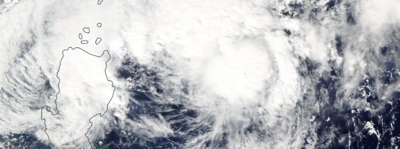
Image credit: NASA Aqua/MODIS. Acquired November 20, 2019
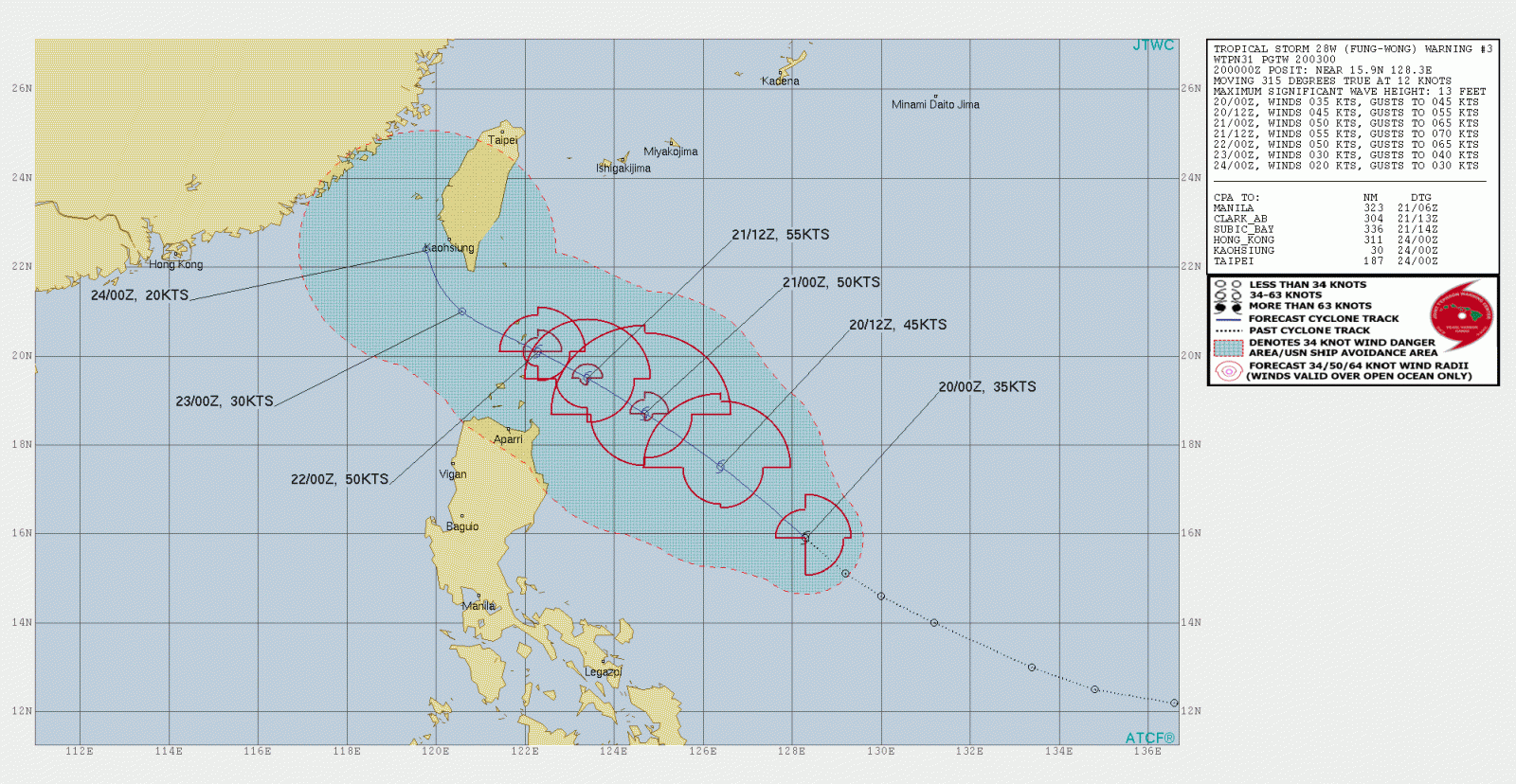
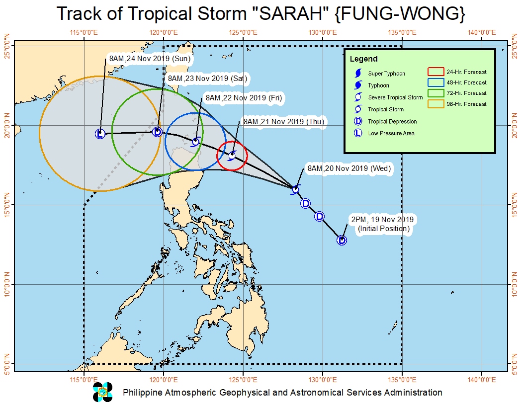
A Low Pressure Area (LPA) inside the Philippine Area of Responsibility (PAR) has intensified into a tropical depression on November 19, 2019, and was named Sarah by the PAGASA. It continued intensifying through the day and reached tropical storm strength, receiving the international name of Fung-Wong. The system is moving toward Northern Luzon. This is the 27th named storm of the 2019 Pacific typhoon season.
The storm has joined Tropical Cyclone "Kalmaegi" or Ramon inside the PAR, raising concerns of further flooding and devastation in the country. Sarah is the 19th cyclone in the Philippines for 2019 and the third for November.
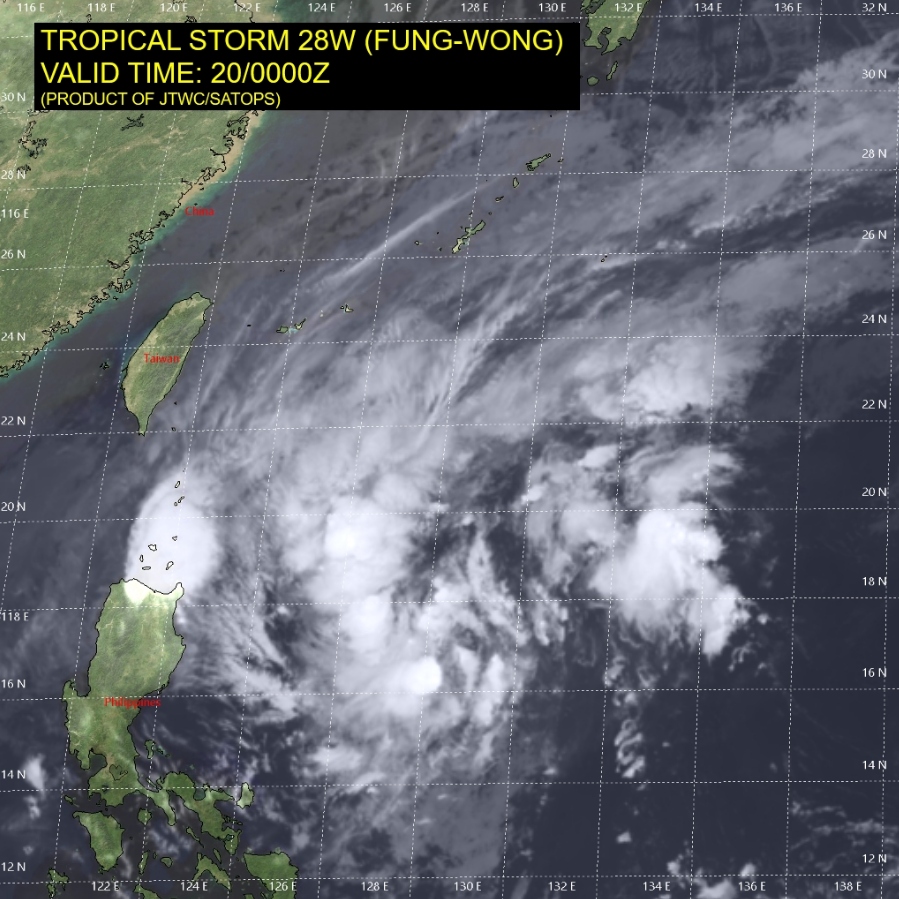
At 03:00 UTC on November 20, the center of Tropical Storm "Fung-Wong" was located approximately 800 km (495 miles) east of Manila, Philippines. The storm was tracking NW at 22 km/h (14 mph) with maximum sustained winds of 65 km/h (40 mph) and gusts to 80 km/h (50 mph).
Light to moderate with occasional heavy rains are expected today over Batanes, Cagayan including Babuyan Islands, Apayao, and the northern portion of Ilocos Norte. Light to moderate with intermittent heavy rains are expected over Ilocos Sur, Abra, Kalinga, Mt. Province, Ifugao, Isabela, La Union, Benguet and the rest of Ilocos Norte.
Moderate to frequent heavy rains are expected over Batanes and Babuyan Islands on November 21. Light to moderate with intermittent heavy rains may prevail over Cagayan, Apayao and the northern portion of Isabela.
Residents in the aforementioned areas, especially those living in areas identified to be highly or very highly susceptible to flooding and rain-induced landslides, are advised to take appropriate actions, coordinate with local disaster risk reduction and management offices, and continue monitoring for updates, especially the Thunderstorm or Rainfall Advisories and Heavy Rainfall Warnings to be issued by PAGASA Regional Services Divisions.
Tropical Cyclone Wind Signal (TCWS) 1 is in effect for Luzon.
Sea travel is risky, especially for small sea crafts, over the seaboards of areas under TCWS, as well as the seaboards of Camarines Norte and Catanduanes, the eastern seaboards of northern Aurora and Isabela, the western seaboards of Zambales, Bataan, Occidental Mindoro and Palawan, and the northern seaboard of Camarines Sur due to prevailing or forecast rough sea conditions caused by Tropical Depression "Kalmaegi" (Ramon), Tropical Storm "Fung-Wong" (Sarah) and the Northeast Monsoon.
Commenting rules and guidelines
We value the thoughts and opinions of our readers and welcome healthy discussions on our website. In order to maintain a respectful and positive community, we ask that all commenters follow these rules.