
Very strong and shallow M7.4 earthquake hits Komandorskiye Ostrova, Russia
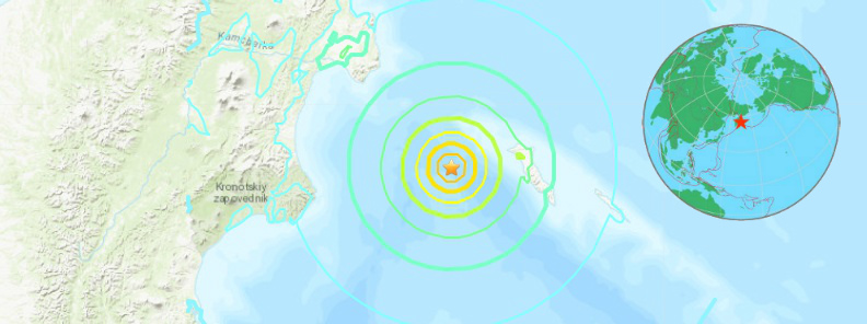
Image credit: USGS, EMSC, TW
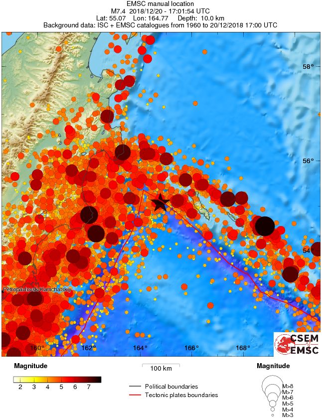
A strong and shallow earthquake registered by the USGS as M7.4 hit Komandorskiye Ostrova region at 17:01 UTC on December 20, 2018. The agency is reporting a depth of 9.6 km (5.9 miles). EMSC is reporting M7.4 at a depth of 10 km (6.2 miles). This earthquake can have a low humanitarian impact based on the magnitude and the affected population and their vulnerability.
At least 5 aftershocks, with magnitudes ranging from 5.0 to 5.6, were registered over the next 90 minutes.
The epicenter was located 187.9 km (116.8 miles) SE of Ust’-Kamchatsk Staryy, Kamtsjatka, Russia and 2 153 km (1 337 miles) NE of Sapporo-shi, Japan.
There are about 600 people living within 100 km (62 miles).
Based on all available data, tsunami waves reaching 0.3 to 1 meters (1 to 3.3 feet) above the tide level are possible for some coasts of Russia, PTWC said 17:49 UTC. At 18:24 UTC, the center said that the tsunami threat from this earthquake has now passed.
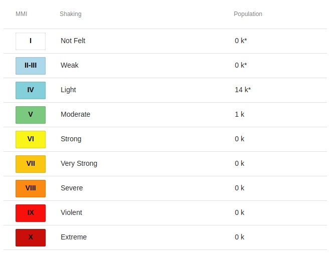
Some 1 000 people are estimated to have felt moderate shaking and 14 000 light.
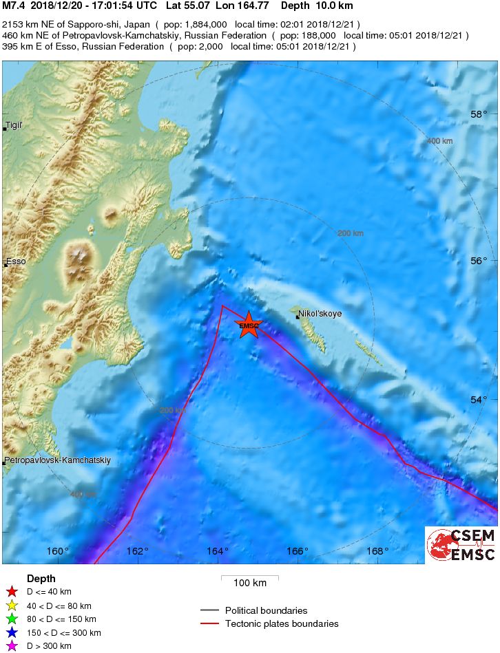
According to the USGS, this quake occurred as the result of oblique-slip faulting in the northern Pacific Ocean, near the junction of the Kursk-Kamchatka and Alaska-Aleutian oceanic trenches.
At the location of this earthquake, the Pacific plate moves towards the northwest with respect to the North America plate at a rate of about 76 mm/y (2.9 inches), translating past the North America plate at the Alaska-Aleutian trench immediately south of this event.
The location, depth, and focal mechanism solution indicate this earthquake likely occurred as the result of interplate faulting along this plate boundary structure, or on a related fault taking up motion between these two plates.
The region surrounding today’s earthquake is an active plate boundary and regularly experiences moderate to large earthquakes. Twenty-one other earthquakes of M6.5+ have occurred within 250 km (155 miles) of this event over the preceding century. Many of these occurred within the Kuril-Kamchatka subduction zone to the west of today’s earthquake.
The largest nearby historic event in the Alaska-Aleutian system was a M7.0 earthquake to the east of today’s event in August 1925. A M6.7 event occurred to the northeast of today’s earthquake in December 2003.
Events in this region are unlikely to cause earthquake-related damage due to their remote location, far from populations.
Estimated population exposure to earthquake shaking
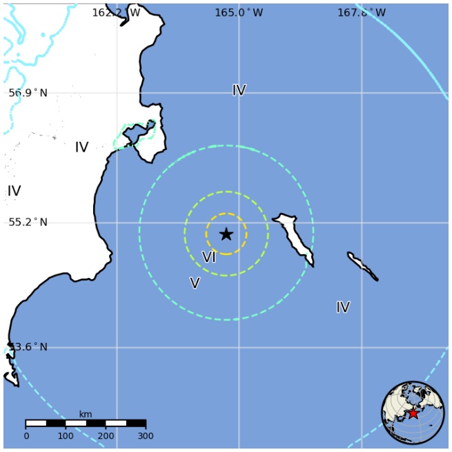
Regional seismicity
I'm a dedicated researcher, journalist, and editor at The Watchers. With over 20 years of experience in the media industry, I specialize in hard science news, focusing on extreme weather, seismic and volcanic activity, space weather, and astronomy, including near-Earth objects and planetary defense strategies. You can reach me at teo /at/ watchers.news.
Commenting rules and guidelines
We value the thoughts and opinions of our readers and welcome healthy discussions on our website. In order to maintain a respectful and positive community, we ask that all commenters follow these rules.