
Extreme rainfall, potentially deadly floods target Spain
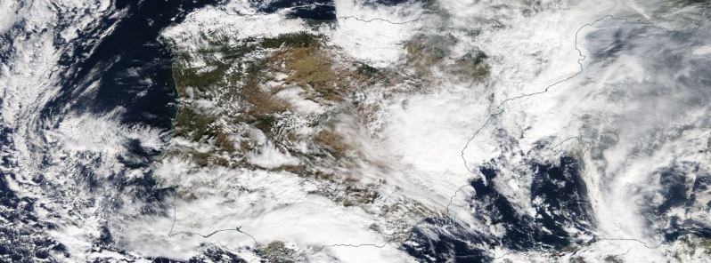
Image credit: NASA Terra/MODIS
Extreme weather conditions are expected across the Iberian Peninsula and the Balearic Islands from October 18 – 21, 2018. The event follows devastating floods that claimed 13 lives in Mallorca and another 13 in neighboring France over the past couple of days. There is a potential for similar rainfall totals and extremely dangerous weather situation.
Spain’s national weather agency (AEMET) issued Red rain alerts for Castellón and Terruel, Orange for the Balearic Islands, Alicante, Valencia, and Tarragona, and Yellow for 11 other neighboring provinces.
The weather front is expected to arrive on October 18 and continue affecting the region through Sunday, October 21 plunging Spain into the worst 'gota fria,' a Spanish term meaning 'cold drop' that explains a sudden drop in temperature, in a decade.
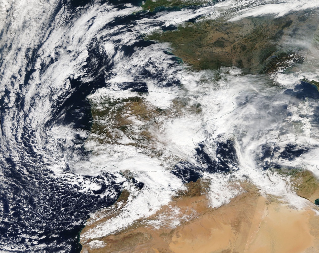
Image credit: NASA Terra/MODIS. Acquired: October 18, 2018
The source is a marked and unstable wet flow from the Mediterranean, resulting from the union of two storms, one from the Mediterranean and another from the Atlantic Ocean.
The situation will lead to strong and persistent rainfall, producing accumulations that may exceed 100 mm (3.9 inches) or even 200 mm (7.9 inches) in just 12 hours.
Accumulations in the province of Castellón and surroundings could exceed 200 mm in 12 hours and even 300 mm (11.8 inches) in longer periods. The rainfall will start decreasing in Andalusia throughout Thursday and then from south to north in the rest of the areas progressive throughout Friday, October 19.
On Saturday, October 20, the storm will move to the southwest, placing the highest probability of precipitation strong and persistent still in the Valencian Community and with greater intensity in the Region of Murcia and in the Andalusian Mediterranean area, where they could be very strong, AEMET said.
Animación de imágenes de las últimas 6 horas, del producto reflectividad del PPI de la composición de radares https://t.co/ti1Tx3LVSz pic.twitter.com/xo5qTmp9QW
— AEMET (@AEMET_Esp) October 18, 2018
Imágenes #METEOSAT canal VISIBLE últimas 6h. https://t.co/CqsXkk4oj0 pic.twitter.com/KkHwUsbj6I
— AEMET (@AEMET_Esp) October 18, 2018
Actualizamos #AvisoEspecial por precipitaciones fuertes y persistentes. Temporal mediterráneo que puede llegar a acumular cantidades muy importantes. Mantente atento a los avisos #FMA y sigue las recomendaciones. https://t.co/WeSZ0O5zzr pic.twitter.com/cD85NMlnDw
— AEMET (@AEMET_Esp) October 18, 2018
"Convective and orographic rainfall is expected through persistent training thunderstorms: locally over 200 mm (7.9 inches) and possibly close to or even over 400 mm (15.7 inches) will accumulate over the next 24 to 36 hours, SWE meteorologists siad.
"There is a HIGH RISK of major flooding: the recent devastating and deadly floods in southern France and on Mallorca in the past two weeks happened in similar rainfall totals."
I'm a dedicated researcher, journalist, and editor at The Watchers. With over 20 years of experience in the media industry, I specialize in hard science news, focusing on extreme weather, seismic and volcanic activity, space weather, and astronomy, including near-Earth objects and planetary defense strategies. You can reach me at teo /at/ watchers.news.
Commenting rules and guidelines
We value the thoughts and opinions of our readers and welcome healthy discussions on our website. In order to maintain a respectful and positive community, we ask that all commenters follow these rules.