
Bogoslof volcano remains in an unpredictable condition, Alaska
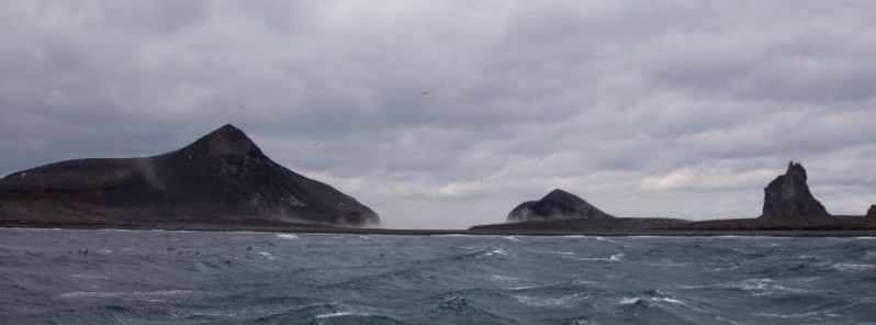
Featured image: Wide view of Bogoslof Volcano taken from the M/V Miss Alyssa on April 7, 2017. Credit: Cyrus Read, AVO/USGS
Bogoslof volcano remains at a heightened state of unrest and in an unpredictable condition, the Alaska Volcano Observatory (AVO) reports. No significant volcanic activity was observed at the volcano in seismic, infrasound data or satellite data over the past day, but activity could increase again at any time.
Activity may ramp back up with additional explosions producing high-altitude (>4.5 km/15 000 feet) volcanic clouds with little precursory activity, AVO said. Some previous explosions have been preceded by an increase in earthquake activity that allowed for short-term forecasts of imminent significant explosive activity.
"Although we are able to detect energetic explosive activity in real-time, there is typically a lag of tens of minutes until we can characterize the magnitude of the event and the altitude of the volcanic cloud. It is possible for low-level unrest, including explosive activity, to occur that we are unable to detect with existing data sources. Such low-level periods of unrest and possible explosions could pose a hazard in the immediate vicinity of the volcano," the observatory added.
There is no ground-based volcano monitoring equipment on Bogoslof volcano so the observatory continues to monitor satellite images, information from the Worldwide Lightning Location Network pertaining to volcanic-cloud lightning, and data from seismic and infrasound instruments on nearby islands for indications of volcanic activity.
Given the lack of a local monitoring network and the unpredictability of the volcano, activity at Bogoslof could increase again at any time. Thus, a Temporary Flight Restriction (TFR) remains in effect over the volcano for the time being.
Current Aviation Color Code is Orange. Volcano Alert Level is Watch.
Geological summary
Bogoslof is the emergent summit of a submarine volcano that lies 40 km north of the main Aleutian arc. It rises 1500 m above the Bering Sea floor. Repeated construction and destruction of lava domes at different locations during historical time has greatly modified the appearance of this "Jack-in-the-Box" volcano and has introduced a confusing nomenclature applied during frequent visits of exploring expeditions.
The present triangular-shaped, 0.75 x 2 km island consists of remnants of lava domes emplaced from 1796 to 1992. Castle Rock (Old Bogoslof) is a steep-sided pinnacle that is a remnant of a spine from the 1796 eruption. Fire Island (New Bogoslof), a small island located about 600 m NW of Bogoslof Island, is a remnant of a lava dome that was formed in 1883. (GVP)
I'm a dedicated researcher, journalist, and editor at The Watchers. With over 20 years of experience in the media industry, I specialize in hard science news, focusing on extreme weather, seismic and volcanic activity, space weather, and astronomy, including near-Earth objects and planetary defense strategies. You can reach me at teo /at/ watchers.news.
Commenting rules and guidelines
We value the thoughts and opinions of our readers and welcome healthy discussions on our website. In order to maintain a respectful and positive community, we ask that all commenters follow these rules.