
Large eruption of Mount Barujari, more than 1 100 evacuated, Indonesia
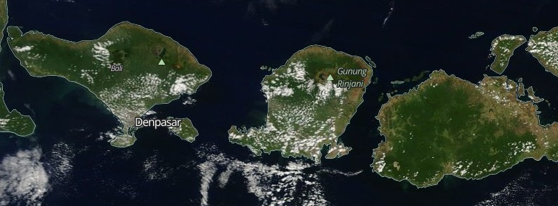
Image credit: NASA Terra/MODIS. Acquired: September 27, 2016.
Mount Barujari on the Indonesian island of Lombok erupted at 07:45 UTC on September 27, 2016, spewing ash 2 000 m (6 560 feet) above the crater, 5 726 m (18 790 feet) above sea level. More than 1 100 people have been evacuated. As of early September 28, authorities are still searching for 389 tourists.
“Barujari has erupted again. Based on volcanology data, the volcano’s eruption was quite huge, with an amplitude level of 52 dB and a volcanic ash altitude of more than 2 000 meters above the crater,” said NTB Disaster Mitigation Agency (BPBD) head Muhammad Rum.
Mount Rinjani observation post reported ash from Barujari's eruption drifted to the southwestern areas, including North Lombok and Mataram. Farms and trees around the volcano were coated in a thin layer of gray ash. Nearby towns and villages were not in danger.
A 3 km (1.8 miles) danger zone was established around the volcano.
Authorities have evacuated more than 1 100 people, but are still searching for 389 tourists (out of 400 registered to climb the mountain). There have been no reports of injuries.
Flights at Ngurah Rai International Airport in Bali (about 135 km / 84 miles W of Barujari) and Selaparang airport in Mataram (on the island) were interrupted for several hours. Flight activities at the Lombok International Airport remained normal.
“We have coordinated with BPBDs at regency and municipal levels to call on all people to remain alert and prepare masks to prevent problems from volcanic ash rain that may occur, especially in North Lombok,” said Rum.
Barujari is a post-caldera cone at the east end of Rinjani's caldera. At the beginning of September, an earthquake in Dompu led to Barujari’s eruption, which disrupted flights at Lombok International Airport and Ngurah Rai Airport in Bali for one day.
Geological summary
Rinjani volcano on the island of Lombok rises to 3726 m, second in height among Indonesian volcanoes only to Sumatra's Kerinci volcano. Rinjani has a steep-sided conical profile when viewed from the east, but the west side of the compound volcano is truncated by the 6 x 8.5 km, oval-shaped Segara Anak (Samalas) caldera. The caldera formed during one of the largest Holocene eruptions globally in 1257 CE, which truncated Samalas stratovolcano.
The western half of the caldera contains a 230-m-deep lake whose crescentic form results from growth of the post-caldera cone Barujari at the east end of the caldera. Historical eruptions dating back to 1847 have been restricted to Barujari cone and consist of moderate explosive activity and occasional lava flows that have entered Segara Anak lake. (GVP)
The Watchers team and our contributors bring the latest on extreme weather, earthquakes, volcanic eruptions, space weather, and all things science. We're all about making sense of the natural world and keeping you informed on what’s happening. Got a tip or a question? Hit us up using the form at newstips!
Commenting rules and guidelines
We value the thoughts and opinions of our readers and welcome healthy discussions on our website. In order to maintain a respectful and positive community, we ask that all commenters follow these rules.