
Shallow M6.0 earthquake hits near the coast of Andreanof Islands, Alaska
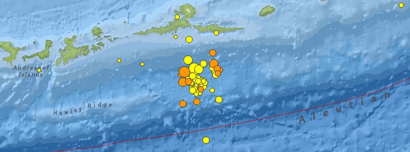
Image credit: USGS
A shallow earthquake registered by the USGS as M6.0 hit near the coast of Atka, Andreanof Islands, Alaska at 01:35 UTC on March 19, 2016. The agency is reporting a depth of 17 km (10.6 miles). EMSC is reporting M6.1 at a depth of 10 km (6.1 miles).
The epicenter was located 76 km (47 miles) S of Atka, Alaska and 1 549 km (963 miles) SSE of Anadyr', Russia.
There are about 188 people living within 100 km (62 miles) radius.
USGS issued a green alert for shaking-related fatalities and economic losses. There is a low likelihood of casualties and damage. Overall, the population in this region resides in structures that are resistant to earthquake shaking, though some vulnerable structures exist.
This was ~40th M2.5+ earthquake registered in this area since February 18. The strongest was M6.3 on March 12.
Since March 12 (7 days), USGS registered a total of 63 earthquakes (all magnitudes) south of Atka. 41 of them had magnitudes 2.5 and above. Since February 18 (30 days), there were 45 M2.5+ earthquakes in the same region (by 04:41 UTC on March 19).
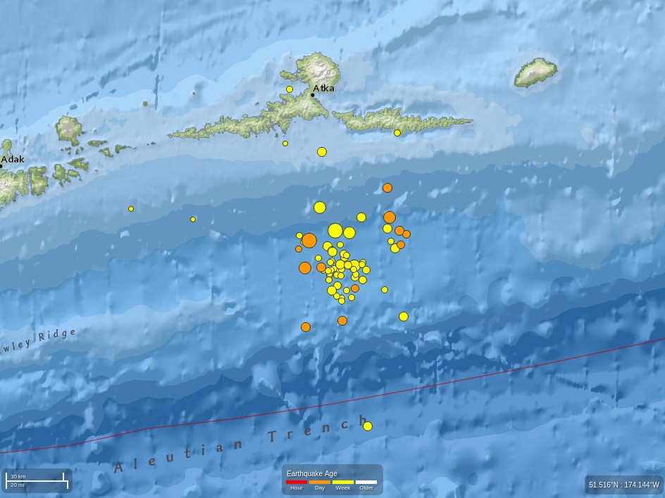
Image credit: USGS
- 4.52016-03-19 04:41:17 UTC10.0 km
- 4.92016-03-19 03:59:59 UTC10.0 km
- 4.12016-03-19 02:31:35 UTC10.0 km
- 4.12016-03-19 02:06:50 UTC10.0 km
- 6.02016-03-19 01:35:12 UTC17.0 km
- 5.02016-03-19 01:22:16 UTC10.0 km
- 3.42016-03-18 13:33:59 UTC25.1 km
- 4.42016-03-18 11:52:20 UTC37.0 km
- 5.12016-03-18 09:38:12 UTC55.4 km
- 3.92016-03-18 09:19:48 UTC48.1 km
- 3.12016-03-18 07:32:50 UTC35.4 km
- 2.92016-03-18 02:05:36 UTC4.0 km
- 4.12016-03-16 23:13:12 UTC10.0 km
- 4.12016-03-15 22:55:11 UTC10.0 km
- 2.92016-03-15 14:41:43 UTC25.9 km
- 4.22016-03-15 10:58:43 UTC37.5 km
- 4.62016-03-13 14:18:46 UTC10.0 km
- 5.42016-03-13 04:19:25 UTC10.0 km
- 4.12016-03-13 03:55:17 UTC10.0 km
- 5.02016-03-13 03:20:03 UTC10.0 km
- 4.62016-03-13 02:28:47 UTC10.0 km
- 2.62016-03-12 23:56:56 UTC10.0 km
- 3.42016-03-12 23:56:05 UTC13.0 km
- 3.32016-03-12 22:42:32 UTC17.5 km
- 3.12016-03-12 22:30:53 UTC8.0 km
- 4.02016-03-12 21:29:20 UTC25.7 km
- 2.52016-03-12 20:25:40 UTC16.6 km
- 3.72016-03-12 19:59:07 UTC8.6 km
- 3.12016-03-12 19:50:21 UTC15.3 km
- 2.52016-03-12 19:43:45 UTC14.7 km
- 2.52016-03-12 19:16:52 UTC12.3 km
- 3.32016-03-12 19:01:42 UTC15.0 km
- 3.22016-03-12 18:15:26 UTC3.2 km
- 6.32016-03-12 18:06:45 UTC19.0 km
- 4.62016-03-12 18:01:04 UTC40.1 km
- 2.72016-03-12 16:23:18 UTC13.6 km
- 2.62016-03-12 14:22:06 UTC23.3 km
- 2.92016-03-12 13:29:19 UTC25.5 km
- 5.42016-03-12 13:23:39 UTC18.0 km
- 3.62016-03-12 12:40:07 UTC25.7 km
- 4.62016-03-12 11:55:51 UTC33.8 km
I'm a dedicated researcher, journalist, and editor at The Watchers. With over 20 years of experience in the media industry, I specialize in hard science news, focusing on extreme weather, seismic and volcanic activity, space weather, and astronomy, including near-Earth objects and planetary defense strategies. You can reach me at teo /at/ watchers.news.
Commenting rules and guidelines
We value the thoughts and opinions of our readers and welcome healthy discussions on our website. In order to maintain a respectful and positive community, we ask that all commenters follow these rules.