
Tropical Storm “Komen” drenching Bangladesh
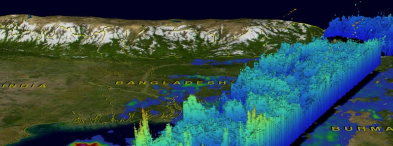
Image credit: NASA/JAXA/SSAI, Hal Pierce.
An area of low pressure has been lingering in the Bay of Bengal for days before it finally developed into a Tropical Storm "02B" and then into Tropical Storm "Komen" on July 29, 2015. Bangladesh was already soaked by monsoon rainfall before Komen started drenching the area.
On July 29 at 05:00 UTC, NASA's Terra satellite passed over 02B in the northern Bay of Bengal. The MODIS instrument captured a visible-light image of the storm that filled up the northern Bay of Bengal. The center of the storm's circulation was apparent in the image, located over the extreme northern Bay of Bengal, and just south of Chittagong, Bangladesh. The image revealed that the northern quadrant of the storm was mostly devoid of clouds, and the bulk of clouds and showers stretched from the eastern quadrant, south and to the western quadrant.
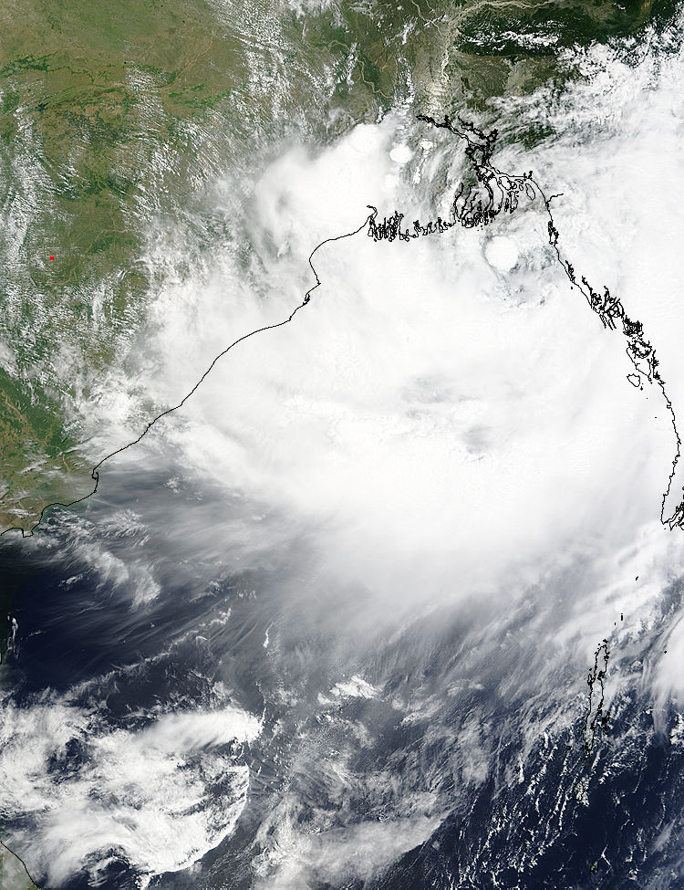
On July 29, 2015, at 05:00 UTC, NASA's Terra satellite captured this image of Tropical Cyclone 02B in the northern Bay of Bengal.
At 09:00 UTC on July 29, 2015, Tropical Storm 02B had maximum sustained winds near 62 km/h (40 mph). It was centered about 129.6 km (80.5 miles) south-southwest of Chittagong, Bangladesh and moving to the northeast at 5.5 km/h (3.4 mph).
The Regional Specialised Meteorological Centre in New Delhi, India noted that the northern part of the system is interacting with dry air which accounts for the lack of clouds in that quadrant as seen in the MODIS imagery.
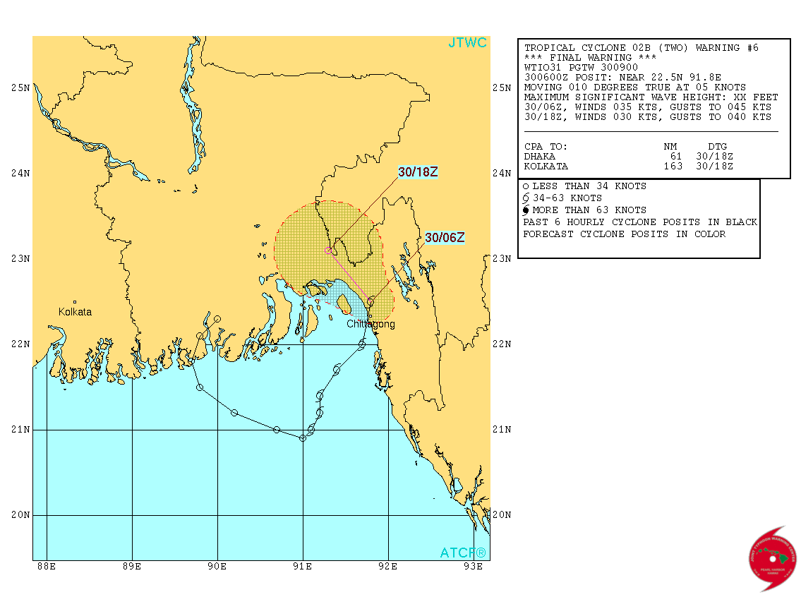
Tropical Storm "Komen" forecast track by JTWC on July 30, 2015. Credit: JTWC/ATCF.
On July 30, 2015 at 04:36 UTC the Global Precipitation Measurement (GPM) mission passed over the Bay of Bengal. At that time GPM's Microwave Imager (GMI) measured rain falling at the extreme rate of close to 150 mm (5.9 inches) per hour in powerful storms situated over the Bay of Bengal.
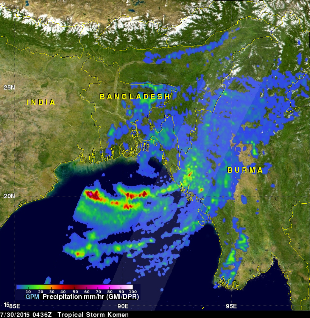
GPM saw rain falling in Komen on July 30 at the extreme rate of close to 150 mm (5.9 inches) per hour in powerful storms situated over the Bay of Bengal. Credits: NASA/JAXA/SSAI, Hal Pierce.
At NASA's Goddard Space Flight Center in Greenbelt, Maryland, a 3-D view of thunderstorm tops was created based on radar reflectivity day from GPM's Dual-Frequency Precipitation Radar (DPR).
DPR (Ku band) radar data were used in a simulated cross section through storm tops associated with tropical storm Komen. GPM's radar saw that some of the cloud tops were reaching heights above 15.9 km (9.9 miles) in the intense thunderstorm feeder bands located over the Bay of Bengal. Those "feeder bands" of thunderstorms were spiraling into the center of Komen's circulation.
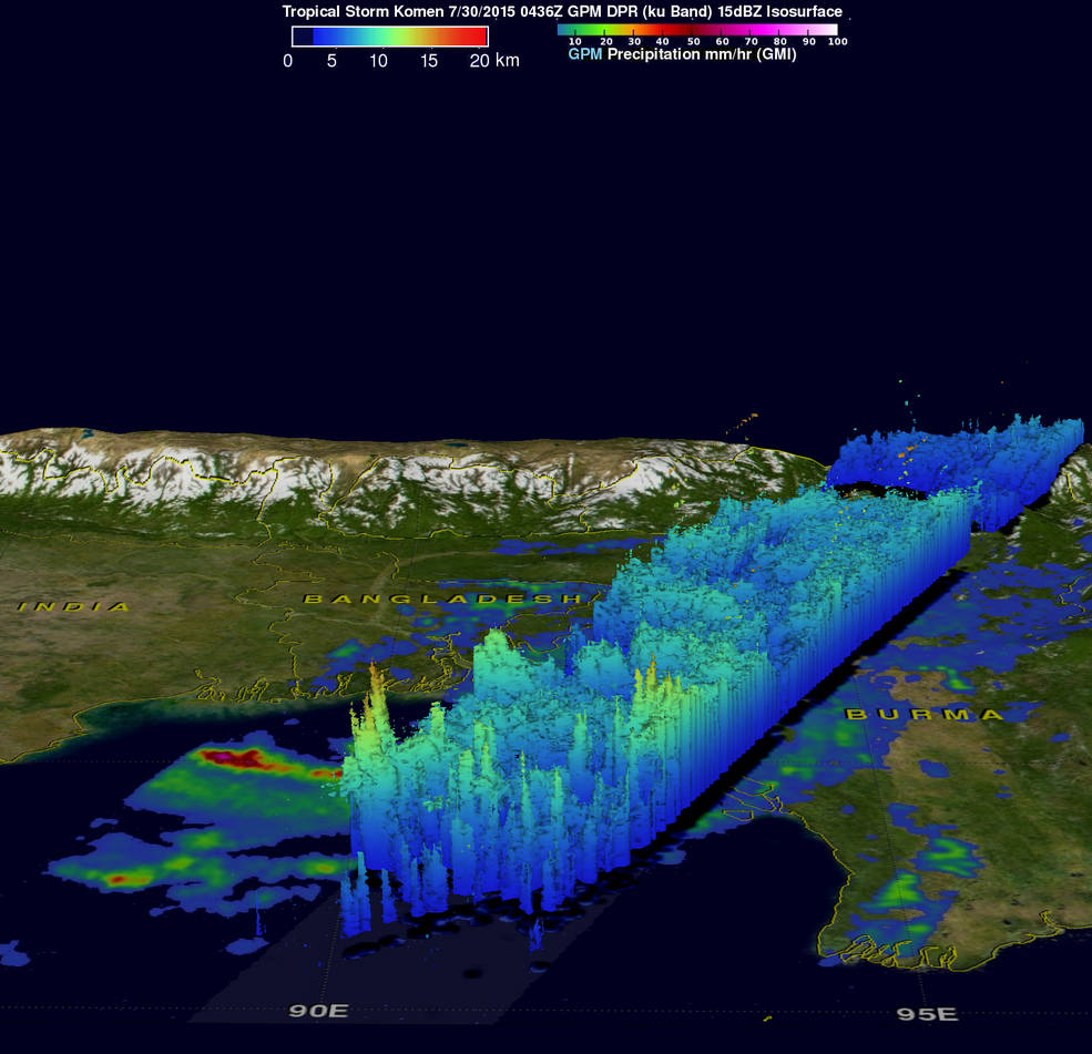
On July 30, GPM saw cloud tops above 15.9 km (9.9 miles) high in bands of thunderstorms over the Bay of Bengal and wrapping into Komen's center. Credits: NASA/JAXA/SSAI, Hal Pierce.
On July 30, 2015 at 09:00 UTC, the JTWC issued their final bulletin on Tropical Storm "Komen". At that time, Komen had already made landfall and was just 22.2 km (13.8 miles) north of Chittagong, Bangladesh. Thy system was moving to the north at 9.2 km/h (5.7 mph) and had maximum sustained winds near 62 km/h (40 mph).
Since making landfall, Komen weakened to a tropical depression and is dissipating over Bangladesh as it moves to the northwest and further inland.
I'm a dedicated researcher, journalist, and editor at The Watchers. With over 20 years of experience in the media industry, I specialize in hard science news, focusing on extreme weather, seismic and volcanic activity, space weather, and astronomy, including near-Earth objects and planetary defense strategies. You can reach me at teo /at/ watchers.news.
Commenting rules and guidelines
We value the thoughts and opinions of our readers and welcome healthy discussions on our website. In order to maintain a respectful and positive community, we ask that all commenters follow these rules.