
M4.8 earthquake reported in Yellowstone, the largest since 1980
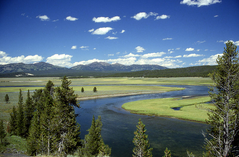
Image credit: Yellowstone River in Hayden Valley. Yellowstone National Park, Wyoming, USA. Author: Ed Austin/Herb Jones
The University of Utah Seismograph Stations recorded M4.8 earthquake at 12:34 UTC on March 30, 2014 (06:34 MDT). The epicenter was located 6.4 km (4 miles) north-northeast of Norris Geyser Basin in Yellowstone National Park, Wyoming.
This earthquake is part of a series of earthquakes that began in this area on Thursday, March 27, 2014. As of 14:15 UTC today, this series has included at least 25 earthquakes in addition to the main shock, with the largest of magnitude 3.1. The magnitude 4.8 main shock was reported felt in Yellowstone National Park and in the towns of West Yellowstone and Gardiner, Montana.
Today's event is the largest earthquake at Yellowstone since February 22, 1980, and occurred near the center of a region of recent ground uplift described in a YVO Information Statement on February 18, 2014:
Since late summer 2013, the Yellowstone GPS network has tracked a small ground deformation episode in north-central Yellowstone National Park. During the past five months, the NRWY GPS station has recorded about 3.5 cm (1.4 in) of uplift and about 1 cm (0.4 in) of southeastward ground movement, relative to a stable reference station north of the Park. Measurements from other GPS stations in northern Yellowstone show smaller displacements, forming a circular pattern of deformation consistent with a minor pressurization, about 6 to 10 km (4-6 miles) deep, near Norris Junction.
Similar patterns of ground deformation have occurred before in this part of Yellowstone. From 1996 through 2003 the Norris Geyser Basin rose about 12 cm, before beginning to subside in 2004. More information about this event is available at http://volcanoes.usgs.gov/volcanoes/yellowstone/yellowstone_monitoring_51.html.
Episodes of ground deformation, which occur commonly in Yellowstone and at other dormant volcanoes around the world, pose no direct volcanic hazards, nor do they imply that an eruption is pending. They do, however, create a scientific opportunity to better understand the geologic processes at work in Yellowstone and elsewhere. YVO and other scientists are pursuing this opportunity, and will continue to monitor the ground deformation closely. (YVO, February 18, 2014)
The Yellowstone Volcano Observatory has been tracking this uplift episode for about 7 months.
As discussed in the March 3, 2014 YVO Monthly Update, seismicity in the general region of the uplift has been elevated for several months. A previous period of uplift in this area occurred between 1996 and 2003, and it was also accompanied by elevated seismicity.
The ground deformation occurring in north-central Yellowstone, which we reported in an Information Statement on February 18, 2014, continues. In March, YVO plans to deploy several additional GPS instruments to learn more about this scientifically interesting deformation episode. Caldera subsidence, which began in 2010, appears to be slowing. All the deformation currently occurring in Yellowstone remains well within historical norms.
During February 2014, the University of Utah reports 245 earthquakes were located in the Yellowstone National Park region. February seismicity in Yellowstone was marked by an ongoing cluster of 153 earthquakes, located about 5 miles WNW of Norris Geyser Basin, YNP, that persisted throughout the month. The cluster included the largest event of the month, which was a minor earthquake of magnitude 3.5 on February 11, 2014 at 4:03 PM MST (22:00 UTC). (YVO, March 3, 2014)
Although seismicity over Yellowstone as a whole is only slightly above normal, seismicity levels in the deforming region in the north-central part of the Park have increased since the deformation began. This correlation is neither worrisome nor surprising since ground deformation and small earthquakes often occur together.
A USGS field team is in Yellowstone and will visit the area near the earthquake's epicenter today. The team will look for any surface changes that the earthquake may have caused, and for possible effects to the hydrothermal system at Norris Geyser Basin.
Based on the style and location of today's earthquake, at this time YVO sees no indication of additional geologic activity other than continuing seismicity.
Source: The Yellowstone Volcano Observatory (YVO) Information Statement – March 30, 2014.
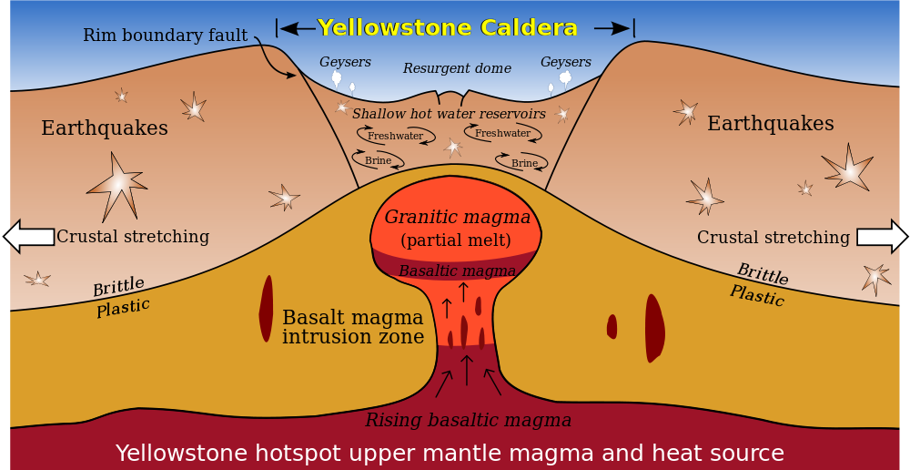
"At Yellowstone and some other volcanoes, some scientists theorize that the earth's crust fractures and cracks in a concentric or ring-fracture pattern. At some point these cracks reach the magma “reservoir,” release the pressure, and the volcano explodes. The huge amount of material released causes the volcano to collapse into a huge crater—a caldera." From nps.gov. Author: Kbh3rd
I'm a dedicated researcher, journalist, and editor at The Watchers. With over 20 years of experience in the media industry, I specialize in hard science news, focusing on extreme weather, seismic and volcanic activity, space weather, and astronomy, including near-Earth objects and planetary defense strategies. You can reach me at teo /at/ watchers.news.
Jamal, don't hold your breath; it goes up and down all the time, a process geologists call breathing. Sometimes it takes a deep breath.
This is very bad news for the whole world. I am living in fear due to my strong believe that the heat is increasing at the Earth's core and the Earth will change its magnetic field when the Sun reaches the peak of its maximum activities in the next two to three years. I am thinking about yellowstone almost every day. Let us hope for the best.