
Active volcanoes in the world: February 20 – February 26, 2013
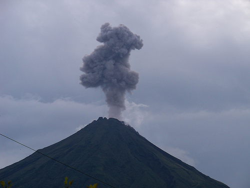
Image credit: Carol Patterson - CC BY 2.0
This week, 8 volcanoes were noticed to have new activity, whereas ongoing activity was reported for 9 volcanoes. This report covers active volcanoes in the world recorded from February 20 – February 26, 2013 based on Smithsonian/USGS criteria.
New activity/unrest: | Cleveland, Chuginadak Island | Etna, Sicily (Italy) | Karkar, Northeast of New Guinea (SW Pacific) | Sabancaya, Perú | Sangay, Ecuador | Soufrière Hills, Montserrat |Tangkubanparahu, Western Java (Indonesia) | White Island, New Zealand
Ongoing activity: | Chirpoi, Kuril Islands (Russia) | Karymsky, Eastern Kamchatka (Russia) | Kilauea, Hawaii (USA) | Kizimen, Eastern Kamchatka (Russia) | Popocatépetl, México | Sakura-jima, Kyushu | Santa María, Guatemala | Shiveluch, Central Kamchatka (Russia) | Tolbachik, Central Kamchatka (Russia)
The Weekly Volcanic Activity Report is a cooperative project between the Smithsonian’s Global Volcanism Program and the US Geological Survey’s Volcano Hazards Program. Updated by 2300 UTC every Wednesday, notices of volcanic activity posted on these pages are preliminary and subject to change as events are studied in more detail. This is not a comprehensive list of all of Earth’s volcanoes erupting during the week, but rather a summary of activity at volcanoes that meet criteria discussed in detail in the “Criteria and Disclaimers” section. Carefully reviewed, detailed reports on various volcanoes are published monthly in the Bulletin of the Global Volcanism Network.
New activity/unrest
CLEVELAND, Chuginadak Island
52.825°N, 169.944°W; summit elev. 1730 m
AVO reported that during 20-26 February clouds obscured satellite views of Cleveland’s lava dome. The Volcanic Alert Level remained at Watch and the Aviation Color Code remained at Orange.
Geologic summary: Symmetrical Mount Cleveland stratovolcano is situated at the western end of the uninhabited dumbbell-shaped Chuginadak Island in the east-central Aleutians. The 1,730-m-high stratovolcano is the highest of the Islands of Four Mountains group and is one of the most active in the Aleutians. Numerous large lava flows descend its flanks. It is possible that some 18th to 19th century eruptions attributed to Carlisle (a volcano located across the Carlisle Pass Strait to the NW) should be ascribed to Cleveland. In 1944 Cleveland produced the only known fatality from an Aleutian eruption. Recent eruptions from Mt. Cleveland have been characterized by short-lived explosive ash emissions, at times accompanied by lava fountaining and lava flows down the flanks.
ETNA, Sicily (Italy)
37.734°N, 15.004°E; summit elev. 3330 m
Sezione di Catania – Osservatorio Etneo reported two episodes of lava fountaining from Etna’s New Southeast Crater (NSEC) on 20 February. The first episode’s most energetic phase occurred during 0150-0235, producing anash plume that drifted ESE, small lahars, lava flows from the fissure cutting the SE crater rim, and lava flows from a new eruptive fissure which opened on the lower SW flank of the cone. After the cessation of lava fountaining, weak spattering and low-rate lava emission continued from two small fissures at the SE base of the cone. During the late morning, eruptive activity at NSEC re-intensified. The second episode began just after 1415 and ended at about 1450. An ash cloud drifted E, and new lava flows traveled towards the Valle del Bove, following the paths of previous flows. Slow-moving lava flows from the fissures at the SE base of the NSEC continued into the next day, accompanied by sporadic, weak Strombolian explosions at the NSEC.
At 0233 on 21 February a new vent opened high on the W slope of the Valle del Bove and produced a lava flow that melted snow, creating lahars and voluminous steam plumes. At about 0300 Strombolian activity resumed at the NSEC; the activity became virtually continuous by 0440 and produced jets of incandescent lava that rose at most 100 m above the crater rim. Cloud cover periodically prevented observations, but at 0540 the clouds were illuminated, and at 0545 a lava flow emerged from the cloud cover. An ash plume drifted N, causing ashfall in the area between Randazzo (15 km NNE) and Linguaglossa (7 km NE), at Patti on the Tyrrhenian (N coast of Sicily), and as far as Lipari (more than 80 km N). Scoria clasts up to 15 cm in diameter also fell in Linguaglossa. After the cessation of this fourth paroxysm in just over two days, effusive activity continued from the eruptive vents, feeding two lava flows that traveled 2.5 km down to the base of the steep W slope of the Valle del Bove. This activity, accompanied by sporadic small Strombolian explosions at the NSEC, continued into the morning of 22 February.
At about 0700 on 22 February, rising tremor amplitude signaled the onset of a new episode, but from Bocca Nuova. Between 0730 and 0815 many vapor puffs and thermal anomalies were observed. Cloud cover prevented clear views, but mild Strombolian activity was likely occurring within the crater. At about 0815 the volcanic tremor amplitude started decreasing and the gas emissions from Bocca Nuova became less conspicuous. Contemporaneously, the emission of lava from the two effusive vents at the SE base of the NSEC cone and below the Belvedere station decreased and completely ceased during the afternoon of 22 February.
At about 1625 on 23 February thermal anomalies were detected from NSEC and 15 minutes later lava was visible from the vent at the SE base of the NSEC cone. By nightfall the lava flow and Strombolian activity were visible from populated areas on the S and E flanks, although cloud cover hampered views. Activity intensified during 1900-1930; lava fountains rose at most 150 m above the crater rim and a well-fed lava flow spilled through the breach in the SE crater rim and traveled toward the W slope of the Valle del Bove. Within the next 10 minutes jets of lava rose 500-800 m above the rim. During that time, the emission of pyroclastic material increased dramatically, forming a dense plume that drifted NE; the entire NE flank, from the NSEC to Pizzi Deneri and beyond, was covered with a sheet of incandescent material. Eyewitnesses also reported the fall of large clasts, some incandescent, in the area of Monte Baracca, ~5 km NE of the NSEC. High lava fountaining continued for about 35 minutes. At 2014 the height of the lava fountains rapidly decreased, and two minutes later, the activity had changed to Strombolian explosions that ejected incandescent tephra up to 100 m above the crater rim. At 2030 all explosive activity was essentially over. During the morning of 24 February, the lava flow emitted from NSEC continued to be fed, probably by one or more vents near Belvedere.
Geologic summary: Mount Etna, towering above Catania, Sicily’s second largest city, has one of the world’s longest documented records of historical volcanism, dating back to 1500 BC. Historical lava flows cover much of the surface of this massive basaltic stratovolcano, the highest and most voluminous in Italy. Two styles of eruptive activity typically occur at Etna. Persistent explosive eruptions, sometimes with minor lava emissions, take place from one or more of the three prominent summit craters, the Central Crater, NE Crater, and SE Crater. Flank eruptions, typically with higher effusion rates, occur less frequently and originate from fissures that open progressively downward from near the summit. A period of more intense intermittent explosive eruptions from Etna’s summit craters began in 1995. The active volcano is monitored by the Instituto Nazionale di Geofisica e Volcanologia (INGV) in Catania.
KARKAR, Northeast of New Guinea (SW Pacific)
4.649°S, 145.964°E; summit elev. 1839 m
Based on analyses of satellite imagery and wind data, the Darwin VAAC reported that on 26 February an ashplume from Karkar rose to an altitude of 9.1 km (30,000 ft) a.s.l.
Geologic summary: Karkar is a 19 x 25 km wide, forest-covered island that is truncated by two nested summit calderas. The 5.5-km-wide outer caldera was formed during one or more eruptions, the last of which occurred 9000 years ago. The eccentric 3.2-km-wide inner caldera was formed sometime between 1500 and 800 years ago. Parasitic cones are present on the northern and southern flanks of basaltic-to-andesitic Karkar volcano; a linear array of small cones extends from the northern rim of the outer caldera nearly to the coast. Most historical eruptions, which date back to 1643, have originated from Bagiai cone, a pyroclastic cone constructed within the steep-walled, 300-m-deep inner caldera. The floor of the caldera is covered by young, mostly unvegetated andesitic lava flows.
SABANCAYA, Perú
15.78°S, 71.85°W; summit elev. 5967 m
According to news articles, INGEMMET recorded 536 earthquakes from Sabancaya, or about 20 per hour, during 22-23 February. About 80 homes were damaged by the earthquakes, causing some evacuations. A plume rose 100 m; plumes had been intermittently visible since 15 January.
Geologic summary: Sabancaya, located on the saddle between 6288-m-high Ampato and 6025-m-high Hualca Hualca volcanoes, is the youngest of these volcanic centers and the only one to have erupted in historical time. The oldest of the three volcanoes, Nevado Hualca Hualca, is of probable late-Pliocene to early Pleistocene age. Both Nevado Ampato and Nevado Sabancaya are only slightly affected by glacial erosion and consist of a series of lava domes aligned along a NW-SW trend. The name of 5967-m-high Sabancaya (meaning “tongue of fire” in the Quechua Indian language) first appeared in records in 1595 AD, suggesting activity prior to that date. Holoceneactivity has consisted of plinian eruptions followed by emission of voluminous andesitic and dacitic lava flows, which form an extensive apron around the volcano on all sides but the south. Records of historical eruptions of Sabancaya date back to 1750.
SANGAY, Ecuador
2.002°S, 78.341°W; summit elev. 5230 m
According to the Washington VAAC, on 22 February a pilot observed an ash plume from Sangay that rose to an altitude of 7.6 km (25,000 ft) a.s.l. and drifted SW. Due to cloud cover in the area, neither satellite image analysis nor the Instituto Geofísico-Escuela Politécnica Nacional (IG) could confirm an ash emission. Ash plumes were not detected in cloudy satellite image views during 23-24 February, but a thermal anomaly was detected on 24 February.
Geologic summary: The isolated Sangay volcano, located E of the Andean crest, is the southernmost of Ecuador’s volcanoes, and its most active. It has been in frequent eruption for the past several centuries. The steep-sided, 5,230-m-high glacier-covered volcano grew within horseshoe-shaped calderas of two previous edifices, which were destroyed by collapse to the E, producing large debris avalanches that reached the Amazonian lowlands. The modern edifice dates back to at least 14,000 years ago. Sangay towers above the tropical jungle on the E side; on the other sides flat plains of ash from the volcano have been sculpted by heavy rains into steep-walled canyons up to 600 m deep. The earliest report of an historical eruption was in 1628. More or less continuous eruptions were reported from 1728 until 1916, and again from 1934 to the present. The more or less constant eruptive activity has caused frequent changes to the morphology of the summit crater complex.
SOUFRIERE HILLS, Montserrat
16.72°N, 62.18°W; summit elev. 915 m
MVO reported that during 15-22 February activity at the Soufrière Hills lava dome was at a low level and sulfur dioxide gas flux returned to baseline levels, similar to the levels measured before the activity that occurred between 3 and 6 February. The Hazard Level remained at 2 (on a scale of 1-5).
Geologic summary: The complex dominantly andesitic Soufrière Hills volcano occupies the southern half of the island of Montserrat. The summit area consists primarily of a series of lava domes emplaced along an ESE-trending zone. English’s Crater, a 1-km-wide crater breached widely to the E, was formed during an eruption about 4,000 years ago in which the summit collapsed, producing a large submarine debris avalanche. Block-and-ash flow and surge deposits associated with dome growth predominate in flank deposits at Soufrière Hills. Non-eruptive seismic swarms occurred at 30-year intervals in the 20th century, but with the exception of a 17th-century eruption that produced the Castle Peak lava dome, no historical eruptions were recorded on Montserrat until 1995. Long-term small-to-moderate ash eruptions beginning in that year were later accompanied by lava-dome growth andpyroclastic flows that forced evacuation of the southern half of the island and ultimately destroyed the capital city of Plymouth, causing major social and economic disruption.
TANGKUBANPARAHU, Western Java (Indonesia)
6.77°S, 107.60°E; summit elev. 2084 m
CVGHM reported that on 21 February tremor increased at Tangkubanparahu and diffuse ash emissions rose from Ratu Crater. Based on the seismicity, visual observations, and temperature increases of the land around the crater, the Alert Level was raised to 2 (on a scale of 1-4) and visitors were reminded not to approach the crater within a radius of 1.5 km.
Geologic summary: Tangkubanparahu is a broad shield-like stratovolcano overlooking Indonesia’s former capital city of Bandung that was constructed within the 6 x 8 km Pleistocene Sunda caldera. The volcano’s low profile is the subject of legends referring to the mountain of the “upturned boat.” The rim of Sunda caldera forms a prominent ridge on the western side; elsewhere the caldera rim is largely buried by deposits of Tangkubanparahu volcano. The dominantly small phreatic historical eruptions recorded since the 19th century have originated from several nested craters within an elliptical 1 x 1.5 km summit depression. Tangkubanparahu last erupted in September 1983, whenash rose up to 150 m above the rim of Kawah Ratu.
WHITE ISLAND, New Zealand
37.52°S, 177.18°E; summit elev. 321 m
GeoNet Data Centre reported that ash venting from White island occurred at about 1130 and 1330 on 23 February. The Aviation Colour Code was raised to Orange and the Volcanic Alert Level was raised to 2 (on a scale of 0-5). During a field investigation on 25 February scientists observed that ash emissions had ceased and small scale steam-and-gas explosions were occurring at the active vent. Volcanic tremor had also increased.
Geologic summary: The uninhabited 2 x 2.4 km White Island, one of New Zealand’s most active volcanoes, is the emergent summit of a 16 x 18 km submarine volcano in the Bay of Plenty about 50 km offshore of North Island. The 321-m-high island consists of two overlapping stratovolcanoes; the summit crater appears to be breached to the SE because the shoreline corresponds to the level of several notches in the SE crater wall. Throughout the shorthistorical period beginning in 1826 the volcano has had long periods of continuous hydrothermal activity and steam release, punctuated by small-to-medium eruptions. Its activity also forms a prominent part of Maori legends. The most recent eruptive episode, which began on 7 March 2000, included the largest eruption at White Island in the past 20 years on 27 July.
Ongoing activity
CHIRPOI, Kuril Islands (Russia)
46.525°N, 150.875°E; summit elev. 742 m
SVERT reported that a thermal anomaly and weak steam-and-gas emissions from Snow, a volcano of Chirpoi, were detected in satellite images during 19 and 22-23 February; cloud cover prevented observations of the volcano on other days during 18-25 February. The Aviation Color Code was Yellow.
Geologic summary: Chirpoi, a small island lying between the larger islands of Simushir and Urup, contains a half dozen volcanic edifices constructed within an 8-9 km wide, partially submerged caldera. The southern rim of thecaldera is exposed on nearby Brat Chirpoev Island. Two volcanoes on Chirpoi Island have been historically active. The symmetrical Cherny volcano, which forms the 691 m high point of the island, erupted twice during the 18th and 19th centuries. The youngest volcano, Snow, originated between 1770 and 1810. It is composed almost entirely oflava flows, many of which have reached the sea on the southern coast. No historical eruptions are known from 742-m-high Brat Chirpoev, but its youthful morphology suggests recent strombolian activity.
KARYMSKY, Eastern Kamchatka (Russia)
54.05°N, 159.45°E; summit elev. 1536 m
KVERT reported that moderate seismic activity at Karymsky was detected during 15-22 February. Possible ashexplosions during 14, 16, and 19-20 February produced ash plumes that rose 4 km (13,100 ft) a.s.l. Satellite imagery showed a thermal anomaly on the volcano during 14 and 18-20 February. The Aviation Color Coderemained at Orange.
Geologic summary: Karymsky, the most active volcano of Kamchatka’s eastern volcanic zone, is a symmetricalstratovolcano constructed within a 5-km-wide caldera that formed about 7,600-7,700 radiocarbon years ago. Construction of the Karymsky stratovolcano began about 2,000 years later. The latest eruptive period began about 500 years ago, following a 2,300-year quiescence. Much of the cone is mantled by lava flows less than 200 years old. Historical eruptions have been Vulcanian or Vulcanian-Strombolian with moderate explosive activity and occasional lava flows from the summit crater. Most seismicity preceding Karymsky eruptions has originated beneath Akademia Nauk caldera, which is located immediately S of Karymsky volcano and erupted simultaneously with Karymsky in 1996.
KILAUEA, Hawaii (USA)
19.421°N, 155.287°W; summit elev. 1222 m
During 20-26 February HVO reported that the circulating lava lake periodically rose and fell in the deep pit within Kilauea’s Halema’uma’u Crater. The plume from the vent continued to deposit variable amounts of ash, spatter, andPele’s hair onto nearby areas. The lake level was 35 m below the Halema’uma’u crater floor on 20 February.
At Pu’u ‘O’o Crater, glow emanated from spatter cones on the SE part of the crater floor, from a spatter cone at the NW edge of the floor, and from a perched lava lake on the NE part of the floor. Multiple lava flows from the NE spatter cone, collectively and informally called the Kahauale’a flow, traveled across the NE flank of Pu’u ‘O’o cone to the cone’s base and continued to advance NE and SW over older flows. Lava flows were active above the pali (5 km SE of Pu’u ‘O’o) and in a 1-km-wide area on the coastal plain. To the W, a 350-m-wide lava flow advanced towards the coast and produced scattered breakouts. Web cameras recorded steam plumes from lava sporadically entering the ocean at multiple locations. A few small bench collapses may have occurred.
Geologic summary: Kilauea, one of five coalescing volcanoes that comprise the island of Hawaii, is one of the world’s most active volcanoes. Eruptions at Kilauea originate primarily from the summit caldera or along one of the lengthy E and SW rift zones that extend from the caldera to the sea. About 90% of the surface of Kilauea is formed of lava flows less than about 1,100 years old; 70% of the volcano’s surface is younger than 600 years. A long-term eruption from the East rift zone that began in 1983 has produced lava flows covering more than 100 sq km, destroying nearly 200 houses and adding new coastline to the island.
KIZIMEN, Eastern Kamchatka (Russia)
55.130°N, 160.32°E; summit elev. 2376 m
KVERT reported that during 15-22 February moderate seismic activity continued at Kizimen. Video data showed that lava continued to extrude from the summit, producing summit incandescence, strong gas-and-steam activity, and hot avalanches on the W and E flanks. Satellite images detected a daily thermal anomaly over the volcano. TheAviation Color Code remained at Orange.
Geologic summary: Kizimen is an isolated, conical stratovolcano that is morphologically similar to Mount St. Helens prior to its 1980 eruption. The summit of Kizimen consists of overlapping lava domes, and blocky lava flows descend the flanks of the volcano, which is the westernmost of a volcanic chain north of Kronotsky volcano. The 2,376-m-high Kizimen was formed during four eruptive cycles beginning about 12,000 years ago and lasting 2,000-3,500 years. The largest eruptions took place about 10,000 and 8300-8400 years ago, and three periods of longterm lava-dome growth have occurred. The latest eruptive cycle began about 3,000 years ago with a large explosion and was followed by lava-dome growth lasting intermittently about 1,000 years. An explosive eruption about 1,100 years ago produced a lateral blast and created a 1.0 x 0.7 km wide crater breached to the NE, inside which a small lava dome (the fourth at Kizimen) has grown. A single explosive eruption, during 1927-28, has been recorded in historical time.
POPOCATEPETL, México
19.023°N, 98.622°W; summit elev. 5426 m
CENAPRED reported that during 19-26 February seismicity at Popocatépetl indicated continuing gas-and-steam emissions sometimes containing ash. Incandescence from the crater was observed at night. On 19 February an ashplume rose 1.5 km above the crater and drifted E. The next day gas-and-steam emissions rose 800 m above the rim and a diffuse bluish plume rose 1 km. On 21 February a gas-and-ash plume rose 800 m, and on 22 February a gas-and-ash plume rose 1.5 km. Multiple ash plumes that drifted NE were observed on 23 February. The Alert Level remained at Yellow, Phase Two.
Geologic summary: Popocatépetl, whose name is the Aztec word for smoking mountain, towers to 5,426 m 70 km SE of Mexico City and is North America’s second-highest volcano. Frequent historical eruptions have been recorded since the beginning of the Spanish colonial era. A small eruption on 21 December 1994 ended five decades of quiescence. Since 1996 small lava domes have incrementally been constructed within the summit crater and destroyed by explosive eruptions. Intermittent small-to-moderate gas-and-ash eruptions have continued, occasionally producing ashfall in neighboring towns and villages.
SAKURA-JIMA, Kyushu
31.585°N, 130.657°E; summit elev. 1117 m
JMA reported that 13 explosions from Sakura-jima’s Showa Crater were detected during 18-22 February, and ejected tephra fell at most 1.3 km from the crater. Crater incandescence was clearly detected at night.
Based on information from JMA, explosions from Showa Crater during 20-26 February generated ash plumes that rose to altitudes of 1.2-2.4 km (4,000-8,000 ft) a.s.l. and drifted SE, E, and NE. According to the Tokyo VAAC, a pilot observed an ash plume that drifted ENE at an altitude of 2.1 km (7,000 ft) a.s.l. on 25 February.
Geologic summary: Sakura-jima, one of Japan’s most active volcanoes, is a post-caldera cone of the Aira calderaat the northern half of Kagoshima Bay. Eruption of the voluminous Ito pyroclastic flow was associated with the formation of the 17 x 23-km-wide Aira caldera about 22,000 years ago. The construction of Sakura-jima began about 13,000 years ago and built an island that was finally joined to the Osumi Peninsula during the major explosive and effusive eruption of 1914. Activity at the Kita-dake summit cone ended about 4,850 years ago, after which eruptions took place at Minami-dake. Frequent historical eruptions, recorded since the 8th century, have depositedash on Kagoshima, one of Kyushu’s largest cities, located across Kagoshima Bay only 8 km from the summit. The largest historical eruption took place during 1471-76.
SANTA MARIA, Guatemala
14.756°N, 91.552°W; summit elev. 3772 m
INSIVUMEH reported that during 20-21 February an explosion from Santa María’s Santiaguito lava-dome complex produced an ash plume that rose 600 m and caused ashfall in the region of Palajunoj, on the SW flank, and in La Florida (5 km S). Steam plumes rose 200 m and drifted SW, and avalanches from lava-flow fronts traveled NE. On 22 February an explosion produced an ash plume that rose 800 m and drifted SW, causing ashfall in Monte Claro (S). Avalanches from lava-flow fronts traveled SE. A change in the wind direction on 23 February blew ash plumes N, generated ashfall in Quetzaltenango (18 km WNW). Explosions during 24-25 February generated ash plumes that rose 500 m and drifted E. Avalanches descended the S and SE flanks.
Geologic summary: Symmetrical, forest-covered Santa María volcano is one of a chain of large stratovolcanoesthat rises dramatically above the Pacific coastal plain of Guatemala. The stratovolcano has a sharp-topped, conical profile that is cut on the SW flank by a large, 1-km-wide crater, which formed during a catastrophic eruption in 1902 and extends from just below the summit to the lower flank. The renowned Plinian eruption of 1902 followed a long repose period and devastated much of SW Guatemala. The large dacitic Santiaguito lava-dome complex has been growing at the base of the 1902 crater since 1922. Compound dome growth at Santiaguito has occurred episodically from four westward-younging vents, accompanied by almost continuous minor explosions and periodiclava extrusion, larger explosions, pyroclastic flows, and lahars.
SHIVELUCH, Central Kamchatka (Russia)
56.653°N, 161.360°E; summit elev. 3283 m
Based on visual observations and analyses of satellite data, KVERT reported that during 15-22 February a viscouslava flow effused on the E flank of Shiveluch’s lava dome, accompanied by hot avalanches, incandescence, andfumarolic activity. Satellite imagery showed a daily thermal anomaly on the lava dome. The Aviation Color Coderemained at Orange.
Geologic summary: The high, isolated massif of Shiveluch volcano (also spelled Sheveluch) rises above the lowlands NNE of the Kliuchevskaya volcano group and forms one of Kamchatka’s largest and most active volcanoes. The currently active Molodoy Shiveluch lava-dome complex was constructed during the Holocene within a large breached caldera formed by collapse of the massive late-Pleistocene Strary Shiveluch volcano. At least 60 large eruptions of Shiveluch have occurred during the Holocene, making it the most vigorous andesitic volcano of the Kuril-Kamchatka arc. Frequent collapses of lava-dome complexes, most recently in 1964, have produced large debris avalanches whose deposits cover much of the floor of the breached caldera. Intermittent explosive eruptions began in the 1990s from a new lava dome that began growing in 1980. The largest historical eruptions from Shiveluch occurred in 1854 and 1964.
TOLBACHIK, Central Kamchatka (Russia)
55.830°N, 160.330°E; summit elev. 3682 m
KVERT reported that the S fissure along the W side of Tolbachinsky Dol, a lava plateau on the SW side of Tolbachik, continued to produce very fluid lava flows during 15-22 February that traveled to the W, S, and SE sides of the plateau. Four cinder cones continued to grow on the S fissure above Krasny cone. Gas-and-ash plumes rose to an altitude of 3.5 km (11,500 ft) a.s.l. and drifted in multiple directions. A very large thermal anomaly on the N part of Tolbachinsky Dol was visible daily in satellite imagery. The Aviation Color Code remained at Orange.
Geologic summary: The massive Tolbachik basaltic volcano is located at the southern end of the dominantlyandesitic Kliuchevskaya volcano group. The Tolbachik massif is composed of two overlapping, but morphologically dissimilar volcanoes. The flat-topped Plosky Tolbachik shield volcano with its nested Holocene Hawaiian-typecalderas up to 3 km in diameter is located east of the older and higher sharp-topped Ostry Tolbachik stratovolcano. The summit caldera at Plosky Tolbachik was formed in association with major lava effusion about 6500 years ago and simultaneously with a major southward-directed sector collapse of Ostry Tolbachik volcano. Lengthy rift zones extending NE and SSW of the volcano have erupted voluminous basaltic lava flows during the Holocene, with activity during the past two thousand years being confined to the narrow axial zone of the rifts. The 1975-76 eruption originating from the SSW-flank fissure system and the summit was the largest historical basaltic eruption in Kamchatka.
Source: Global Volcanism Program
Commenting rules and guidelines
We value the thoughts and opinions of our readers and welcome healthy discussions on our website. In order to maintain a respectful and positive community, we ask that all commenters follow these rules.