
Ice cover in the Sea of Okhotsk
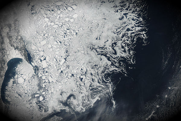
Image credit: TW
In late March, 2012 sea ice hugged the shores of Russia’s Sakhalin Island and covered much of the Sea of Okhotsk. As spring brings increasing sunlight to the region, the ice will begin to break up and flow out to the Pacific Ocean. On March 23, the Japanese Meteorological Agency predicted that ice would flow out of the Goyoumai Pass and the Kunashiri Pass near Hokkaido, Japan in the upcoming week, and warned ships to be cautious about the movement of sea ice.

The National Snow and Ice Data Center (NSIDC) announced that the Arctic sea ice reached its maximum extent for the winter of 2011-2012 on March 18. The total extent was 15.24 million square kilometers (5.88 million square miles), which was below the 1979-2000 average, but still slightly above the record low, which was recorded during the winter of 2010-2011.
The Sea of Okhotsk lies at a similar latitude as Portland, Oregon and Venice, Italy, and the Sea is the southernmost extent of Artic sea ice. It is generally icebound from November to June, and is frequently covered in heavy fog, making clear images, such as this one, difficult to acquire. (MODIS)

Published in the last 24 hours
- High Risk of excessive rainfall covers Florida’s Space Coast as St. Johns River near Cocoa reaches 5.67 m
- Four small asteroids will pass close to Earth from November 21 to 23
- Cyclone Akvan weakens after landfall near Gopalpur; more than 300 000 evacuated in Odisha, India
- A broad low over southeastern Florida and the northwestern Bahamas has a 30 percent chance of subtropical or tropical development within 48 hours and a 50 percent chance within 7 days, the National Hurricane Center says
