
Tropical Storm “Eta” makes landfall in Florida after leaving more than 235 dead in Central America
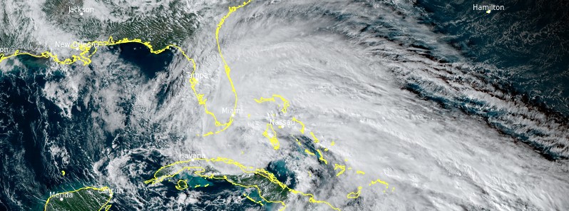
Featured image: Tropical Storm "Eta" at 20:20 UTC on November 8, 2020. Credit: NOAA/GOES-East, RAMMB/CIRA
After striking Nicaragua on November 2 as a Category 4 hurricane and leaving more than 235 people dead in Central America, Eta made landfall along the south-central coast of Cuba at around 09:00 UTC on November 8 and in Lower Matecumbe Key in Florida, U.S at 04:00 UTC on November 9, both with maximum sustained winds of 100 km/h (65 mph) – tropical storm strength.
- Heavy rainfall from Eta will continue across portions of Cuba, Jamaica, the Bahamas, and southern Florida and spread north into central Florida, NHC warns.
- Life-threatening flash flooding will be possible across inundated urban areas of southeast Florida today.
- Flash and urban flooding will also be possible for Cuba, Jamaica, the Bahamas and the remainder of southern Florida, along with potential minor river flooding in central Florida.
- Tropical storm conditions will continue across portions of the Florida Keys, and south and central Florida today.
- Water levels will gradually recede along portions of the southern coast of the Florida peninsula and Keys. Residents in these areas should follow any advice given by local officials.
- Eta could approach the Florida Gulf Coast later this week as a tropical storm, and possibly bring impacts from rain, wind, and storm surge. Interests in this area should monitor the progress of Eta and updates to the forecast this week.
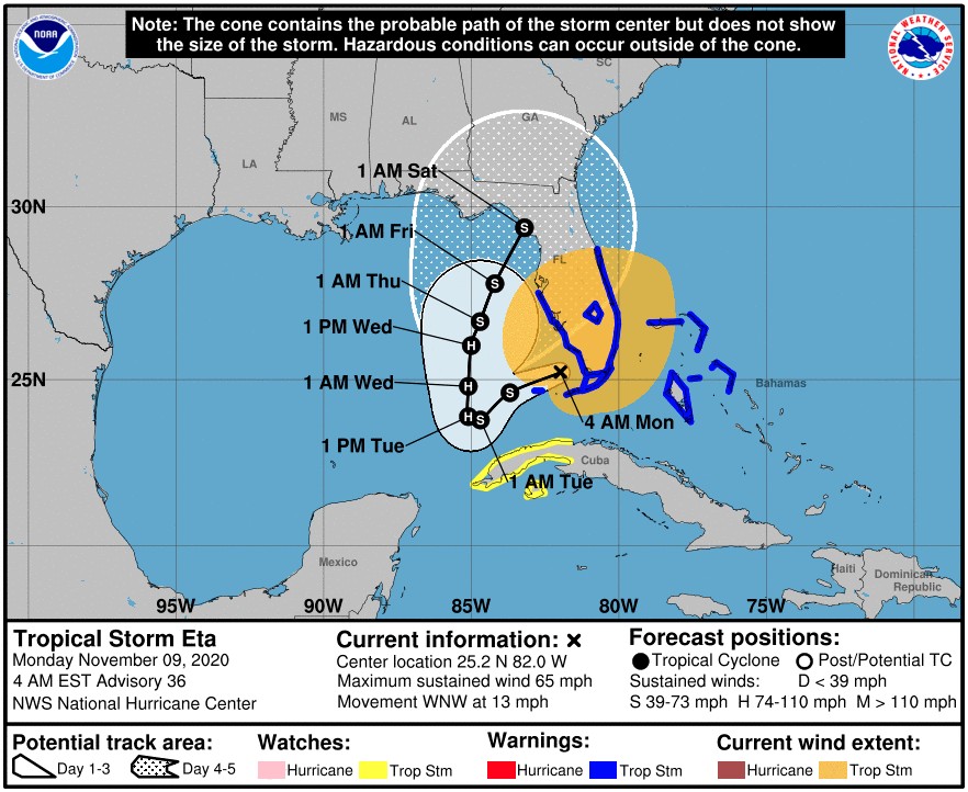
At 09:00 UTC on November 9, the center of Tropical Storm "Eta" was located about 70 km (45 miles) NNW of Key West and 100 km (62 miles) S of Naples, Florida. Eta had maximum sustained winds of 100 km/h (62 mph) and was moving 20 km/h (13 mph). Its minimum central pressure was 992 hPa.
A Tropical Storm Warning is in effect for the Northwestern Bahamas, including the Abacos, Andros Island, Berry Islands, Bimini, Eleuthera, Grand Bahama Island, and New Providence; Florida coast from Brevard/Volusia County line to Anna Maria Island; Florida Keys from Ocean Reef to the Dry Tortugas, including Florida Bay; and Lake Okeechobee.
A Tropical Storm Watch is in effect for the Cuban provinces of La Habana, Artemisa, Mayabeque, Pinar del Rio, and the Isle of Youth.
A west to west-southwest motion with some reduction in forward speed is expected later today (EST) and tonight.
Little overall motion is expected on Tuesday, November 10, and a slow northward motion is forecast on Wednesday.
Tropical Storm "Eta" at 20:20 UTC on November 8, 2020. Credit: NOAA/GOES-East, RAMMB/CIRA
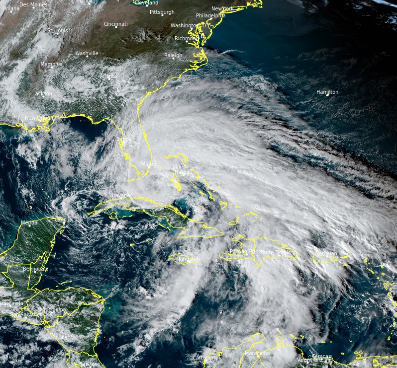
Tropical Storm "Eta" at 08:20 UTC on November 9, 2020. Credit: NOAA/GOES-East, RAMMB/CIRA
On the forecast track, the center of Eta will gradually pull away from the Florida Keys and south Florida today and be over the southeastern Gulf of Mexico tonight through Wednesday.
Data from a NOAA Hurricane Hunter aircraft and National Weather Service Doppler radar indicate that the maximum sustained winds remain near 100 km/h with higher gusts.
Some strengthening is forecast during the next day or so, and Eta is forecast to become a hurricane when it moves over the southeastern Gulf of Mexico, according to the NHC.
"However, there will be a fair amount of dry air surrounding Eta, and that should limit the amount of intensification. Beyond a couple of days, depending on exactly where Eta is, the models show an increase in westerly shear, which in combination with the dry air should cause a slow decay," NHC forecaster Cangialosi noted.
"The NHC intensity forecast is unchanged from the previous one, and is also of low confidence since its unclear where Eta will be located later in the week."
At least 235 fatalities have been reported across Central America since November 2, including about 150 in Guatemala, 41 in Honduras, 22 in Mexico, 17 in Panama, 2 in Nicaragua, two in Costa Rica, and 1 in El Salvador.
"Eta is the record 12th named storm to make landfall in the continental U.S. this year. Prior to 2020, the most Atlantic named storms to make landfall in the continental U.S. in a single hurricane season was 9, set in 1916," Dr. Philip Klotzbach noted.
I'm a dedicated researcher, journalist, and editor at The Watchers. With over 20 years of experience in the media industry, I specialize in hard science news, focusing on extreme weather, seismic and volcanic activity, space weather, and astronomy, including near-Earth objects and planetary defense strategies. You can reach me at teo /at/ watchers.news.
Commenting rules and guidelines
We value the thoughts and opinions of our readers and welcome healthy discussions on our website. In order to maintain a respectful and positive community, we ask that all commenters follow these rules.