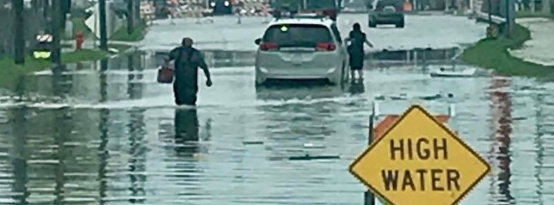
Severe storms and widespread flooding claim 7 lives, cause major damage, U.S.

At least three people have been killed after major flooding hit U.S. Midwest late this week, bringing the death toll to at least 7 since Monday, April 29, 2019. Widespread flooding is affecting the country from Michigan to the South and is expected to continue in the days ahead.
Storms that hit the region over the past 7 days produced numerous tornadoes, overturning trucks and damaging homes, and dumped heavy rain on a region dealing with widespread flooding since mid-March.
"The state of Iowa has received more precipitation in the last 12 months than any recorded period in 124 years of data," Bob Gallagher, the mayor of the of Bettendorf said Friday, May 3. "When you get as much rain as we have this year there's just no way to avoid this situation."
The Mississippi River reached 6.91 m (22.70 feet) at Rock Island, the Quad Cities region on May 2, breaking the previous record of 6.89 mm (22.63 feet) set on July 9, 1993, and making it the highest level there in 157 years. The flood crest surpassed 7.34 m (24.10 feet) in Illinois City on May 3, NWS reported.
The Mississippi River has been at a major flood stage for 42 days and will continue at this stage this weekend. Yet another rise is expected next week as new storms hit the region.
A preliminary unofficial crest and possible new record of 22.70 feet was recorded on the Mississippi River at Rock Island just before 6 PM Thursday May 2nd. pic.twitter.com/9ebf3e0Zgn
— NWS Quad Cities (@NWSQuadCities) May 3, 2019
Here is the latest Mississippi River flood crest information! pic.twitter.com/gM2Fbhub53
— NWS Quad Cities (@NWSQuadCities) May 3, 2019
A state of emergency was declared in Michigan's Wayne County after storms caused widespread flooding, leaving an estimated 3 000 homes flooded.
A levee overtopped about 60 km (40 miles) NW of St. Louis, flooding the towns of Winfield and Foley.
Other parts of the Midwest and the South experienced severe flooding, with roads and bridges closed, and flooding is expected to continue in the days ahead as more storms descend on the region.


A slow moving cold front will gradually push into the South and East to produce strong to severe thunderstorms and locally heavy rainfall with flooding from the South and Tennessee Valley into the Southeast and Mid-Atlantic this weekend, NWS warned.
The highest likelihood for severe thunderstorms will be from the Central Gulf Coast into parts of the Southeast and Carolinas, where there is a Slight Risk of severe weather in place from the Storm Prediction Center.
There is also a Slight Risk of excessive rainfall today, where heavy rain could cause flash flooding across the Lower Mississippi Valley as well as parts of the Ohio Valley and Mid-Atlantic region.
On Sunday, May 5, rain should be confined to the Eastern Seaboard as the front pushing east will help clear out the moisture in the Central Gulf Coast states and the Tennessee/Ohio Valleys.
Warm temperatures are expected in the Southeast, Carolinas, and Mid-Atlantic ahead of the front, especially for overnight lows – several record high minimum temperatures could be set on Saturday and Sunday morning.
Featured image credit: Moline Police

Commenting rules and guidelines
We value the thoughts and opinions of our readers and welcome healthy discussions on our website. In order to maintain a respectful and positive community, we ask that all commenters follow these rules:
We reserve the right to remove any comments that violate these rules. By commenting on our website, you agree to abide by these guidelines. Thank you for helping to create a positive and welcoming environment for all.