
In the winter of 1811–12, earthquakes near New Madrid, Missouri, shook so hard that witnesses saw the Mississippi River flow backward, and the shaking left a brand-new lake in Tennessee
During the New Madrid earthquakes of 1811–1812, waves and sudden riverbed uplift sent parts of the Mississippi River surging upstream. The February 7, 1812 shock also reshaped northwestern Tennessee, where ground subsidence and obstructed drainage helped form modern Reelfoot Lake. The river disturbance was temporary; the flooded landscape endured.
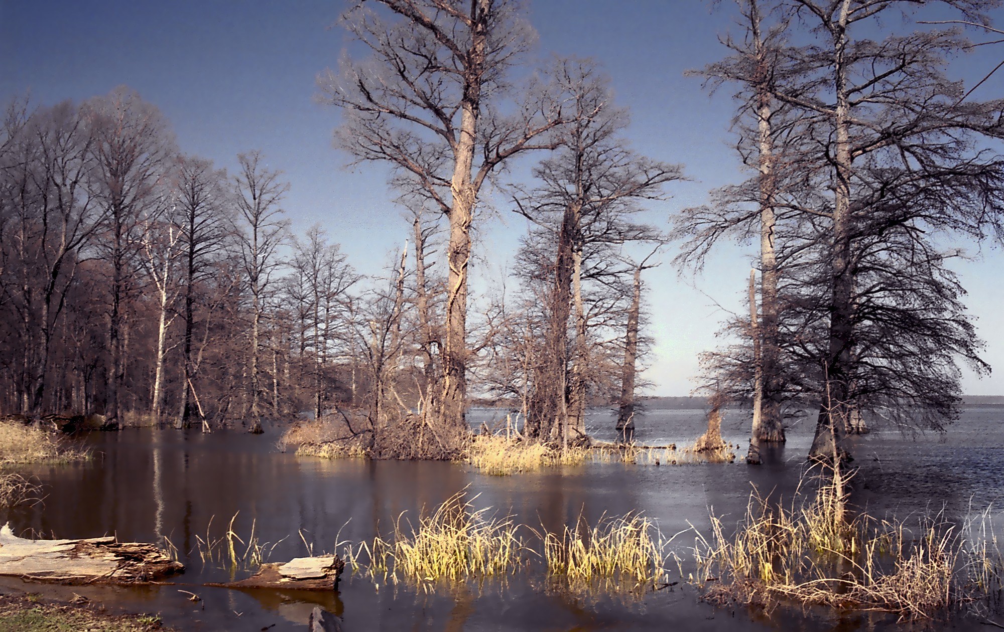
Reelfoot Lake in northwest Tennessee, formed when land subsided during the New Madrid earthquakes of 1811 and 1812. Credit: JeremyA, CC BY-SA 2.5, via Wikimedia Commons.
The Mississippi Valley experienced three principal earthquakes between December 16, 1811, and February 7, 1812. The sequence damaged settlements, collapsed riverbanks and changed the elevation of parts of the floodplain around New Madrid, Missouri, and neighboring states.
Its two best-known water stories describe different effects. Upstream waves and temporary obstructions disturbed the Mississippi’s flow, while lasting changes to ground levels and drainage helped establish the modern extent of Reelfoot Lake in northwestern Tennessee.
Three main shocks and months of aftershocks
The first principal earthquake struck northeastern Arkansas before dawn on December 16. The January 23 shock occurred in Missouri, followed by the February 7 earthquake along the Reelfoot fault in Missouri and Tennessee. The USGS summary gives the following approximate times and preferred magnitude estimates, using values adopted for its 2014 national seismic hazard maps.
| Date | Approximate UTC time | Approximate local time | Estimated magnitude |
|---|---|---|---|
| December 16, 1811 | 08:15 | 02:15 | 7.5 |
| January 23, 1812 | 15:15 | 09:15 | 7.3 |
| February 7, 1812 | 09:45 | 03:45 | 7.5 |
A major aftershock followed at about 13:15 UTC (07:15 local time) on December 16. The USGS estimates its magnitude at about 7.0 and notes that some researchers treat it as a fourth principal earthquake. Aftershocks continued for months.
No instrumental seismograms exist for these events. Researchers estimate their size from historical descriptions of shaking and damage, supported by geological evidence. Accounts describing the cumulative effects of several shocks make it especially difficult to separate the later earthquakes’ impacts.
The USGS estimates that damaging shaking from the first earthquake covered about 600 000 km² (230 000 square miles), while its summary gives roughly 5 million km² (1.9 million square miles) for the sequence’s broader felt area. Chimney damage was reported as far away as Cincinnati, Ohio.
Waves and raised riverbeds disrupted the current
Earthquake shaking generated large waves on the Mississippi, including sloshing oscillations described by the USGS as seiches. Waves traveling upstream could make water surge against the river’s usual direction.
Ground deformation also changed the channel itself. The USGS describes uplift along a fault crossing the river that created a scarp, or steep rise, producing temporary damming and waterfalls at different locations. Water backing up behind an obstruction offers another explanation for boatmen’s reports of reverse flow.
These were real disturbances of water and ground. The accounts do not establish a lasting reversal of the Mississippi’s entire course, or one duration that applies to every reported upstream surge.
Bryan remembered more than one river disturbance
Eliza Bryan described the sequence in a letter to the Reverend Lorenzo Dow dated March 22, 1816. Her account, preserved in the University of Memphis earthquake compendium, is an eyewitness recollection written more than four years after the first shock.
While recounting December 16, she described the Mississippi’s current as “retrograde for a few minutes.” The placement of that passage matters: it is not her description of the February 7 event.
Her February account describes water retreating from the banks, returning violently and carrying boats into a small creek. She also recalled residents living in makeshift camps because they feared their houses would fall.
Bryan acknowledged that she was writing “just as it occurred to my memory.” Her letter records what she remembered seeing and hearing; its estimates of heights, distances and timing require the care appropriate to a retrospective eyewitness account.
Subsidence and blocked drainage expanded the lake
The February 7 earthquake produced lasting deformation near Reelfoot Lake. The USGS summary reports subsidence of about 1.5–6 m (5–20 feet) in the affected lake area, east of the uplifted Tiptonville dome.
The drainage change was also important. A 2021 study in Tectonics describes how folding above the Reelfoot fault, together with subsidence on its lower side, dammed the Reelfoot River and flooded the lowlands upstream. Water accumulated because both the land surface and its outlet had changed.
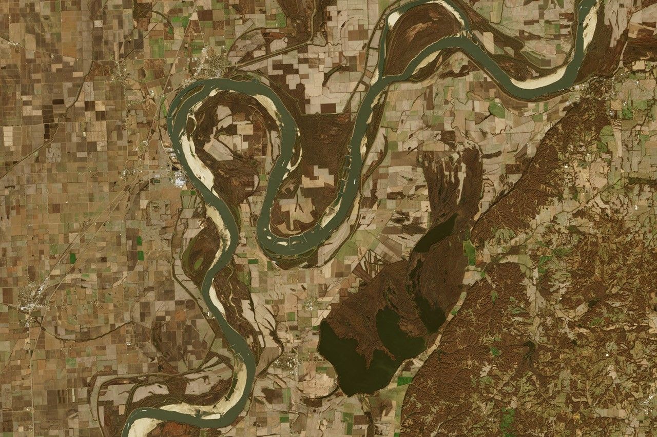
The lake occupies an older river landscape. A USGS geological investigation published in 1982 inferred that remnants of oxbow lakes existed before the earthquakes, based on lake-bottom topography, abandoned channels and submerged land features. It described the earthquakes as enlarging the lake.
That history supports describing the 1812 earthquake as helping form modern Reelfoot Lake through expanded inundation and altered drainage. The lake and surrounding wetlands now include a state park and national wildlife refuge.
Buried faults leave evidence across the floodplain
The New Madrid Seismic Zone lies inside the North American plate, far from its boundaries. Its faults are largely hidden beneath river sediment. Seismometers have recorded thousands of small to moderate earthquakes in the region since 1974.
The region remains a focus of earthquake-hazard assessments, and small earthquakes were reported near New Madrid in December 2024. Those observations belong to a continuing record of activity, rather than a forecast of a particular large earthquake.

Water-saturated sandy sediment also preserves evidence of strong shaking. During liquefaction, rising pore-water pressure causes the sediment to lose strength, allowing water and sand to escape through fissures and spread across the surface as sand blows. Some deposits in the region predate 1811 and record older earthquakes.2
Researchers also examine landforms above the buried faults. Jaime Delano and colleagues used laser-derived terrain maps and boreholes in the nearby Obion River valley to identify broad folding associated with Reelfoot fault movement. Such deformation can alter drainage without producing an obvious surface break, making warped terraces and former shorelines important evidence for reconstructing the region’s earthquake history.4
References
1 Summary of 1811–1812 New Madrid Earthquakes Sequence — U.S. Geological Survey — October 2, 2019.
2 The New Madrid Seismic Zone — U.S. Geological Survey — program overview and questions; accessed November 11, 2026.
3 Bryan, Eliza. Letter to the Reverend Lorenzo Dow, March 22, 1816 — reproduced in History of Cosmopolite, pp. 344–346 — Center for Earthquake Research and Information, University of Memphis, scanned account.
4 Delano, J. E., Briggs, R. W., Thompson Jobe, J., Gold, R. D., and Engelhart, S. E. Quaternary Reelfoot Fault Deformation in the Obion River Valley, Tennessee, USA — Tectonics, 40, e2019TC005990 — August 6, 2021 — DOI: 10.1029/2019TC005990.
5 McKeown, F. A., and Pakiser, L. C., editors. Investigations of the New Madrid, Missouri, Earthquake Region — U.S. Geological Survey Professional Paper 1236 — 1982 — discussion of Reelfoot Lake by D. P. Russ, p. 106.
6 A Lake Born out of an Earthquake — NASA Earth Observatory — December 22, 2023.
7 Map New Madrid Seismic Zone — U.S. Geological Survey — historical map and media description; accessed November 11, 2026.

Rishav Kothari is Editor-in-Chief of The Watchers, where he runs the newsroom and covers earthquakes, volcanoes, severe weather and space weather.
Published in the last 24 hours
- On 28 August 1859 a solar storm shocked telegraph operators and threw sparks on other lines, and on 2 September Boston to Portland clerks unhooked their batteries and kept sending for more than two hours on the aurora's current alone. Epicenter
- In 2019, the Ronald Reagan Presidential Library hired hundreds of goats to eat 13 acres of brush around it; months later the Easy Fire surrounded the library, and the fire break the goats left behind slowed the flames before they reached the building Epicenter
- In 1927, Louisiana dynamited a Mississippi River levee to save New Orleans, flooding the homes of about 10,000 people downstream, and the city turned out never to need it Epicenter
- In April 2014, golden-winged warblers in the mountains of Tennessee, songbirds weighing about as much as four dimes, fled their breeding grounds a day or two before a tornado outbreak and flew hundreds of miles south, while the scientists tracking them sheltered in a Waffle House Epicenter
