Tropical storm “Beryl” forecast to strengthen into hurricane near Windward Islands

Tropical Storm “Beryl” formed at 03:00 UTC on June 29, 2024, as the second named storm of the 2024 Atlantic hurricane season. Beryl is forecast to strengthen into a hurricane as it reaches Windward Islands.
- Residents, visitors, local authorities, and businesses in the Lesser Antilles should closely monitor the progress of this system. Hurricane and Tropical Storm Watches will likely be required for portions of the area early Saturday, June 29.
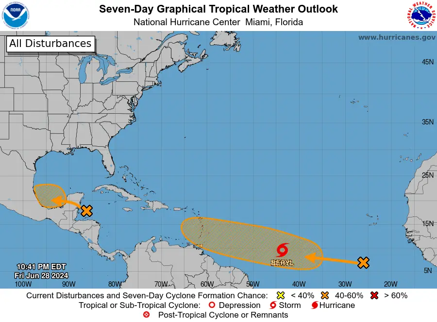
- There are 2 more disturbances in the basin, as of early June 29.
At 03:00 UTC on June 29, the center of Tropical Storm “Beryl” was located about 1 785 km (1 110 miles) ESE of Barbados. The storm had maximum sustained winds of 65 km/h (40 mph) and a minimum central pressure of 1 006 hPa. It was moving W at 30 km/h (18 mph).
At the time, tropical-storm-force winds extended outward up to 75 km (45 miles) from the center.
Steady strengthening is forecast, and Beryl is expected to become a hurricane as it approaches Windward Islands.
Relatively quick westward to west-northwestward motion is expected to take Beryl across the Windward Islands late Sunday night, June 30, and Monday, July 1.


A total of 75 – 150 mm (3 to 6 inches) of rainfall is expected across Barbados and the Windward Islands, potentially producing localized flooding in vulnerable areas.
Swells are expected to reach the Windward and southern Leeward Islands by late Sunday. These swells are likely to cause life-threatening surf and rip current conditions.
There are 2 more disturbances in the basin, as of early June 29.
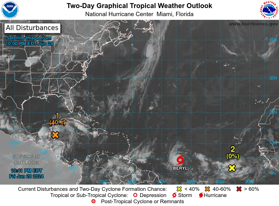
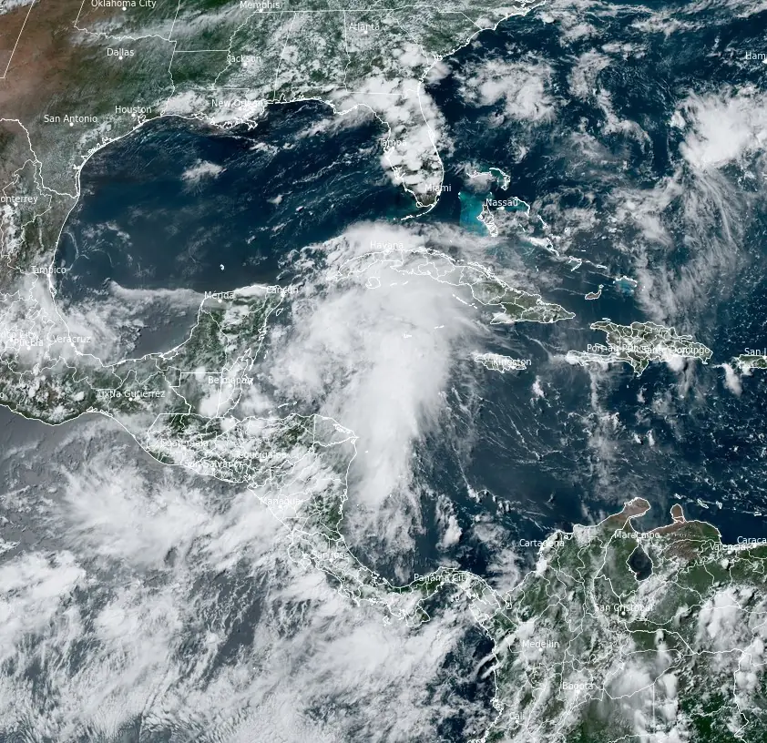
In the northwestern Caribbean Sea, a broad area of low pressure is producing widespread but disorganized showers and thunderstorms. Development of this low is not expected before it moves inland over the Yucatan Peninsula today.
The system is forecast to move west-northwestward, emerging over the Bay of Campeche on Saturday night or early Sunday (LT), where conditions are generally conducive for further development. A tropical depression could form before the system moves inland again early next week over Mexico.
Regardless of development, heavy rainfall associated with this low-pressure area will affect parts of Central America and Mexico through early next week. The formation chance through 48 hours is medium at 40 percent, and the formation chance through seven days remains medium at 40 percent.
In the Eastern Tropical Atlantic, a tropical wave located several hundred km SSW of the Cabo Verde Islands is producing an area of disorganized showers and thunderstorms.
Environmental conditions appear generally conducive for additional development of this system, and a tropical depression could form by the middle of next week while it moves generally westward at 24 to 32 km/h (15 to 20 mph) across the eastern and central tropical Atlantic.
The formation chance through 48 hours is low at nearly 0 percent, but the formation chance through seven days is medium at 40 percent.
References:
1 Tropical Storm Beryl – Advisory Number 2 – NWS/NHC – 03:00 UTC on June 29, 2024
2 Tropical Weather Outlook – NWS/NHC – 00:00 UTC on June 29, 2024
Featured image: Tropical Storm “Beryl” forming in the Atlantic Ocean. Credit: NOAA/GOES-East, RAMMB/CIRA, The Watchers. Acquired at 19:40 UTC on June 28, 2024
Commenting rules and guidelines
We value the thoughts and opinions of our readers and welcome healthy discussions on our website. In order to maintain a respectful and positive community, we ask that all commenters follow these rules.