
High-level eruption at Hunga Tonga-Hunga Ha’apai volcano, Tonga
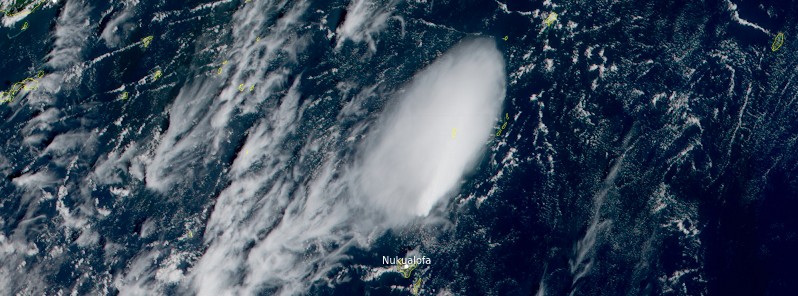
Featured image: Hunga Tonga-Hunga Ha'apai eruption on December 19, 2021. Credit: JMA/Himawari-8, RAMMB/CIRA, TW
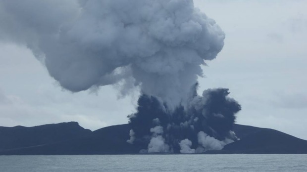
A high-level eruption started at Hunga Tonga-Hunga Ha'apai volcano, Tonga on December 19, 2021, with a volcanic plume rising up to 6 km (20 000 feet) above sea level at 21:41 UTC, according to the Wellington VAAC. The Aviation Color Code was raised to Red.
Satellite imagery acquired at 22:09 UTC indicates steam plume with no ash identifiable, Wellington VAAC reported in VA Advisory issued at 22:09 UTC on December 19.1
Tonga's head geologist Taaniela Kula said the plume eventually rose up to 16 km (52 000 feet) above sea level.
His initial analysis was based on the quality of images they were receiving from Japan's Himawari-8 satellite.2
"The eruption was so violent and loud that several people here in Vava'u heard them," said Brian Meikle. Vava'u is about 261 km (162 miles) NE of the volcano.
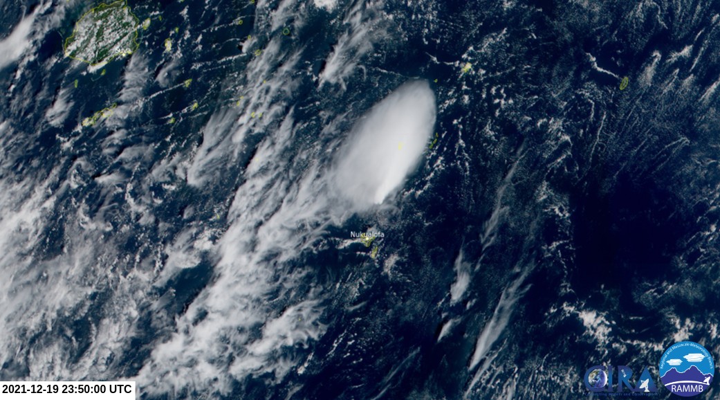
Hunga Tonga-Hunga Ha'apai eruption on December 19, 2021. Credit: JMA/Himawari-8, RAMMB/CIRA, TW
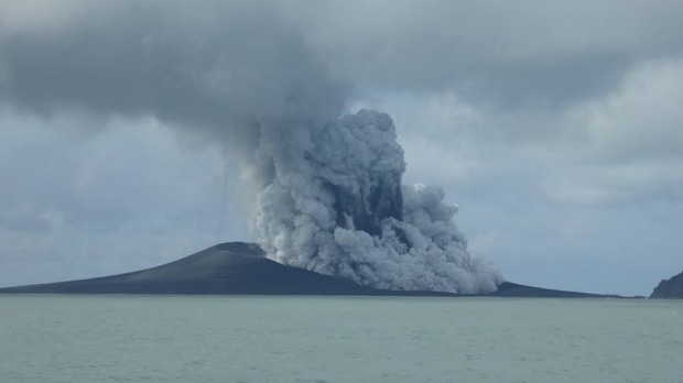
A high-level eruption to 12.2 km (40 000 feet) a.s.l. was observed on satellite imagery acquired at 17:50 UTC on December 20, Wellington VAAC reported at 19:38 UTC on December 20.
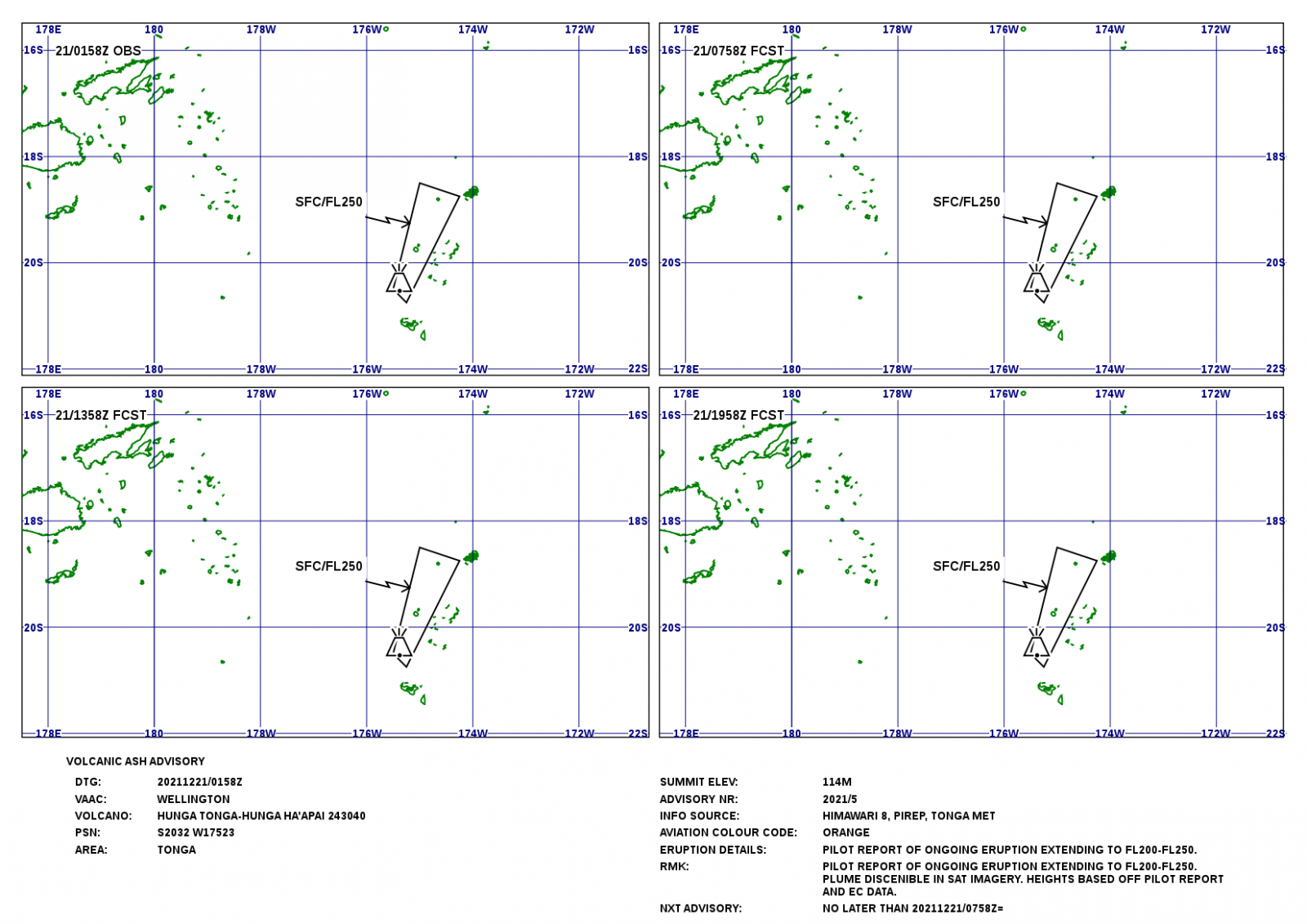
Based on pilot reports, the volcanic plume was observed rising up to 6 – 7.6 km (20 000 to 25 000 feet) a.s.l., the center said in a new advisory issued at 01:58 UTC on December 21.
The last eruption of this volcano started on December 19, 2014, and ended on January 23 (± 3 days), 2015 (VEI 2).
The eruption created a new island, about 65 km (40 miles) NW of Nuku'alofa, Tonga, still there today.3
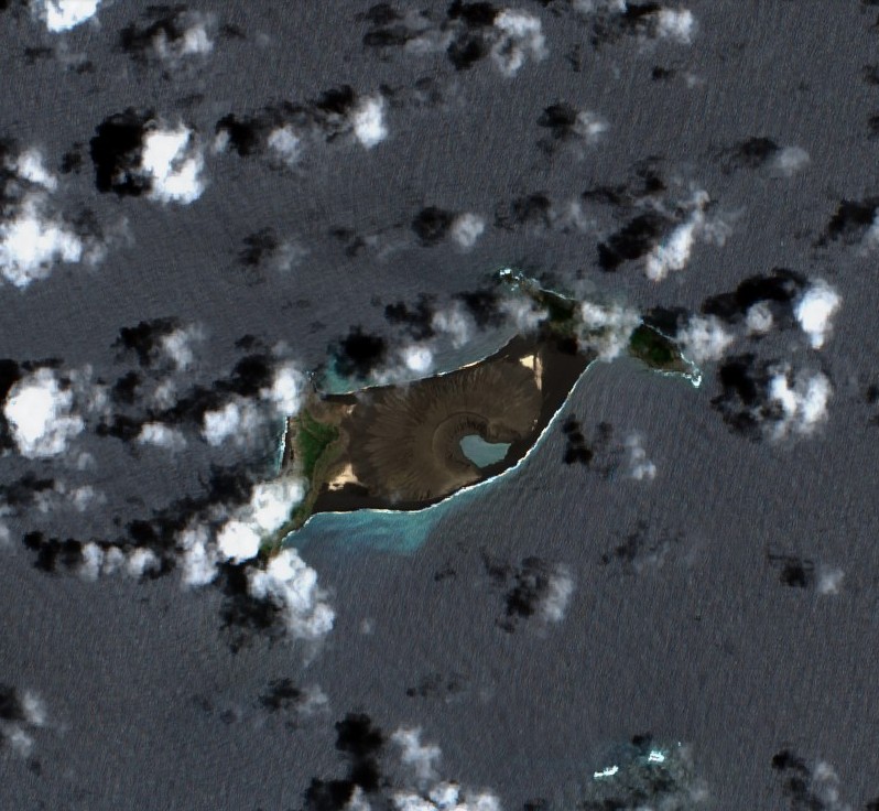
Hunga Tonga-Hunga Ha'apai on December 18, 2021. Credit: Copernicus EU/Sentinel-2, TW
As of January 15, 2015 the island was more than 1 km (0.6 miles) long, about 2 km (1.2 miles) wide, and around 100 m (330 feet) high, Tonga's Lands, Survey and Natural Resources Ministry deputy secretary Taaniela Kula said.
"A new island has been built by the eruption between the existing islands of Hunga Tonga and Hunga Ha'apai, and is now joined to Hunga Ha'apai," he said.
.jpg)
The eruption site as reported on December 20, 2014. Image credit: Lands, Survey and Natural Resources Ministry – Tonga
The location of new island. Image credit: Lands, Survey and Natural Resources Ministry – Tonga / Matangi Tonga
"During our observations the volcano was erupting about every five minutes to a height of about 400 m (1 300 feet), accompanied by some large rocks. As the ash is very wet, most is being deposited close to the vent, building up the new island."
Hazardous surges of ash and steam were seen to spread out horizontally during eruptions, and these extended more than 1 km (0.6 miles) from the erupting vent.
Hunga Tonga-Hunga Ha'apai eruption on January 15, 2015. Image credit: New Zealand High Commission – Tonga
Leaves on trees on Hunga Tonga and Hunga Ha'apai have died, probably caused by volcanic ash and gases.
No large rafts of pumice or other floating volcanic debris were observed. Strong smells of volcanic gases were noticed on a few occasions.
Hunga Tonga-Hunga Ha'apai eruption on January 15, 2015. Image credit: New Zealand High Commission – Tonga
This eruption was similar to that at Hunga Ha’apai in 2009, but produced a larger volume of materials building the island, Kula said.
Ash and acid rain was falling within 10 km (6.2 miles) of the eruption.
The image below shows the eruption area on April 28, 2015, four months after the eruption.
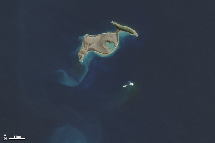
Image credit: NASA/USGS. Acquired April 28, 2015.
Geologic summary
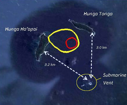
The small islands of Hunga Tonga and Hunga Ha'apai cap a large seamount located about 30 km (18 miles) SSE of Falcon Island.
The two linear andesitic islands are about 2 km (1.2 miles) long and represent the western and northern remnants of the rim of a largely submarine caldera lying east and south of the islands.
Hunga Tonga and Hunga Ha'apai reach an elevation of only 149 m (488 feet) and 128 m (419 feet) above sea level, respectively, and display inward-facing sea cliffs with lava and tephra layers dipping gently away from the submarine caldera.
A rocky shoal 3.2 km (2 miles) SE of Hunga Ha'apai and 3 km (1.8 miles) south of Hunga Tonga marks the most prominent historically active vent.
Several submarine eruptions have occurred at Hunga Tonga-Hunga Ha'apai since the first historical eruption in 1912.4
References:
1 VA ADVISORY DTG: 20211219/2209Z VAAC: WELLINGTON
2 Air NZ funeral flight to Tonga cancelled as Hunga eruption continues – Matangi Tonga
3 New island being formed by Hunga Tonga-Hunga Ha'apai eruption – The Watchers
4 Hunga Tonga-Hunga Ha'apai – Geological summary – GVP
I'm a dedicated researcher, journalist, and editor at The Watchers. With over 20 years of experience in the media industry, I specialize in hard science news, focusing on extreme weather, seismic and volcanic activity, space weather, and astronomy, including near-Earth objects and planetary defense strategies. You can reach me at teo /at/ watchers.news.
Commenting rules and guidelines
We value the thoughts and opinions of our readers and welcome healthy discussions on our website. In order to maintain a respectful and positive community, we ask that all commenters follow these rules.