
The Weekly Volcanic Activity Report: August 11 – 17, 2021
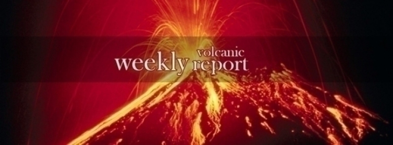
Image credit: TW
New activity/unrest was reported for 10 volcanoes from August 11 to 17, 2021. During the same period, ongoing activity was reported for 7 volcanoes.
New activity/unrest: Atka, Andreanof Islands (USA) | Chirinkotan, Kuril Islands (Russia) | Fukutoku-Oka-no-Ba, Volcano Islands (Japan) | Great Sitkin, Andreanof Islands (USA) | Krysuvik-Trolladyngja, Iceland | Nishinoshima, Japan | Pacaya, Guatemala | Pavlof, United States | Sarychev Peak, Matua Island (Russia) | Semisopochnoi, Aleutian Islands (USA).
Ongoing activity: Ebeko, Paramushir Island (Russia) | Karymsky, Eastern Kamchatka (Russia) | Lewotolok, Lembata Island (Indonesia) | Merapi, Central Java (Indonesia) | Rincon de la Vieja, Costa Rica | Sheveluch, Central Kamchatka (Russia) | Suwanosejima, Ryukyu Islands (Japan).
The Weekly Volcanic Activity Report is a cooperative project between the Smithsonian's Global Volcanism Program and the US Geological Survey's Volcano Hazards Program. Updated by 23:00 UTC every Wednesday, these reports are preliminary and subject to change as events are studied in more detail. This is not a comprehensive list of all of Earth's volcanoes erupting during the week, but rather a summary of activity at volcanoes that meet criteria discussed in detail in the "Criteria and Disclaimers" section. Carefully reviewed, detailed reports about recent activity are published in issues of the Bulletin of the Global Volcanism Network.
New activity/unrest
Atka, Andreanof Islands (USA)
52.331°N, 174.139°W, Summit elev. 1448 m
The number of small shallow earthquakes increased at Atka during 10-11 August, prompting AVO to raise the Aviation Color Code to Yellow and the Volcano Alert Level to Advisory. The earthquakes were located at a depth of 3-6 km and around 7 km SW of Korovin, though may be related to the several vents that are part of the Atka volcanic complex. Seismicity declined afterwards but remained above background levels through 16 August, and was near baseline levels by 17 August.
Geological summary: The largest volcanic center in the central Aleutians, Atka consists of a central shield and Pleistocene caldera with several post-caldera volcanoes. A major dacitic explosive eruption accompanied formation of the caldera about 500,000 to 300,000 years ago. The most prominent of the post-caldera stratovolcanoes are Kliuchef and Sarichef, both of which may have been active in historical time. Sarichef has a symmetrical profile, but the less eroded Kliuchef is the source of most if not all historical eruptions. Kliuchef may have been active on occasion simultaneously with Korovin volcano to the north. Hot springs and fumaroles are located on the flanks of Mount Kliuchef and in a glacial valley SW of Kliuchef.
Chirinkotan, Kuril Islands (Russia)
48.98°N, 153.48°E, Summit elev. 724 m
KVERT reported that the eruption at Chirinkotan continued during 11-17 August. An explosion at 1315 on 14 August produced a 15 x 17 km ash plume that rose 3-3.5 km (10,000-11,500 ft) a.s.l. and drifted 13 km SSE. Ash plumes from an explosion at 0945 on 15 August rose 2.5-3 km (8,200-10,000 ft) a.s.l. and drifted 8 km S. KVERT and SVERT noted that another explosive event at 1010 on 16 August generated ash plumes that rose 3.5-5 km (11,500-16,400 ft) a.s.l. and drifted 23 km E. The Aviation Color Code remained at Orange (the second highest level on a four-color scale).
Geological summary: The small, mostly unvegetated 3-km-wide island of Chirinkotan occupies the far end of an E-W volcanic chain that extends nearly 50 km W of the central part of the main Kuril Islands arc. It is the emergent summit of a volcano that rises 3000 m from the floor of the Kuril Basin. A small 1-km-wide caldera about 300-400 m deep is open to the SW. Lava flows from a cone within the breached crater reached the shore of the island. Historical eruptions have been recorded since the 18th century. Lava flows were observed by the English fur trader Captain Snow in the 1880s.
Fukutoku-Oka-no-Ba, Volcano Islands (Japan)
24.285°N, 141.481°E, Summit elev. -29 m
JMA reported that a large eruption at Fukutoku-Oka-no-Ba commenced around 0620 on 13 August based on satellite data. Ash plumes rose as high as 16 km (54,000 ft) a.s.l. and drifted W. The eruption was also confirmed during an overflight later that day. Video showed Surtseyan explosions ejecting black material above the ocean’s surface, and ash plumes drifted W. Ash plumes identified in satellite images rose 12.2-16 km (40,000-54,000 ft) a.s.l. during 13-15 August; the height of the plume decreased afterwards though the eruption intermittently continued. The Japan Coast Guard observed a new horseshoe-shaped island that was about 1 km in diameter during an overflight on 15 August. They also observed and photographed a notable pumice raft swirling with the currents as far as 60 km NW. JMA noted that the volcano last erupted in 2010 and frequent episodes of discolored seawater had been observed since then.
Geological summary: Fukutoku-Oka-no-ba is a submarine volcano located 5 km NE of the pyramidal island of Minami-Ioto. Water discoloration is frequently observed from the volcano, and several ephemeral islands have formed in the 20th century. The first of these formed Shin-Ioto ("New Sulfur Island") in 1904, and the most recent island was formed in 1986. The volcano is part of an elongated edifice with two major topographic highs trending NNW-SSE, and is a trachyandesitic volcano geochemically similar to Ioto.
Great Sitkin, Andreanof Islands (USA)
52.076°N, 176.13°W, Summit elev. 1740 m
AVO reported that the lava dome at Great Sitkin continued to be active, growing in diameter from 250 m on 6 August, to 380 m three days later, and to 700 m by 16 August. Steam-and-gas plumes were periodically observed in webcam images, in satellite data, and by observers on the ground during 11-17 August. Elevated surface temperatures and small earthquakes detected daily were consistent with the growing dome. The Aviation Color Code and the Volcano Alert Level remained at Orange and Watch, respectively.
Geological summary: The Great Sitkin volcano forms much of the northern side of Great Sitkin Island. A younger parasitic volcano capped by a small, 0.8 x 1.2 km ice-filled summit caldera was constructed within a large late-Pleistocene or early Holocene scarp formed by massive edifice failure that truncated an ancestral volcano and produced a submarine debris avalanche. Deposits from this and an older debris avalanche from a source to the south cover a broad area of the ocean floor north of the volcano. The summit lies along the eastern rim of the younger collapse scarp. Deposits from an earlier caldera-forming eruption of unknown age cover the flanks of the island to a depth up to 6 m. The small younger caldera was partially filled by lava domes emplaced in 1945 and 1974, and five small older flank lava domes, two of which lie on the coastline, were constructed along northwest- and NNW-trending lines. Hot springs, mud pots, and fumaroles occur near the head of Big Fox Creek, south of the volcano. Historical eruptions have been recorded since the late-19th century.
Krysuvik-Trolladyngja, Iceland
63.917°N, 22.067°W, Summit elev. 360 m
The fissure eruption in the W part of the Krýsuvík-Trölladyngja volcanic system, close to Fagradalsfjall on the Reykjanes Peninsula, continued during 11-17 August. According to the Institute of Earth Sciences photographs of the flow field captured on 8 August suggested that the lava effusion rate averaged 9.3 cubic meters per second over the previous 12 days. The area of the flow field had grown to 4.4 square kilometers, and the total volume erupted was 119 million cubic meters. New ground cracks were observed in Gónhóll, a hill S of the main crater (the fifth vent) that was a former vantage point but is now surrounded by lava, though they had likely formed sometime in the previous two weeks and may not have been caused by rising magma. A new vent that opened on 9 August was not confirmed to be separate from the nearby main vent until about a week later. The new cone quickly grew from intense spattering and by 17 August was around the same height as the main crater. Spattering from the new vent was at times ejected higher than spatter from the main vent. The Aviation Color Code remained at Orange due to the lack of ash and tephra emissions, though IMO warned of the potential for lapilli and scoria fallout within a 650 m radius of the active vent. Authorities also warned of gas emissions hazards.
Geological summary: The Krýsuvík-Trölladyngja volcanic system is described by the Catalogue of Icelandic Volcanoes as an approximately 50-km-long composite fissure swarm trending about N38°E, including a 30-km-long swarm of fissures, with no central volcano. It is one of the volcanic systems arranged en-echelon along the Reykjanes Peninsula west of Kleifarvatn lake. The Fagradalsfjall and Krýsuvík fissure swarms are considered splits or secondary swarms of the Krýsuvík–Trölladyngja volcanic system. Small shield volcanoes have produced a large portion of the erupted volume within the system. Several eruptions have taken place since the settlement of Iceland, including the eruption of a large basaltic lava flow from the Ogmundargigar crater row around the 12th century. The latest eruption, identified through tephrochronology, took place during the 14th century.
Nishinoshima, Japan
27.247°N, 140.874°E, Summit elev. 25 m
JMA reported that ash plumes from Nishinoshima were visible in satellite images on 14 August rising about 1.9 km and drifting N. The Japan Coast Guard conducted an overflight the next day and did not observe eruptive activity or new deposits from the day before. The Tokyo VAAC noted that a period of continuous ash emissions was visible in satellite data on 15 August.
Geological summary: The small island of Nishinoshima was enlarged when several new islands coalesced during an eruption in 1973-74. Another eruption that began offshore in 2013 completely covered the previous exposed surface and enlarged the island again. Water discoloration has been observed on several occasions since. The island is the summit of a massive submarine volcano that has prominent satellitic peaks to the S, W, and NE. The summit of the southern cone rises to within 214 m of the sea surface 9 km SSE.
Pacaya, Guatemala
14.382°N, 90.601°W, Summit elev. 2569 m
INSIVUMEH reported that gas emissions rose as high as 1.1 km above Pacaya’s summit and drifted as far as 1 km S and SW during 10-17 August. Two explosions produced ash plumes that drifted S on 13 August.
Geological summary: Eruptions from Pacaya, one of Guatemala's most active volcanoes, are frequently visible from Guatemala City, the nation's capital. This complex basaltic volcano was constructed just outside the southern topographic rim of the 14 x 16 km Pleistocene Amatitlán caldera. A cluster of dacitic lava domes occupies the southern caldera floor. The post-caldera Pacaya massif includes the ancestral Pacaya Viejo and Cerro Grande stratovolcanoes and the currently active Mackenney stratovolcano. Collapse of Pacaya Viejo between 600 and 1500 years ago produced a debris-avalanche deposit that extends 25 km onto the Pacific coastal plain and left an arcuate somma rim inside which the modern Pacaya volcano (Mackenney cone) grew. A subsidiary crater, Cerro Chino, was constructed on the NW somma rim and was last active in the 19th century. During the past several decades, activity has consisted of frequent strombolian eruptions with intermittent lava flow extrusion that has partially filled in the caldera moat and armored the flanks of Mackenney cone, punctuated by occasional larger explosive eruptions that partially destroy the summit of the growing young stratovolcano.
Pavlof, United States
55.417°N, 161.894°W, Summit elev. 2493 m
AVO reported that several small daily explosions at Pavlof were recorded by seismic and infrasound sensors during 10-17 August. The vent producing the explosions was possibly near the 2007 vent location on the upper SE flank. Small ash emissions, visible in webcam images and occasionally observed by pilots, dissipated quickly and likely deposited ash no further on the upper flanks. The Volcano Alert Level and Aviation Color Code remained at Watch and Orange, respectively.
Geological summary: The most active volcano of the Aleutian arc, Pavlof is a 2519-m-high Holocene stratovolcano that was constructed along a line of vents extending NE from the Emmons Lake caldera. Pavlof and its twin volcano to the NE, 2142-m-high Pavlof Sister, form a dramatic pair of symmetrical, glacier-covered stratovolcanoes that tower above Pavlof and Volcano bays. A third cone, Little Pavlof, is a smaller volcano on the SW flank of Pavlof volcano, near the rim of Emmons Lake caldera. Unlike Pavlof Sister, Pavlof has been frequently active in historical time, typically producing Strombolian to Vulcanian explosive eruptions from the summit vents and occasional lava flows. The active vents lie near the summit on the north and east sides. The largest historical eruption took place in 1911, at the end of a 5-year-long eruptive episode, when a fissure opened on the N flank, ejecting large blocks and issuing lava flows.
Sarychev Peak, Matua Island (Russia)
48.092°N, 153.2°E, Summit elev. 1496 m
SVERT reported that an emission of sulfur dioxide from Sarychev Peak was identified in satellite data on 15 August.
Geological summary: Sarychev Peak, one of the most active volcanoes of the Kuril Islands, occupies the NW end of Matua Island in the central Kuriles. The andesitic central cone was constructed within a 3-3.5-km-wide caldera, whose rim is exposed only on the SW side. A dramatic 250-m-wide, very steep-walled crater with a jagged rim caps the volcano. The substantially higher SE rim forms the 1496 m high point of the island. Fresh-looking lava flows, prior to activity in 2009, had descended in all directions, often forming capes along the coast. Much of the lower-angle outer flanks of the volcano are overlain by pyroclastic-flow deposits. Eruptions have been recorded since the 1760s and include both quiet lava effusion and violent explosions. Large eruptions in 1946 and 2009 produced pyroclastic flows that reached the sea.
Semisopochnoi, Aleutian Islands (USA)
51.93°N, 179.58°E, Summit elev. 1221 m
AVO reported that an eruption at Semisopochnoi’s North Cerberus crater was ongoing during 11-17 August, characterized by daily explosions, ash plumes, and occasional sulfur dioxide emissions identified in satellite images. Multiple energetic explosions were detected daily in seismic and infrasound data, and strong seismic tremor was occasionally recorded. Daily steam-and-ash plumes identified in webcam and satellite data rose no higher than 3 km (10,000 ft) a.s.l. and drifted 200-300 km W. Daily ashfall likely occurred on the island. The Aviation Color Code remained at Orange and the Volcano Alert Level remained at Watch.
Geological summary: Semisopochnoi, the largest subaerial volcano of the western Aleutians, is 20 km wide at sea level and contains an 8-km-wide caldera. It formed as a result of collapse of a low-angle, dominantly basaltic volcano following the eruption of a large volume of dacitic pumice. The high point of the island is Anvil Peak, a double-peaked late-Pleistocene cone that forms much of the island's northern part. The three-peaked Mount Cerberus was constructed within the caldera during the Holocene. Each of the peaks contains a summit crater; lava flows on the N flank of Cerberus appear younger than those on the south side. Other post-caldera volcanoes include the symmetrical Sugarloaf Peak SSE of the caldera and Lakeshore Cone, a small cinder cone at the edge of Fenner Lake in the NE part of the caldera. Most documented eruptions have originated from Cerberus, although Coats (1950) considered that both Sugarloaf and Lakeshore Cone could have been recently active.
Ongoing activity
Ebeko, Paramushir Island (Russia)
50.686°N, 156.014°E, Summit elev. 1103 m
According to volcanologists in Severo-Kurilsk (Paramushir Island), about 7 km E of Ebeko, explosions during 6-9 and 11 August produced ash plumes that rose as high as 2.5 km (8,200 ft) a.s.l. and drifted E and SE. A thermal anomaly was identified in satellite images on 6, 9, and 11 August. The Aviation Color Code remained at Orange (the second highest level on a four-color scale).
Geological summary: The flat-topped summit of the central cone of Ebeko volcano, one of the most active in the Kuril Islands, occupies the northern end of Paramushir Island. Three summit craters located along a SSW-NNE line form Ebeko volcano proper, at the northern end of a complex of five volcanic cones. Blocky lava flows extend west from Ebeko and SE from the neighboring Nezametnyi cone. The eastern part of the southern crater contains strong solfataras and a large boiling spring. The central crater is filled by a lake about 20 m deep whose shores are lined with steaming solfataras; the northern crater lies across a narrow, low barrier from the central crater and contains a small, cold crescentic lake. Historical activity, recorded since the late-18th century, has been restricted to small-to-moderate explosive eruptions from the summit craters. Intense fumarolic activity occurs in the summit craters, on the outer flanks of the cone, and in lateral explosion craters.
Karymsky, Eastern Kamchatka (Russia)
54.049°N, 159.443°E, Summit elev. 1513 m
KVERT reported that explosions at Karymsky during 6-13 August produced ash plumes that rose as high as 2.5 km (8,200 ft) a.s.l. Gas-and-steam plumes containing some ash drifted over 60 km SE and SE. A thermal anomaly was identified in satellite images during 7-8 August. The Aviation Color Code remained at Orange (the second highest level on a four-color scale).
Geological summary: Karymsky, the most active volcano of Kamchatka's eastern volcanic zone, is a symmetrical stratovolcano constructed within a 5-km-wide caldera that formed during the early Holocene. The caldera cuts the south side of the Pleistocene Dvor volcano and is located outside the north margin of the large mid-Pleistocene Polovinka caldera, which contains the smaller Akademia Nauk and Odnoboky calderas. Most seismicity preceding Karymsky eruptions originated beneath Akademia Nauk caldera, located immediately south. The caldera enclosing Karymsky formed about 7600-7700 radiocarbon years ago; construction of the stratovolcano began about 2000 years later. The latest eruptive period began about 500 years ago, following a 2300-year quiescence. Much of the cone is mantled by lava flows less than 200 years old. Historical eruptions have been vulcanian or vulcanian-strombolian with moderate explosive activity and occasional lava flows from the summit crater.
Lewotolok, Lembata Island (Indonesia)
8.274°S, 123.508°E, Summit elev. 1431 m
PVMBG reported that the Strombolian eruption at Lewotolok continued during 11-17 August. White, gray, and sometimes black plumes rose as high as 2 km above the summit and drifted S, NW, and W during 10-12 August. Incandescent lava was ejected 200-350 m radially on 10 August, accompanied by banging noises. Ash plumes rose 100-300 m during 13-17 August and drifted NE and W. Incandescence from the SW part of the crater was visible during 15-16 August. The Alert Level remained at 3 (on a scale of 1-4) and the public was warned to stay 3 km away from the summit crater.
Geological summary: The Lewotolok (or Lewotolo) stratovolcano occupies the eastern end of an elongated peninsula extending north into the Flores Sea, connected to Lembata (formerly Lomblen) Island by a narrow isthmus. It is symmetrical when viewed from the north and east. A small cone with a 130-m-wide crater constructed at the SE side of a larger crater forms the volcano's high point. Many lava flows have reached the coastline. Eruptions recorded since 1660 have consisted of explosive activity from the summit crater.
Merapi, Central Java (Indonesia)
7.54°S, 110.446°E, Summit elev. 2910 m
BPPTKG reported that both the lava dome just below Merapi’s SW rim and the lava dome in the summit crater remained active during 5-12 August. The domes grew and shed material down the flanks, resulting in relatively stable dome volumes. A total of 28 pyroclastic flows descended the SW flank as far as 3 km; as many as 252 lava avalanches traveled a maximum of 2 km SW and one traveled 500 m SE. BNPB noted that ashfall was reported in 19 villages on 10 August and several on 12 August, in the districts of Dukun, Sawangan, Grabag, Pakis, Tegalrejo, Secang, Srumbung, Salam, Muntilan, and Mungkid. Winds played a role in the extensive distribution of ashfall. The Alert Level remained at 3 (on a scale of 1-4), and the public was warned to stay 5 km away from the summit.
Geological summary: Merapi, one of Indonesia's most active volcanoes, lies in one of the world's most densely populated areas and dominates the landscape immediately north of the major city of Yogyakarta. It is the youngest and southernmost of a volcanic chain extending NNW to Ungaran volcano. Growth of Old Merapi during the Pleistocene ended with major edifice collapse perhaps about 2,000 years ago, leaving a large arcuate scarp cutting the eroded older Batulawang volcano. Subsequent growth of the steep-sided Young Merapi edifice, its upper part unvegetated due to frequent activity, began SW of the earlier collapse scarp. Pyroclastic flows and lahars accompanying growth and collapse of the steep-sided active summit lava dome have devastated cultivated lands on the western-to-southern flanks and caused many fatalities.
Rincon de la Vieja, Costa Rica
10.83°N, 85.324°W, Summit elev. 1916 m
OVSICORI-UNA reported that eruptive events at Rincón de la Vieja were recorded at 1052 on 12 August and 0703 on 13 August, though weather conditions prevented visual confirmation of emissions. Fumarolic activity within the crater increased during 16-17 August.
Geological summary: Rincón de la Vieja, the largest volcano in NW Costa Rica, is a remote volcanic complex in the Guanacaste Range. The volcano consists of an elongated, arcuate NW-SE-trending ridge constructed within the 15-km-wide early Pleistocene Guachipelín caldera, whose rim is exposed on the south side. Sometimes known as the "Colossus of Guanacaste," it has an estimated volume of 130 km3 and contains at least nine major eruptive centers. Activity has migrated to the SE, where the youngest-looking craters are located. The twin cone of Santa María volcano, the highest peak of the complex, is located at the eastern end of a smaller, 5-km-wide caldera and has a 500-m-wide crater. A Plinian eruption producing the 0.25 km3 Río Blanca tephra about 3,500 years ago was the last major magmatic eruption. All subsequent eruptions, including numerous historical eruptions possibly dating back to the 16th century, have been from the prominent active crater containing a 500-m-wide acid lake located ENE of Von Seebach crater.
Sheveluch, Central Kamchatka (Russia)
56.653°N, 161.36°E, Summit elev. 3283 m
KVERT reported that a thermal anomaly over Sheveluch was identified in satellite images during 6-13 August. Gas-and-steam plumes containing some ash drifted 140 km SW during 7 and 9-12 August. On 11 August the Kamchatka Branch of Geophysical Services (KBGS; Russian Academy of Sciences) reported that the spine had crumbled and incandescent material descended the flanks. The Aviation Color Code remained at Orange (the second highest level on a four-color scale).
Geological summary: The high, isolated massif of Sheveluch volcano (also spelled Shiveluch) rises above the lowlands NNE of the Kliuchevskaya volcano group. The 1300 km3 volcano is one of Kamchatka's largest and most active volcanic structures. The summit of roughly 65,000-year-old Stary Shiveluch is truncated by a broad 9-km-wide late-Pleistocene caldera breached to the south. Many lava domes dot its outer flanks. The Molodoy Shiveluch lava dome complex was constructed during the Holocene within the large horseshoe-shaped caldera; Holocene lava dome extrusion also took place on the flanks of Stary Shiveluch. At least 60 large eruptions have occurred during the Holocene, making it the most vigorous andesitic volcano of the Kuril-Kamchatka arc. Widespread tephra layers from these eruptions have provided valuable time markers for dating volcanic events in Kamchatka. Frequent collapses of dome complexes, most recently in 1964, have produced debris avalanches whose deposits cover much of the floor of the breached caldera.
Suwanosejima, Ryukyu Islands (Japan)
29.638°N, 129.714°E, Summit elev. 796 m
JMA reported that 10 explosions at Suwanosejima's Ontake Crater produced eruption plumes that rose as high as 2.2 km above the crater rim during 6-13 August. Large volcanic bombs were ejected 400 m from the crater. Crater incandescence was visible nightly and ashfall was occasionally reported in Toshima village (4 km SSW). The Alert Level remained at 2 and the public was warned to stay 1 km away from the crater.
Geological summary: The 8-km-long, spindle-shaped island of Suwanosejima in the northern Ryukyu Islands consists of an andesitic stratovolcano with two historically active summit craters. The summit is truncated by a large breached crater extending to the sea on the east flank that was formed by edifice collapse. Suwanosejima, one of Japan's most frequently active volcanoes, was in a state of intermittent strombolian activity from Otake, the NE summit crater, that began in 1949 and lasted until 1996, after which periods of inactivity lengthened. The largest historical eruption took place in 1813-14, when thick scoria deposits blanketed residential areas, and the SW crater produced two lava flows that reached the western coast. At the end of the eruption the summit of Otake collapsed forming a large debris avalanche and creating the horseshoe-shaped Sakuchi caldera, which extends to the eastern coast. The island remained uninhabited for about 70 years after the 1813-1814 eruption. Lava flows reached the eastern coast of the island in 1884. Only about 50 people live on the island.
Source: GVP
I'm a dedicated researcher, journalist, and editor at The Watchers. With over 20 years of experience in the media industry, I specialize in hard science news, focusing on extreme weather, seismic and volcanic activity, space weather, and astronomy, including near-Earth objects and planetary defense strategies. You can reach me at teo /at/ watchers.news.
Commenting rules and guidelines
We value the thoughts and opinions of our readers and welcome healthy discussions on our website. In order to maintain a respectful and positive community, we ask that all commenters follow these rules.