
Taal Volcano Advisory: Vog observed over Taal Caldera, pronounced haze over the caldera region
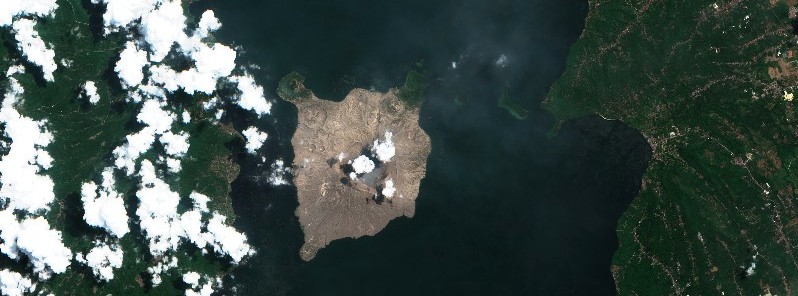
Featured image: Taal Volcano on June 26, 2021. Credit: Copernicus EU/Sentinel-2, TW
Volcanic smog or vog has been observed over Taal Caldera resulting from continued volcanic SO2 gas emission from the Main Crater.
High levels of volcanic sulfur dioxide or SO2 gas emissions and steam-rich plumes that rose as much as 3 km (9 842 feet) high have been observed from the Taal Main Crater over the past two days.
SO2 flux on June 27 averaged 4 771 tonnes/day while atmospheric temperatures of 30 °C (86 °F), relative humidity of 75% and wind velocities that slowed to 1 to 0 meters/second at near-surface levels prevailed over Taal Volcano Island based on All-Weather Systems station data.
These atmospheric conditions, especially the near-absence of air movement, resulted in the formation of volcanic smog or vog that brought a pronounced haze over the Taal Caldera region.
Should SO2 gas emission continue at the same rate (past week average of ~4 330 tonnes/day) or increase and atmospheric conditions promote the formation of vog, communities surrounding Taal Lake are advised to take necessary precautions, PHIVOLCS warns.
Vog is a type of air pollution that is caused by volcanoes. It consists of fine droplets containing volcanic gas such as SO2 which is acidic and can cause irritation of the eyes, throat and respiratory tract in severities depending on the gas concentrations and durations of exposure.
People particularly sensitive to such ill effects are those with health conditions such as asthma, lung disease and heart disease, the elderly, pregnant women and children. If vog occurs and exposure cannot be avoided, please be mindful of the following:
- Limit your exposure. Avoid outdoor activities, stay indoors and shut doors and windows to block out vog.
- Protect yourself. Cover nose, ideally with an N95 facemask. Drink plenty of water to reduce any throat irritation or constriction. If belonging to the particularly sensitive group of people above, watch over yourself and seek help from a doctor or the barangay health unit if needed. If serious effects are experienced, call the doctor or the barangay health unit.
Alert Level 2 (Increased Unrest) prevails over Taal Volcano. PHIVOLCS reminds the public that the threat of sudden steam- or gas-driven explosions and lethal accumulations or expulsions of volcanic gas can occur and threaten areas within and around TVI.
Venturing into TVI must therefore remain strictly prohibited.
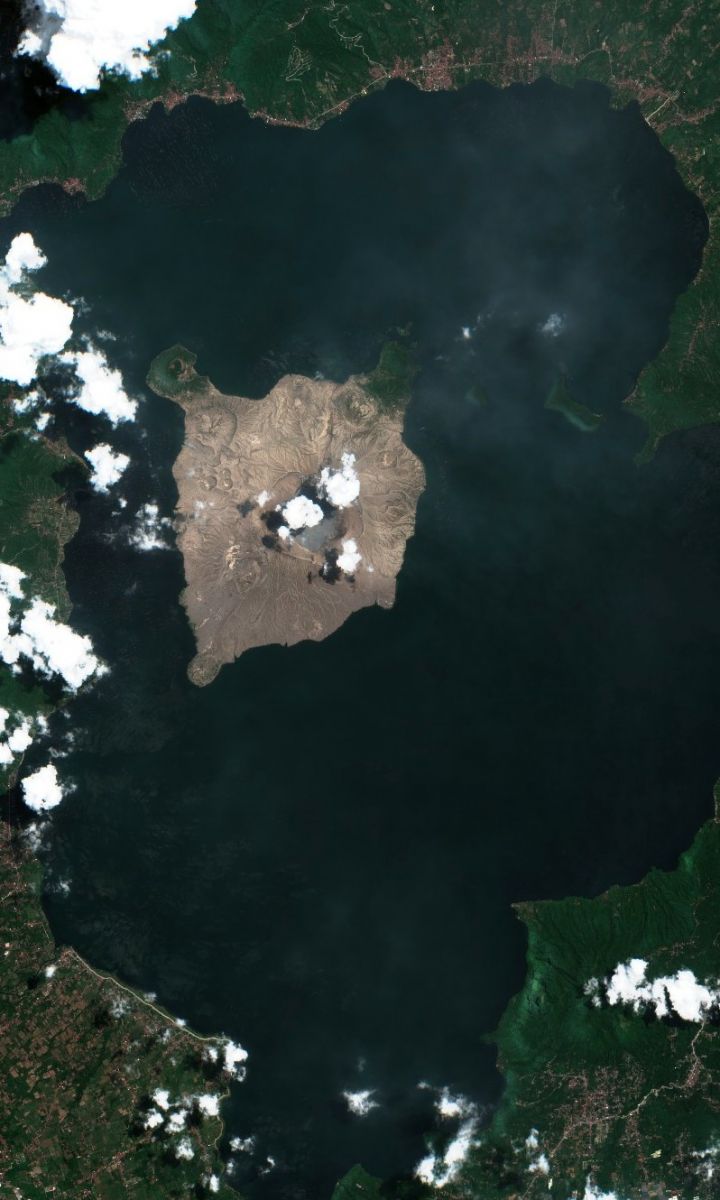
Taal volcano on June 26, 2021. Credit: Copernicus EU/Sentinel-2, TW
Geological summary
Taal is one of the most active volcanoes in the Philippines and has produced some of its most powerful historical eruptions. Though not topographically prominent, its prehistorical eruptions have greatly changed the topography of SW Luzon.
The 15 x 20 km (9 x 12 feet) Talisay (Taal) caldera is largely filled by Lake Taal, whose 267 km2 (103 mi2) surface lies only 3 m (9.8 feet) above sea level.
The maximum depth of the lake is 160 m (525 feet), and several eruptive centers lie submerged beneath the lake. The 5 km (3.1 miles) wide Volcano Island in north-central Lake Taal is the location of all historical eruptions.
The island is composed of coalescing small stratovolcanoes, tuff rings, and scoria cones that have grown about 25% in the area during historical time. Powerful pyroclastic flows and surges from historical eruptions have caused many fatalities. (GVP)
I'm a dedicated researcher, journalist, and editor at The Watchers. With over 20 years of experience in the media industry, I specialize in hard science news, focusing on extreme weather, seismic and volcanic activity, space weather, and astronomy, including near-Earth objects and planetary defense strategies. You can reach me at teo /at/ watchers.news.
Commenting rules and guidelines
We value the thoughts and opinions of our readers and welcome healthy discussions on our website. In order to maintain a respectful and positive community, we ask that all commenters follow these rules.