
The Weekly Volcanic Activity Report: March 10 – 16, 2021
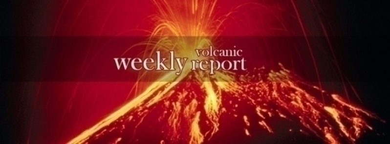
Image credit: TW
New activity/unrest was reported for 9 volcanoes from March 10 to 16, 2021. During the same period, ongoing activity was reported for 14 volcanoes.
New activity/unrest: Bagana, Bougainville (Papua New Guinea) | Etna, Sicily (Italy) | Krysuvik-Trolladyngja, Iceland | Momotombo, Nicaragua | Pacaya, Guatemala | San Cristobal, Nicaragua | Semisopochnoi, Aleutian Islands (USA) | Taal, Luzon (Philippines) | Veniaminof, United States.
Ongoing activity: Aira, Kyushu (Japan) | Dukono, Halmahera (Indonesia) | Ebeko, Paramushir Island (Russia) | Kadovar, Papua New Guinea | Kilauea, Hawaiian Islands (USA) | Klyuchevskoy, Central Kamchatka (Russia) | Lewotolok, Lembata Island (Indonesia) | Merapi, Central Java (Indonesia) | Popocatepetl, Mexico | Raung, Eastern Java (Indonesia) | Sangay, Ecuador | Sheveluch, Central Kamchatka (Russia) | Sinabung, Indonesia | Suwanosejima, Ryukyu Islands (Japan).
The Weekly Volcanic Activity Report is a cooperative project between the Smithsonian's Global Volcanism Program and the US Geological Survey's Volcano Hazards Program. Updated by 23:00 UTC every Wednesday, these reports are preliminary and subject to change as events are studied in more detail. This is not a comprehensive list of all of Earth's volcanoes erupting during the week, but rather a summary of activity at volcanoes that meet criteria discussed in detail in the "Criteria and Disclaimers" section. Carefully reviewed, detailed reports about recent activity are published in issues of the Bulletin of the Global Volcanism Network.
New activity/unrest
Bagana, Bougainville (Papua New Guinea)
6.137°S, 155.196°E, Summit elev. 1855 m
Based on satellite and wind model data, the Darwin VAAC reported that on 10 March ash plumes from Bagana rose to 2.4 km (8,000 ft) a.s.l. and drifted NW and WNW.
Geological summary: Bagana volcano, occupying a remote portion of central Bougainville Island, is one of Melanesia's youngest and most active volcanoes. This massive symmetrical cone was largely constructed by an accumulation of viscous andesitic lava flows. The entire edifice could have been constructed in about 300 years at its present rate of lava production. Eruptive activity is frequent and characterized by non-explosive effusion of viscous lava that maintains a small lava dome in the summit crater, although explosive activity occasionally producing pyroclastic flows also occurs. Lava flows form dramatic, freshly preserved tongue-shaped lobes up to 50 m thick with prominent levees that descend the flanks on all sides.
Etna, Sicily (Italy)
37.748°N, 14.999°E, Summit elev. 3320 m
INGV reported continuing episodes of lava fountaining at Etna’s Southeast Crater (SEC) on 9 and 12 March. The eleventh episode began with Strombolian activity at SEC observed at 1914 on 9 March. Just after midnight activity quickly intensified with lava fountaining and a large eruption plume that rose at least 9 km a.s.l. The plume drifted ENE and caused ash and lapilli to fall in Mascali (18 km E), Giarre (17 km ESE), and Fiumefreddo (19 km ENE). Lava reached an elevation of 1,800 m, also effusing from the flank of the S vent. Lava fountaining ceased at 0430 on 10 March and sporadic ash emissions continued until 0700.
The twelfth episode began at 0630 on 12 March with Strombolian activity at SEC and ash emissions. The activity intensified at 0754 and lava overflowed the E part of SEC, traveling towards the Valle de Bove. Lava fountaining began at 0841, with jets up to 500 m, and an eruption plume rose 6 km a.s.l. and drifted E. Lava advanced to 2,800 m elevation and within another hour had reached 2,000 m elevation. At 0939 the plume had risen 9-10 km and had caused ashfall in Milo and Fornazzo (10 km E), Giarre, Santa Venerina (15 km SE), and Torre Archirafi (20 km ESE). Lava fountaining ceased at 1050, though weak Strombolian activity and ash emissions continued until 1115. The lava flow advanced as far as 1,700 m elevation and a second lava flow expanded SE on the W slope of the Valle del Bove, stopping at 3,000 m a.s.l.
Geological summary: Mount Etna, towering above Catania, Sicily's second largest city, has one of the world's longest documented records of historical volcanism, dating back to 1500 BCE. Historical lava flows of basaltic composition cover much of the surface of this massive volcano, whose edifice is the highest and most voluminous in Italy. The Mongibello stratovolcano, truncated by several small calderas, was constructed during the late Pleistocene and Holocene over an older shield volcano. The most prominent morphological feature of Etna is the Valle del Bove, a 5 x 10 km horseshoe-shaped caldera open to the east. Two styles of eruptive activity typically occur, sometimes simultaneously. Persistent explosive eruptions, sometimes with minor lava emissions, take place from one or more summit craters. Flank vents, typically with higher effusion rates, are less frequently active and originate from fissures that open progressively downward from near the summit (usually accompanied by Strombolian eruptions at the upper end). Cinder cones are commonly constructed over the vents of lower-flank lava flows. Lava flows extend to the foot of the volcano on all sides and have reached the sea over a broad area on the SE flank.
Krysuvik-Trolladyngja, Iceland
63.917°N, 22.067°W, Summit elev. 360 m
IMO reported that seismicity in the Reykjanes Peninsula remained elevated with thousands of earthquakes recorded during 10-16 March, in the western part of the Krýsuvík-Trölladyngja volcanic system in the Fagradalsfjall fissure swarm area. About 16,500 earthquakes had been detected over the week. Some of the largest events, M 4.3-5.4 recorded during 10-12 and 14-15 March, were felt as far as Hvanneyri (97 km NNE of Grindavik), Hvolsvollur (110 km ESE of Grindavik), and Saudakrokur (250 NE of Grindavik). A few, short-lived pulses of tremor were also recorded. The magma intrusion continued to move SW along a fault between Keilir and Fagradalsfjall, and was as shallow as 1 km below the surface. GPS, satellite, and seismic data indicated that the intrusion had expanded S to Nátthaga, a valley just E of Borgarfjall and S of Fagradalsfjall, and was 3-5 km long. Ground fracturing was visible in the area above the intrusion. The Aviation Color Code for Krýsuvík remained at Orange.
Geological summary: The Krýsuvík-Trölladyngja volcanic system is described by the Catalogue of Icelandic Volcanoes as an approximately 50-km-long composite fissure swarm trending about N38°E, including a 30-km-long swarm of fissures, with no central volcano. It is one of five volcanic systems arranged en-echelon along the Reykjanes Peninsula west of Kleifarvatn lake. Small shield volcanoes have produced a large portion of the erupted volume within the system. Several eruptions have taken place since the settlement of Iceland, including the eruption of a large basaltic lava flow from the Ogmundargigar crater row around the 12th century. The latest eruption, identified through tephrochronology, took place during the 14th century.
Momotombo, Nicaragua
12.423°N, 86.539°W, Summit elev. 1270 m
The Washington VAAC reported that on 14 March a possible ash emission was visible in webcam and satellite data just above Momotombo. Ash was not visible in a subsequent satellite image captured around six hours later.
Geological summary: Momotombo is a young stratovolcano that rises prominently above the NW shore of Lake Managua, forming one of Nicaragua's most familiar landmarks. Momotombo began growing about 4500 years ago at the SE end of the Marrabios Range and consists of a somma from an older edifice that is surmounted by a symmetrical younger cone with a 150 x 250 m wide summit crater. Young lava flows extend down the NW flank into the 4-km-wide Monte Galán caldera. The youthful cone of Momotombito forms an island offshore in Lake Managua. Momotombo has a long record of Strombolian eruptions, punctuated by occasional stronger explosive activity. The latest eruption, in 1905, produced a lava flow that traveled from the summit to the lower NE base. A small black plume was seen above the crater after a 10 April 1996 earthquake, but later observations noted no significant changes in the crater. A major geothermal field is located on the south flank.
Pacaya, Guatemala
14.382°N, 90.601°W, Summit elev. 2569 m
INSIVUMEH and CONRED reported that pulses of moderate-to-strong Strombolian explosions at Pacaya’s Mackenney Crater were commonly recorded during 9-16 March. Frequent ash plumes rose as high as 2 km and drifted as far as 30 km W, SW, and S. On 10 March lapilli (2 mm to 6 cm in length) fell in El Caracol (3 km SW), and ash fell in El Patrocinio (about 5 km W) and likely in other areas downwind. Ash plumes caused daily ashfall in variable places during 11-16 March, including El Patrocinio, San José El Rodeo, the municipality of San Vicente Pacaya (5 km NW), San Francisco de Sales (5 km N), San José el Bejucal (4 km N), San Antonio el Pepinal (7 km N), Concepción El Cedro (9 km NNW), San José Calderas, and the municipalities of Amatitlán (12 km N), Villa Nueva (16 km N), and Mixco (30 km N). Lapilli as long as 2 cm fell in El Patrocinio, San José El Rodeo and Concepción El Cedro on 16 March.
Strombolian explosions and periodic lava fountaining ejected incandescent material as high as 800 m above the summit; tephra fell within a 500 m radius of Mackenney Crater. Explosions and ash emissions also rose from fissures on the S flank, 300 m below Mackenney Crater. The lava flow on the S flank had two branches and was 1 km on 10 March, but had lengthened to 1.8 km by 16 March. Block avalanches from the summit traveled down the S flank.
Geological summary: Eruptions from Pacaya, one of Guatemala's most active volcanoes, are frequently visible from Guatemala City, the nation's capital. This complex basaltic volcano was constructed just outside the southern topographic rim of the 14 x 16 km Pleistocene Amatitlán caldera. A cluster of dacitic lava domes occupies the southern caldera floor. The post-caldera Pacaya massif includes the ancestral Pacaya Viejo and Cerro Grande stratovolcanoes and the currently active Mackenney stratovolcano. Collapse of Pacaya Viejo between 600 and 1500 years ago produced a debris-avalanche deposit that extends 25 km onto the Pacific coastal plain and left an arcuate somma rim inside which the modern Pacaya volcano (Mackenney cone) grew. A subsidiary crater, Cerro Chino, was constructed on the NW somma rim and was last active in the 19th century. During the past several decades, activity has consisted of frequent strombolian eruptions with intermittent lava flow extrusion that has partially filled in the caldera moat and armored the flanks of Mackenney cone, punctuated by occasional larger explosive eruptions that partially destroy the summit of the growing young stratovolcano.
San Cristobal, Nicaragua
12.702°N, 87.004°W, Summit elev. 1745 m
SINAPRED reported that a series of five explosions at San Cristóbal were recorded during 1306-1332 on 9 March. The strongest explosion, at 1325, produced an ash plume that rose 800 m above the crater rim. Ashfall as deep as 2 mm was reported in El Viejo (19 km WSW), Chinandega (16 km SW), and Chichigalapa (16 km S); ash also fell in other communities downwind including Las Grecias, La Mora, and La Bolsa.
Geological summary: The San Cristóbal volcanic complex, consisting of five principal volcanic edifices, forms the NW end of the Marrabios Range. The symmetrical 1745-m-high youngest cone, named San Cristóbal (also known as El Viejo), is Nicaragua's highest volcano and is capped by a 500 x 600 m wide crater. El Chonco, with several flank lava domes, is located 4 km W of San Cristóbal; it and the eroded Moyotepe volcano, 4 km NE of San Cristóbal, are of Pleistocene age. Volcán Casita, containing an elongated summit crater, lies immediately east of San Cristóbal and was the site of a catastrophic landslide and lahar in 1998. The Plio-Pleistocene La Pelona caldera is located at the eastern end of the complex. Historical eruptions from San Cristóbal, consisting of small-to-moderate explosive activity, have been reported since the 16th century. Some other 16th-century eruptions attributed to Casita volcano are uncertain and may pertain to other Marrabios Range volcanoes.
Semisopochnoi, Aleutian Islands (USA)
51.93°N, 179.58°E, Summit elev. 1221 m
On 12 March AVO reported that although no ash plumes were observed at Semisopochnoi and nothing was detected in regional infrasound data during the previous week, ash deposits within Mount Cerberus’s N crater and extending 1.5 km on the flank were identified in satellite data. The Aviation Color Code and the Volcano Alert Level remained at Yellow/Advisory, respectively.
Geological summary: Semisopochnoi, the largest subaerial volcano of the western Aleutians, is 20 km wide at sea level and contains an 8-km-wide caldera. It formed as a result of collapse of a low-angle, dominantly basaltic volcano following the eruption of a large volume of dacitic pumice. The high point of the island is Anvil Peak, a double-peaked late-Pleistocene cone that forms much of the island's northern part. The three-peaked Mount Cerberus was constructed within the caldera during the Holocene. Each of the peaks contains a summit crater; lava flows on the N flank of Cerberus appear younger than those on the south side. Other post-caldera volcanoes include the symmetrical Sugarloaf Peak SSE of the caldera and Lakeshore Cone, a small cinder cone at the edge of Fenner Lake in the NE part of the caldera. Most documented eruptions have originated from Cerberus, although Coats (1950) considered that both Sugarloaf and Lakeshore Cone could have been recently active.
Taal, Luzon (Philippines)
14.002°N, 120.993°E, Summit elev. 311 m
PHIVOLCS reported that during 10-13 March there were around 51-55 volcanic earthquakes recorded daily at Taal, and about 23-49 periods of volcanic tremor with variable durations. One hybrid earthquake was recorded during 11-12 March. Diffuse steam plumes from fumarolic vents in Main Crater rose only 5 m. Sulfur dioxide emissions were 1,327 tonnes per day on 10 March, and fluctuated between 518 and 795 tonnes per day through 14 March. At 1411 on 12 March a short-lived (2.5 minutes) burst of steam-rich gas from Main Crater generated white plumes that rose 400-500 m. Diffuse steam plumes rose 50 m above fumarolic vents on the inner N and E walls during the rest of the day.
The number of volcanic earthquakes per day rose to 74 during 13-14 March and to 252 during 15-16 March. Episodes of tremor persisted, with 17-46 periods recorded per day. Five hybrid events were detected during 14-15 March. An episode of high-temperature gas upwelling to the crater lake’s surface occurred during 1830-2045 on 14 March. Sulfur dioxide emissions were 1,216 tonnes per day on 15 March. Steam emissions rose 10 km during 15-16 March. The seismic network recorded 42 volcanic earthquakes and 34 periods of tremor. The Alert Level for Taal remained at 2 (on a scale of 0-5). PHIVOLCS strongly recommended no entry onto the island, and access to the Main Crater and Daang Kastila fissure (along the walking trail) was strictly prohibited.
Geological summary: Taal is one of the most active volcanoes in the Philippines and has produced some of its most powerful historical eruptions. Though not topographically prominent, its prehistorical eruptions have greatly changed the landscape of SW Luzon. The 15 x 20 km Talisay (Taal) caldera is largely filled by Lake Taal, whose 267 km2 surface lies only 3 m above sea level. The maximum depth of the lake is 160 m, and several eruptive centers lie submerged beneath the lake. The 5-km-wide Volcano Island in north-central Lake Taal is the location of all historical eruptions. The island is composed of coalescing small stratovolcanoes, tuff rings, and scoria cones that have grown about 25% in area during historical time. Powerful pyroclastic flows and surges from historical eruptions have caused many fatalities.
Veniaminof, United States
56.17°N, 159.38°W, Summit elev. 2507 m
AVO reported that the eruption at Veniaminof continued during 9-16 March. Ash emissions rose to 2.1-3 km (7,000-10,000 ft) a.s.l. and drifted 200 km NE and SE during 9-10 March. Explosions and ash emissions declined to lower levels the rest of the week, though new ash deposits within the caldera, and as far as 10 km SE, were sometimes identified in satellite images. Lava continued to effuse under the intra-caldera glacier in an area on the flank about 1 km E of the cone’s summit. Elevated surface temperatures over this area were identified in a satellite images during most days, along with steam plumes and a broadening collapse pit in the ice from melting around the eruption site. Data from local seismic stations were back online by 12 March and showed elevated seismicity and tremor through 15 March. Steam-and-has plumes were identified in satellite images during 15-16 March. The Volcano Alert Level remained at Watch and the Aviation Color Code remained at Orange.
Geological summary: Veniaminof, on the Alaska Peninsula, is truncated by a steep-walled, 8 x 11 km, glacier-filled caldera that formed around 3,700 years ago. The caldera rim is up to 520 m high on the north, is deeply notched on the west by Cone Glacier, and is covered by an ice sheet on the south. Post-caldera vents are located along a NW-SE zone bisecting the caldera that extends 55 km from near the Bering Sea coast, across the caldera, and down the Pacific flank. Historical eruptions probably all originated from the westernmost and most prominent of two intra-caldera cones, which rises about 300 m above the surrounding icefield. The other cone is larger, and has a summit crater or caldera that may reach 2.5 km in diameter, but is more subdued and barely rises above the glacier surface.
Ongoing activity
Aira, Kyushu (Japan)
31.593°N, 130.657°E, Summit elev. 1117 m
JMA reported that during 8-15 March incandescence from Minamidake Crater (at Aira Caldera’s Sakurajima volcano) was visible nightly. Seven explosions and 10 non-explosive events generated eruption plumes that rose 2.4-2.7 km above the crater rim and ejected bombs 0.8-1.7 km away from the crater. The sulfur dioxide emission rate was 2,300 tons per day on 10 March. The Alert Level remained at 3 (on a 5-level scale).
Geological summary: The Aira caldera in the northern half of Kagoshima Bay contains the post-caldera Sakurajima volcano, one of Japan's most active. Eruption of the voluminous Ito pyroclastic flow accompanied formation of the 17 x 23 km caldera about 22,000 years ago. The smaller Wakamiko caldera was formed during the early Holocene in the NE corner of the Aira caldera, along with several post-caldera cones. The construction of Sakurajima began about 13,000 years ago on the southern rim of Aira caldera and built an island that was finally joined to the Osumi Peninsula during the major explosive and effusive eruption of 1914. Activity at the Kitadake summit cone ended about 4850 years ago, after which eruptions took place at Minamidake. Frequent historical eruptions, recorded since the 8th century, have deposited ash on Kagoshima, one of Kyushu's largest cities, located across Kagoshima Bay only 8 km from the summit. The largest historical eruption took place during 1471-76.
Dukono, Halmahera (Indonesia)
1.693°N, 127.894°E, Summit elev. 1229 m
Based on satellite and wind model data, the Darwin VAAC reported that during 10-16 March ash plumes from Dukono rose to 2.1-2.4 km (7,000-8,000 ft) a.s.l. and drifted in multiple directions. The Alert Level remained at 2 (on a scale of 1-4), and the public was warned to remain outside of the 2-km exclusion zone.
Geological summary: Reports from this remote volcano in northernmost Halmahera are rare, but Dukono has been one of Indonesia's most active volcanoes. More-or-less continuous explosive eruptions, sometimes accompanied by lava flows, occurred from 1933 until at least the mid-1990s, when routine observations were curtailed. During a major eruption in 1550, a lava flow filled in the strait between Halmahera and the north-flank cone of Gunung Mamuya. This complex volcano presents a broad, low profile with multiple summit peaks and overlapping craters. Malupang Wariang, 1 km SW of the summit crater complex, contains a 700 x 570 m crater that has also been active during historical time.
Ebeko, Paramushir Island (Russia)
50.686°N, 156.014°E, Summit elev. 1103 m
Volcanologists in Severo-Kurilsk (Paramushir Island), about 7 km E of Ebeko, observed explosions during 5, 7-9, and 11-12 March that sent ash plumes to 2.3 km (7,500 ft) a.s.l. and drifted NE and E. Ashfall was reported in Severo-Kurilsk during 7-8 March. The Aviation Color Code remained at Orange (the second highest level on a four-color scale).
Geological summary: The flat-topped summit of the central cone of Ebeko volcano, one of the most active in the Kuril Islands, occupies the northern end of Paramushir Island. Three summit craters located along a SSW-NNE line form Ebeko volcano proper, at the northern end of a complex of five volcanic cones. Blocky lava flows extend west from Ebeko and SE from the neighboring Nezametnyi cone. The eastern part of the southern crater contains strong solfataras and a large boiling spring. The central crater is filled by a lake about 20 m deep whose shores are lined with steaming solfataras; the northern crater lies across a narrow, low barrier from the central crater and contains a small, cold crescentic lake. Historical activity, recorded since the late-18th century, has been restricted to small-to-moderate explosive eruptions from the summit craters. Intense fumarolic activity occurs in the summit craters, on the outer flanks of the cone, and in lateral explosion craters.
Kadovar, Papua New Guinea
3.608°S, 144.588°E, Summit elev. 365 m
Based on satellite and wind model data, the Darwin VAAC reported that on 11 March ash plumes from Kadovar rose to an altitude of 1.5 km (5,000 ft) a.s.l. and drifted W.
Geological summary: The 2-km-wide island of Kadovar is the emergent summit of a Bismarck Sea stratovolcano of Holocene age. It is part of the Schouten Islands, and lies off the coast of New Guinea, about 25 km N of the mouth of the Sepik River. Prior to an eruption that began in 2018, a lava dome formed the high point of the andesitic volcano, filling an arcuate landslide scarp open to the south; submarine debris-avalanche deposits occur in that direction. Thick lava flows with columnar jointing forms low cliffs along the coast. The youthful island lacks fringing or offshore reefs. A period of heightened thermal phenomena took place in 1976. An eruption began in January 2018 that included lava effusion from vents at the summit and at the E coast.
Kilauea, Hawaiian Islands (USA)
19.421°N, 155.287°W, Summit elev. 1222 m
HVO reported that vents on the inner NW wall of Kilauea’s Halema`uma`u Crater continued to supply the lava lake during 10-16 March. Lava flowed from both the main vent and a newer vent several meters NE into the lake through submerged inlets. Another lava flow emerged from about halfway up the cone structure starting at 0220 on 16 March.
The depth of the western part of the lake rose from 221 m to 222 m and lava continued to circulate in that part. The E half of the lake remained solidified and lower that the W half, with the crusted E half expanding towards the W. The sulfur dioxide emission rate was 900 tons/day on 14 March. The Aviation Color Code remained at Orange and the Volcano Alert Level remained at Watch.
Geological summary: Kilauea, which overlaps the E flank of the massive Mauna Loa shield volcano, has been Hawaii's most active volcano during historical time. Eruptions are prominent in Polynesian legends; written documentation extending back to only 1820 records frequent summit and flank lava flow eruptions that were interspersed with periods of long-term lava lake activity that lasted until 1924 at Halemaumau crater, within the summit caldera. The 3 x 5 km caldera was formed in several stages about 1500 years ago and during the 18th century; eruptions have also originated from the lengthy East and SW rift zones, which extend to the sea on both sides of the volcano. About 90% of the surface of the basaltic shield volcano is formed of lava flows less than about 1100 years old; 70% of the volcano's surface is younger than 600 years. A long-term eruption from the East rift zone that began in 1983 has produced lava flows covering more than 100 km2, destroying nearly 200 houses and adding new coastline to the island.
Klyuchevskoy, Central Kamchatka (Russia)
56.056°N, 160.642°E, Summit elev. 4754 m
KVERT reported that the Strombolian eruption from vents on Klyuchevskoy’s lower NW flank continued during 5-12 March. A large, bright thermal anomaly over the vents was identified daily in satellite images. A plume of re-suspended ash drifted 375 km E on 5 March. IVS FEB RAS posted that the lava traveled downslope, melting ice and snow on the Erman glacier; the meltwater formed mud flows along the along the Krutenkaya River. The Aviation Color Code remained at Orange (the second highest level on a four-color scale).
Geological summary: Klyuchevskoy (also spelled Kliuchevskoi) is Kamchatka's highest and most active volcano. Since its origin about 6000 years ago, the beautifully symmetrical, 4835-m-high basaltic stratovolcano has produced frequent moderate-volume explosive and effusive eruptions without major periods of inactivity. It rises above a saddle NE of sharp-peaked Kamen volcano and lies SE of the broad Ushkovsky massif. More than 100 flank eruptions have occurred during the past roughly 3000 years, with most lateral craters and cones occurring along radial fissures between the unconfined NE-to-SE flanks of the conical volcano between 500 m and 3600 m elevation. The morphology of the 700-m-wide summit crater has been frequently modified by historical eruptions, which have been recorded since the late-17th century. Historical eruptions have originated primarily from the summit crater, but have also included numerous major explosive and effusive eruptions from flank craters.
Lewotolok, Lembata Island (Indonesia)
8.274°S, 123.508°E, Summit elev. 1431 m
PVMBG reported that the Strombolian eruption at Lewotolok continued during 10-16 March. Daily gray-and-white ash plumes rose as high as 1.5 km above the summit and drifted mainly E and SE. The eruptive events were accompanied by rumbling and banging sounds. Visual observations were hindered by weather on 10 March; each day during 11-16 March incandescent material was ejected as high as 500 m above the crater. Almost daily incandescent material was ejected 500-1,300 m E and SE from the crater. The Alert Level remained at 3 (on a scale of 1-4) and the public was warned to stay 4 km away from the summer crater.
Geological summary: The Lewotolok (or Lewotolo) stratovolcano occupies the eastern end of an elongated peninsula extending north into the Flores Sea, connected to Lembata (formerly Lomblen) Island by a narrow isthmus. It is symmetrical when viewed from the north and east. A small cone with a 130-m-wide crater constructed at the SE side of a larger crater forms the volcano's high point. Many lava flows have reached the coastline. Eruptions recorded since 1660 have consisted of explosive activity from the summit crater.
Merapi, Central Java (Indonesia)
7.54°S, 110.446°E, Summit elev. 2910 m
BPPTKG reported that the 2021 lava dome just below Merapi’s SW rim and the lava dome in the summit crater both continued to grow during 5-11 March. The 2021 lava-dome volume was an estimated 785,600 cubic meters on 11 March, with a growth rate of about 13,500 cubic meters per day, and continued to shed material down the flank. A total of 12 pyroclastic flows traveled a maximum of 1.9 km down the SW flank. Incandescent avalanches, recorded 226 times, traveled as far as 1.3 km down the SW flank. The height of the summit lava dome was relatively steady at 45 m. The Alert Level remained at 3 (on a scale of 1-4), and the public were warned to stay 5 km away from the summit.
Geological summary: Merapi, one of Indonesia's most active volcanoes, lies in one of the world's most densely populated areas and dominates the landscape immediately north of the major city of Yogyakarta. It is the youngest and southernmost of a volcanic chain extending NNW to Ungaran volcano. Growth of Old Merapi during the Pleistocene ended with major edifice collapse perhaps about 2,000 years ago, leaving a large arcuate scarp cutting the eroded older Batulawang volcano. Subsequent growth of the steep-sided Young Merapi edifice, its upper part unvegetated due to frequent activity, began SW of the earlier collapse scarp. Pyroclastic flows and lahars accompanying growth and collapse of the steep-sided active summit lava dome have devastated cultivated lands on the western-to-southern flanks and caused many fatalities.
Popocatepetl, Mexico
19.023°N, 98.622°W, Summit elev. 5393 m
During an overflight of Popocatépetl on 5 March scientists from Instituto de Geofísica de la Universidad Nacional Autónoma de México (UNAM) and CENAPRED observed that the inner crater was 360-390 m in diameter and 150-182 m deep. Tephra deposits on the crater floor were visible and there was no sign of a lava dome. Each day during 10-15 March there were 35-104 steam, gas, and ash emissions that drifted mainly SSW and NW. Minor ashfall was reported in the municipalities of Amecameca (20 km NW) and Tlalmanalco (30 km NW) around 2250 on 12 March. An explosion was recorded at 2351 on 13 March. Minor ashfall was reported in Amecameca the next day. The Alert Level remained at Yellow, Phase Two (middle level on a three-color scale).
Geological summary: Volcán Popocatépetl, whose name is the Aztec word for smoking mountain, rises 70 km SE of Mexico City to form North America's 2nd-highest volcano. The glacier-clad stratovolcano contains a steep-walled, 400 x 600 m wide crater. The generally symmetrical volcano is modified by the sharp-peaked Ventorrillo on the NW, a remnant of an earlier volcano. At least three previous major cones were destroyed by gravitational failure during the Pleistocene, producing massive debris-avalanche deposits covering broad areas to the south. The modern volcano was constructed south of the late-Pleistocene to Holocene El Fraile cone. Three major Plinian eruptions, the most recent of which took place about 800 CE, have occurred since the mid-Holocene, accompanied by pyroclastic flows and voluminous lahars that swept basins below the volcano. Frequent historical eruptions, first recorded in Aztec codices, have occurred since Pre-Columbian time.
Raung, Eastern Java (Indonesia)
8.119°S, 114.056°E, Summit elev. 3260 m
PVMBG reported that daily gray ash plumes rose 100-1,200 m above Raung’s summit during 10-16 March. Ash plumes drifted mainly N, NE, E, and S. The Alert Level remained at 2 (on a scale of 1-4), and the public was warned to remain outside of the 2-km exclusion zone.
Geological summary: Raung, one of Java's most active volcanoes, is a massive stratovolcano in easternmost Java that was constructed SW of the rim of Ijen caldera. The unvegetated summit is truncated by a dramatic steep-walled, 2-km-wide caldera that has been the site of frequent historical eruptions. A prehistoric collapse of Gunung Gadung on the W flank produced a large debris avalanche that traveled 79 km, reaching nearly to the Indian Ocean. Raung contains several centers constructed along a NE-SW line, with Gunung Suket and Gunung Gadung stratovolcanoes being located to the NE and W, respectively.
Sangay, Ecuador
2.005°S, 78.341°W, Summit elev. 5286 m
IG reported a high level of activity at Sangay during 10-16 March. Seismicity was characterized by daily explosions, long-period earthquakes, and signals indicating emissions. Weather clouds often prevented visual observations of the volcano, but satellite and webcam images recorded daily ash plumes.
Ash plumes were notable during 10-11 March and impacted communities downwind with ashfall. Pyroclastic flows, visible in webcam images, descended the flanks at 0950 on 10 March. The Washington VAAC stated that ash plumes rose 6.7-8.5 km (22,000-28,000 ft) a.s.l. and drifted W at lower altitudes and NW at higher altitudes. A period of explosions recorded during 0315-0545 on 11 March produced ash plumes that rose as high as 13.7 km (45,000 ft) a.s.l., or 8.5 km above the summit, and drifted NW, W, and SW. Ash plumes drifted N, NW, and W, causing significant ashfall in Guamote (42 km WNW), notable ashfall in Chambo (43 km NW), Riobamba (50 km NW), Penipe (55 km NW), and Guano (55 km NW), and minor ashfall in Colta (55 km NW), Alausí (60 km SW), and Macas. According to a social media video post the ash plumes caused widespread darkness in Riobamba for several hours. Other residents posted photos of crops covered in ash. The eruption released 31 kilotons of sulfur dioxide, the highest value recorded during the current eruptive period that began in May 2019.
Heavy rainfall overnight during 11-12 March caused hot lahars in the Volcán River drainage that reached the confluence of the Upano River. Overflows in the Upano River resulting in additional lahars and debris flows. Weather clouds hindered visual observations. During 13-15 March gas-and-ash plumes rose as high has 2 km above the summit and drifted NE. Seismic signals indicating lahars were recorded on 14 March. The VAAC reported that ash plumes rose to 6-9 km (20,000-30,000 ft) a.s.l. and drifted W and WNW on 16 March.
Geological summary: The isolated Sangay volcano, located east of the Andean crest, is the southernmost of Ecuador's volcanoes and its most active. The steep-sided, glacier-covered, dominantly andesitic volcano grew within horseshoe-shaped calderas of two previous edifices, which were destroyed by collapse to the east, producing large debris avalanches that reached the Amazonian lowlands. The modern edifice dates back to at least 14,000 years ago. It towers above the tropical jungle on the east side; on the other sides flat plains of ash have been sculpted by heavy rains into steep-walled canyons up to 600 m deep. The earliest report of a historical eruption was in 1628. More or less continuous eruptions were reported from 1728 until 1916, and again from 1934 to the present. The almost constant activity has caused frequent changes to the morphology of the summit crater complex.
Sheveluch, Central Kamchatka (Russia)
56.653°N, 161.36°E, Summit elev. 3283 m
KVERT reported that a thermal anomaly over Sheveluch was identified in satellite images during 5-12 March. The Aviation Color Code remained at Orange (the second highest level on a four-color scale).
Geological summary: The high, isolated massif of Sheveluch volcano (also spelled Shiveluch) rises above the lowlands NNE of the Kliuchevskaya volcano group. The 1300 km3 volcano is one of Kamchatka's largest and most active volcanic structures. The summit of roughly 65,000-year-old Stary Shiveluch is truncated by a broad 9-km-wide late-Pleistocene caldera breached to the south. Many lava domes dot its outer flanks. The Molodoy Shiveluch lava dome complex was constructed during the Holocene within the large horseshoe-shaped caldera; Holocene lava dome extrusion also took place on the flanks of Stary Shiveluch. At least 60 large eruptions have occurred during the Holocene, making it the most vigorous andesitic volcano of the Kuril-Kamchatka arc. Widespread tephra layers from these eruptions have provided valuable time markers for dating volcanic events in Kamchatka. Frequent collapses of dome complexes, most recently in 1964, have produced debris avalanches whose deposits cover much of the floor of the breached caldera.
Sinabung, Indonesia
3.17°N, 98.392°E, Summit elev. 2460 m
PVMBG reported that the eruption at Sinabung continued during 10-16 March. Avalanches of material traveled 500-1,500 m down the E, SE, and S flanks almost daily. Pyroclastic flows traveled 2-3 km down the E and SE flanks on 11 March. Ash plumes rose to 2.4-4.3 km (8,000-14,000 ft) a.s.l. and drifted SE, SW, and W during 10-12 and 15 March. The Alert Level remained at 3 (on a scale of 1-4), with a general exclusion zone of 3 km and extensions to 5 km in the SE sector and 4 km in the NE sector.
Geological summary: Gunung Sinabung is a Pleistocene-to-Holocene stratovolcano with many lava flows on its flanks. The migration of summit vents along a N-S line gives the summit crater complex an elongated form. The youngest crater of this conical andesitic-to-dacitic edifice is at the southern end of the four overlapping summit craters. The youngest deposit is a SE-flank pyroclastic flow 14C dated by Hendrasto et al. (2012) at 740-880 CE. An unconfirmed eruption was noted in 1881, and solfataric activity was seen at the summit and upper flanks in 1912. No confirmed historical eruptions were recorded prior to explosive eruptions during August-September 2010 that produced ash plumes to 5 km above the summit.
Suwanosejima, Ryukyu Islands (Japan)
29.638°N, 129.714°E, Summit elev. 796 m
JMA reported that the seismic network for Suwanosejima’s Ontake Crater detected a total of 29 explosions during 5-12 March, less than the 131 explosions recorded previous week. These events produced eruption plumes that rose as high as 1.5 km above the crater rim. Incandescence from the crater was occasionally visible at night. Rumbling was heard in a village 4 km SSW. The Alert Level remained at 2 (on a 5-level scale).
Geological summary: The 8-km-long, spindle-shaped island of Suwanosejima in the northern Ryukyu Islands consists of an andesitic stratovolcano with two historically active summit craters. The summit is truncated by a large breached crater extending to the sea on the east flank that was formed by edifice collapse. Suwanosejima, one of Japan's most frequently active volcanoes, was in a state of intermittent strombolian activity from Otake, the NE summit crater, that began in 1949 and lasted until 1996, after which periods of inactivity lengthened. The largest historical eruption took place in 1813-14, when thick scoria deposits blanketed residential areas, and the SW crater produced two lava flows that reached the western coast. At the end of the eruption the summit of Otake collapsed forming a large debris avalanche and creating the horseshoe-shaped Sakuchi caldera, which extends to the eastern coast. The island remained uninhabited for about 70 years after the 1813-1814 eruption. Lava flows reached the eastern coast of the island in 1884. Only about 50 people live on the island.
Source: GVP
I'm a dedicated researcher, journalist, and editor at The Watchers. With over 20 years of experience in the media industry, I specialize in hard science news, focusing on extreme weather, seismic and volcanic activity, space weather, and astronomy, including near-Earth objects and planetary defense strategies. You can reach me at teo /at/ watchers.news.
Fagradalsfjall pops after 10000yr slumber