
Arctic outbreak descends on SE Europe, lots of snow and strong Bura winds expected
Featured image: GFS Winter Overview model for January 6, 2018. Credit: WXCharts.EU
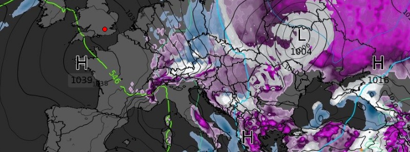
Frigid Arctic air is descending down from Scandinavia to southeastern Europe this week. Large amounts of snow are expected as well as strong Bura winds along the Adriatic Sea. Meanwhile, a persistent stau-effect snowfall is expected across the northern Alps, with snow at both low and high elevations, SWE meteorologists warn. Cold Arctic air is expected to reach Libya and Tunisia by the end of the week.
While Scandinavia is already witnessing a significant drop in temperatures as well as all-time record winds in parts of western Finland, the Balkan peninsula will still have at least a day before frigid Arctic air settles over the region.
Forecasts call for lots of snow, especially over Bosnia and Herzegovina, continental Croatia, Serbia, Montenegro and all the way down to Greece.
"On Thursday, January 3, very cold airmass advects across the Balkan peninsula into the Adriatic region and south-central Italy," Severe Weather Europe meteorologists said.
"A day later, the cold advection intensifies and affects almost the same region again with even colder temperature, ranging 10 – 12 °C (18 – 22 °F) below average! On Saturday, January 5, the coldest airmass spreads further south into the southern Balkan peninsula and as far south as the southern Mediterranean, reaching Libya and Tunisia as well. This will bring snow also to lower elevations in the region, especially Greece!"
"Once the very cold airmass advects into the Balkan peninsula, a sharp pressure and temperature gradient develops across the Adriatic sea, resulting in severe to extremely severe Bora winds."
Meanwhile, a persistent stau-effect snowfall is expected across the northern Alps, with snow both at low and high elevations. Snowfall there is expected at least until the end of the week.
Two or three weeks later, this outbreak is expected to be followed by freezing effects of a major SSW event currently underway high above Arctic region.
All things considered, it seems that very significant winter weather is about to hit Europe and stay there for quite some time.
Check up on your neighbors from time to time, especially the elders and all those without a home.
I'm a dedicated researcher, journalist, and editor at The Watchers. With over 20 years of experience in the media industry, I specialize in hard science news, focusing on extreme weather, seismic and volcanic activity, space weather, and astronomy, including near-Earth objects and planetary defense strategies. You can reach me at teo /at/ watchers.news.
Commenting rules and guidelines
We value the thoughts and opinions of our readers and welcome healthy discussions on our website. In order to maintain a respectful and positive community, we ask that all commenters follow these rules.