Eruption at Mount Agung ejects ash up to 5.2 km (17 000 feet) a.s.l., Bali, Indonesia
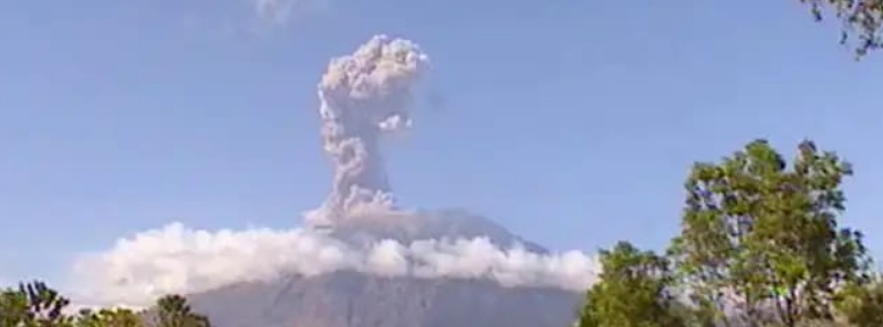
A moderately strong eruption took place at Mount Agung, Bali, Indonesia at 01:05 UTC (09:05 local time) on July 15, 2018. Ash column rose up to 5.2 km (17 000 feet) above sea level, according to Darwin VAAC. The eruption lasted 1 minute and 45 seconds.
"The ash cloud is observed as a thick intense cloud that tends to face the southeast region and west," said Sutopo Purwo Nugroho, spokesperson for the National Disaster Mitigation Agency (BNPB).
The event was preceded by a smaller but longer (2 minutes and 20 seconds) eruption at 20:52 UTC on July 14.
Ashfall was reported in nearby villages and communities.
Dua kali letusan Gunung Agung menyambut Minggu (15/7/2018) pagi. Pukul 04.52 WITA, tinggi letusan tidak teramati. Letusan hanya berlangsung 2 menit 20 detik. Letusan kedua pada pukul 09.05 WITA dengan tinggi kolom 1.500 meter selama 1 menit 45 detik. Bandara normal. Bali aman. pic.twitter.com/CtGFWFpfrw
— Sutopo Purwo Nugroho (@Sutopo_PN) July 15, 2018
Daerah yang terpapar hujan abu Gunung Agung yaitu Desa Bhuana Giri, Desa Pidpid, Desa Tista, Desa Nawa Kerti, Desa Datah, sebagian Desa Ababi, sebagian di Desa Abang, Desa Kertha Mandala dan Wilayah Kota Amlapura dan sekitarnya. Bandara aman dan tetap beroperasi normal. pic.twitter.com/9Phj5zzAcY
— Sutopo Purwo Nugroho (@Sutopo_PN) July 15, 2018
According to Sutopo, Agung's status remains at level 3 ‘siaga.’
BNPB recommends people not to conduct any activities in the region considered to be within the danger zone, which includes hiking. The danger zone is 4 km (2.5 miles) around the crater.
While flights in and from Bali can sometimes be affected, today's eruption had no impact on the tourism industry and airports are secure and operating normally. This volcano is far away from tourist destinations.
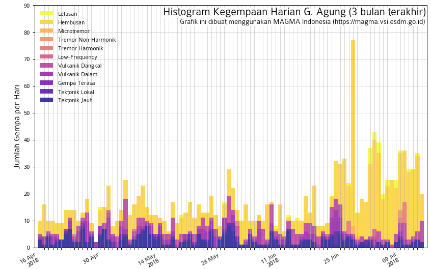
Seismic activity is characterized by low frequency earthquakes.
Sulfur dioxide flux was 1 400 – 2 400 tons/day on July 3 and 400 – 1 500 tons/day on July 4. Satellite data acquired on July 4 indicated continuing lava effusion in the crater, with 4-5 million cubic meters effused in the past week.
Time-lapse video of the eruption of #Agung volcano earlier today, 6th July. The original video is around 2.5minute in length. Photo location was 16km from the volcano. Restriction zone is currently 4km radius from the summit, as the status is still Level 3. #Bali pic.twitter.com/2v3jcxyhps
— Øystein L. Andersen (@OysteinLAnderse) July 6, 2018
Featured image: Mount Agung eruption ejects ash up to 5.2 km (17 000 feet) a.s.l. on July 15, 2018. Credit: BNPB
I don’t no about you but that number 52 km equaling 17000 feat sound just like the true number for the jubilee year to end at the new moon of May 18th and then to begin again on the new moon of May 19th 2019 yes the time is up! Genesis 15:13-14 Acts 7:6-7 Isaiah 18:3-7 it looks like you should listen to the signs.