
Magnitude 6.6 earthquake near Vanuatu
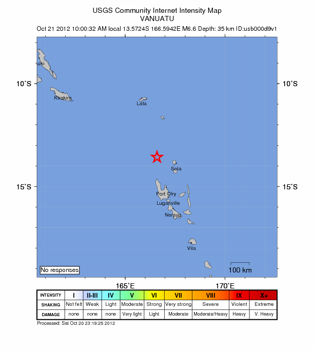
Image credit: USGS
Strong earthquake M 6.6 hit Vanuatu on October 20, 2012 at 23:00:32 UTC. Epicenter was located 226 km (140 miles) NNW (345°) from Santo (Luganville) and 499 km (310 miles) NNW (338°) from PORT-VILA, Vanuatu (13.572°S, 166.594°E) at depth of 35.4 km (22.0 miles) according to USGS. Magnitude 6.2 was registered by EMSC at depth of 49 km (30.4 miles) but was later revisited to M6.6 at depth of 40 km (24.8 miles).
UPDATE: USGS has changed initial M 6.6 to M 6.2


About 2000 people live within 100km radius. USGS PAGER issued Green alert for shaking-related fatalities and economic losses. There is a low likelihood of casualties and damage. GDACS reported this earthquake is expected to have a low humanitarian impact based on the magnitude and the affected population and their vulnerability.
Pacific Tsunami Warning Center (PTWC) have no information about the event online at this point. More updates coming soon.
")
Commenting rules and guidelines
We value the thoughts and opinions of our readers and welcome healthy discussions on our website. In order to maintain a respectful and positive community, we ask that all commenters follow these rules.