
Extremely dangerous M6.6 earthquake hit Xinjiang, China
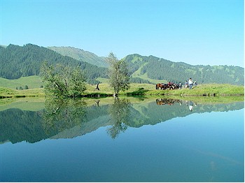
Image credit: Landscape approx. 15 km from the epicenter - image courtesy 老何
Earthquake with recorded magnitude of 6.6 hit northern Xinjiang, China on June 29, 2012 at 21:07 UTC. Epicenter was located 99 km (61 miles) S of Dushanzi, China (43.444°N, 84.725°E).. The Chinese seismological authorities reported a depth of 7 km at a magnitude of 6.6. Recorded depth by USGS was 18 km (11.2 miles), EMSC is reporting magnitude 6.3 with depth of 10km.
The epicenter was located in the Xinjiang mountains. Nearest big city (at a safe distance): Xinjuan. 150,000 people are living in a 100 km radius.
Blackouts were reported in the greater epicenter area. People living in Urumqi reported heavy shaking that lasted 1 minute.
Houses in a 50 km area are mostly simple and made from Brick, rocks and adobe. Generally spoken Chinese houses have little resistance against earthquakes. New constructions however are build with a very high earthquake resistance.
Xinjiang seismological bureau is organizing search and rescue teams to be dispatched to the epicenter area.
Until 23:00 UTC Chinese seismological services reported 7 M3+ aftershocks.
Note: Chart represents USGS data with magnitude 6.3. Chinese seismologists reported magnitude 6.6.
| Magnitude | 6.3 |
|---|---|
| Date-Time |
|
| Location | 43.444°N, 84.725°E |
| Depth | 18 km (11.2 miles) |
| Region | NORTHERN XINJIANG, CHINA |
| Distances | 99 km (61 miles) S of Dushanzi, China 141 km (87 miles) SW of Shihezi, China 218 km (135 miles) WSW of Changji, China 219 km (136 miles) NNW of Korla, China |
| Location Uncertainty | horizontal +/- 13 km (8.1 miles); depth +/- 2.8 km (1.7 miles) |
| Parameters | NST=387, Nph=394, Dmin=416.3 km, Rmss=0.91 sec, Gp= 22°, M-type=centroid moment magnitude (Mw), Version=9 |
| Source |
|
| Event ID | usb000aue4 |

Shake map

Sources: Earthquake-report, USGS, EMSC
I'm a dedicated researcher, journalist, and editor at The Watchers. With over 20 years of experience in the media industry, I specialize in hard science news, focusing on extreme weather, seismic and volcanic activity, space weather, and astronomy, including near-Earth objects and planetary defense strategies. You can reach me at teo /at/ watchers.news.
Commenting rules and guidelines
We value the thoughts and opinions of our readers and welcome healthy discussions on our website. In order to maintain a respectful and positive community, we ask that all commenters follow these rules.