
Magnitude 6.2 earthquake hits Vanuatu
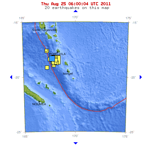
Image credit: TW
A 6.2 magnitude earthquake had a depth of only 10.1 km and was much shallower than the two 7.0+ quakes which struck the region in quick succession on August 20, 2011. The earthquake was 77 km (48 miles) SW (232°) from Port-Vila, Vanuatu. It is considered to be an aftershock of 7.1 magnitude earthquake that hits Vanuatu few days ago.
This is the third in a series of earthquakes which have rattled the region of Vanuatu over the last four days.


Vanuatu straddles the New Hebrides Plate in the South Pacific. The New Hebrides Plate is a minor tectonic plate located in the Pacific Ocean near the island nation of Vanuatu. The plate is bounded on the southwest by the Indo-Australian Plate which is subducting below it. The New Hebrides Subduction Zone is extremely active, producing over 20 earthquakes of magnitude 7 or higher in just the past 25 years. No tsunami warnings were issued with the latest earthquake. This region is now highly volatile. Seismic tension appears to be rising across the planet in unprecedented fashion.

Commenting rules and guidelines
We value the thoughts and opinions of our readers and welcome healthy discussions on our website. In order to maintain a respectful and positive community, we ask that all commenters follow these rules.