• Formation of a new tropical cyclone in west Pacific ocean

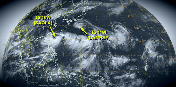
    Formation of significant tropical cyclone is possible within 165 nm either side of a line from 23.3N 145.9E to 24.2N 140.8E within the next 12 to 24 hours according to latest report by Joint Typhoon Warning Center (JTWC). Winds in the area are estimated to be 18 to 23
  • Dust storm blew from Argentina’s Laguna Mar Chiquita

    Dry conditions plagued the region of Argentina’s Laguna Mar Chiquita in June and July, 2012. Laguna Mar Chiquita straddles the border between the states of Santiago del Estero in the north, and Cordoba in the south. Cordoba was one of the states contending with

  • Another deadly derecho in United States

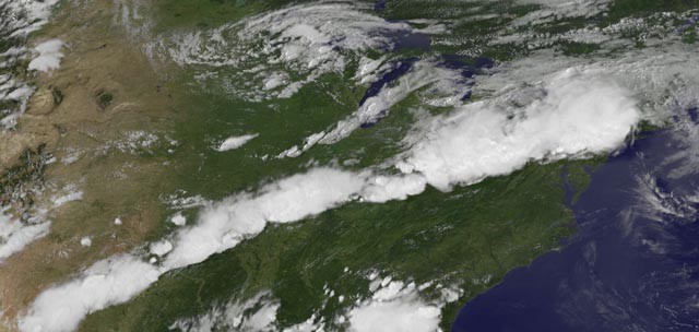
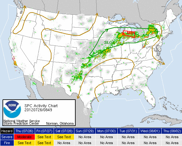
    A huge outbreak of severe thunderstorms hit United States on Thursday, July 26, 2012 causing damage in fifteen states and knocking out power to over 250,000 customers. Severe thunderstorm warnings were in effect for 132 counties in 15 states along but it was not as

  • Low Pressure system east of Newfoundland, Canada

    Thunderstorm activity has diminished in association with a non-tropical low pressure system located about 370 km (230 miles) east of Cape Race, Newfoundland. The Low is now moving rapidly north-northeastward at 50 to 55 km/h (30 to 35 mph) over cold waters, and

  • Typhoon Vicente slams South China

    Typhoon Vicente made landfall on July 23, 2012 UTC about 131 km south-west of Hong Kong as a Category 3 typhoon in Taishan, Guangdong, China, with maximum sustained winds of about 120 mph. Vicente missed the Hong Kong and Macau, the two populous cities in South China.

  • Patterns in thick plume of dust over Gulf of Aden

    A thick plume of dust blows off the coast near the Djibouti-Somalia border and over the Gulf of Aden. The ridged patterns in the plume are caused by changes in air currents. A thin veil of dust also hangs over the Red Sea and the Bab el Mandeb Strait, which connects