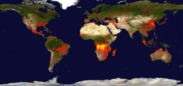
• Global 10-day Fire Map: June 10 – 19, 2013

    This fire map bellow accumulates the locations of the fires detected by MODIS on board the Terra and Aqua satellites over a 10-day period, from June 10 – June 19, 2013. Each colored dot indicates a location where MODIS detected at least one fire during the

  • Smoke plumes from North American wildfires over Spain

    Massive wildfires in US and Canada produced smoke plumes that drifted over the Atlantic Ocean and reached Europe in late June 2013. MODIS satellite imagery shows smoke plumes hovering over Spain and the western Mediterranean Sea on June 26-27,

  • Timelapse of a supercell near Booker, Texas

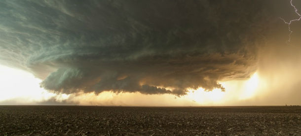
    After four years of searching for perfect supercell in the Central Plains, photographer Mike Olbinski from Arizona and his friend Andy Hoeland captured an amazing rotating supercell near Booker, Texas. Rotating clouds looking like

  • Active volcanoes in the world: June 19 – June 25, 2013

    This week, 4 volcanoes had new activity, whereas ongoing activity was reported for 13 volcanoes. This report covers active volcanoes in the world recorded from June 19 – June 25, 2013 based on Smithsonian/USGS criteria.

    New

  • Cosme became hurricane and weakened into tropical storm again

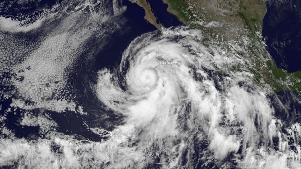
    Cosme is the second hurricane of the 2013 Eastern Pacific season. During late May, Barbara became a hurricane just prior to making landfall near Puerto Arista, Mexico in the Gulf of Tehuantepec. On June 26, 2013, Hurricane Cosme was battering Clarion Island,

  • Early monsoon brings trouble to Uttarakhand state, India

    Over the last few weeks torrential rainfall across northern India and Nepal has been inducing widespread flooding, cloudbursts, riverbank erosions and massive landslides. Heavy monsoon rains started about two weeks earlier than usual. 

    Torrential downpours

  • M6.4 earthquake – northern Mid-Atlantic Ridge

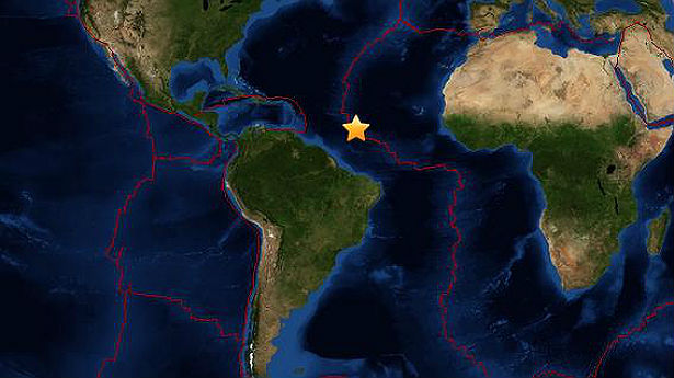
    Strong earthquake registered as M6.4 (USGS) occurred at northern Mid-Atlantic Ridge at 22:04 UTC on June 24, 2013. USGS registered depth of 10.0km (6.2 miles).The epicenter was located 1248 km (775 miles) ENE of Cayenne, French Guiana and 1 359 km (844 miles) NNE of Sal

  • Two new areas of low pressure formed in East Pacific

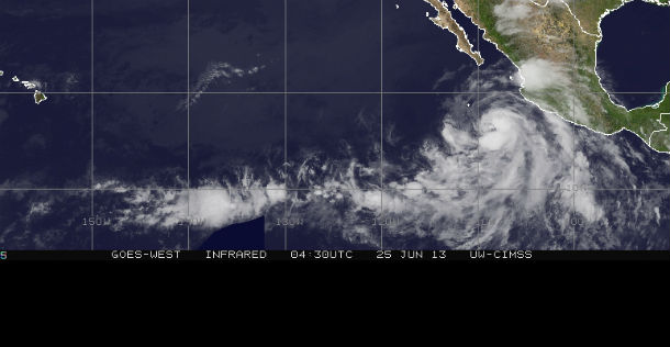
    Two new areas of low pressure are forming in the East Pacific. Both of these systems pose little if any threat to land as they continue to move westward away from the mainland. 

    Combined infrared image by GOES West (09:30 UTC, June 23, 2013) and GOES East