
Earthquakes at Taal volcano, increase in water temperature, Philippines
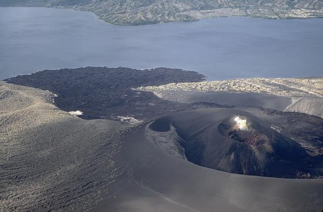
Image credit: Kurt Frederickson / Smithsonian Institution
The Philippine Institute of Volcanology and Seismology (PHIVOLCS) has recorded 10 volcanic earthquakes on April 14 and another 6 on April 15, 2016. The Alert Level remains at 1 – hazardous eruption is not imminent. The last eruption of this volcano took place in 1977.
In addition, field measurements on April 11, 2019 at the eastern sector of the Main Crater Lake yielded an increase in water temperature from 31.7 to 31.9 °C (89.06 – 89.42 °F), a decrease in water level from 0.41 meter to 0.31 m (1.34 to 1.01 feet) and decrease in acidity from pH 2.67 to pH 2.95.
Ground deformation measurements through precise leveling surveys from March 18 to 27, 2019 indicated slight inflation of the edifice consistent with recent results from continuous GPS data.
PHIVOLCS maintains Alert Level at 1 since March 28.
While this means that hazardous eruption is not imminent, the public is reminded that the Main Crater should be strictly off-limits because sudden steam explosions may occur and high concentrations of toxic gases may accumulate.
The northern portion of the Main Crater rim, in the vicinity of Daang Kastila Trail, may also become hazardous when steam emission along existing fissures suddenly increases.
Furthermore, the public is also reminded that the entire Volcano Island is a Permanent Danger Zone (PDZ), and permanent settlement in the island is strongly not recommended.
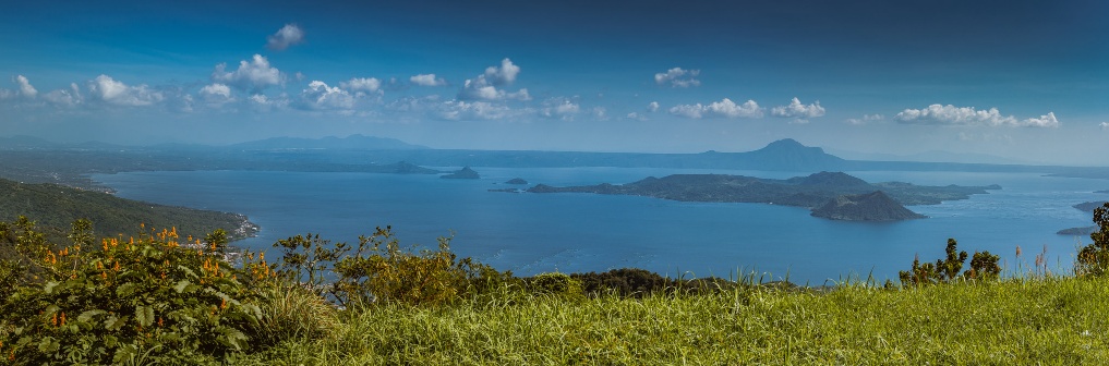
Image credit: Ray in Manila
The last eruption of this volcano started in October 1997 and lasted approximately 1 month (VEI 2). VEI4 eruption took place from September 28 – 30, 1965. Both eruptions took place on Taal's SW flank near Mt. Tabaro.
Geological summary
Taal is one of the most active volcanoes in the Philippines and has produced some of its most powerful historical eruptions. Though not topographically prominent, its prehistorical eruptions have greatly changed the topography of SW Luzon. The 15 x 20 km (9 x 12 feet) Talisay (Taal) caldera is largely filled by Lake Taal, whose 267 km2 (103 mi2) surface lies only 3 m (9.8 feet) above sea level.
The maximum depth of the lake is 160 m (525 feet), and several eruptive centers lie submerged beneath the lake. The 5-km-wide (3.1 miles) Volcano Island in north-central Lake Taal is the location of all historical eruptions. The island is composed of coalescing small stratovolcanoes, tuff rings, and scoria cones that has grown about 25% in area during historical time. Powerful pyroclastic flows and surges from historical eruptions have caused many fatalities.
I'm a dedicated researcher, journalist, and editor at The Watchers. With over 20 years of experience in the media industry, I specialize in hard science news, focusing on extreme weather, seismic and volcanic activity, space weather, and astronomy, including near-Earth objects and planetary defense strategies. You can reach me at teo /at/ watchers.news.
Commenting rules and guidelines
We value the thoughts and opinions of our readers and welcome healthy discussions on our website. In order to maintain a respectful and positive community, we ask that all commenters follow these rules.