
Winter Storm “Eboni” claims 6 lives, causes widespread flooding, rare New Mexico blizzard
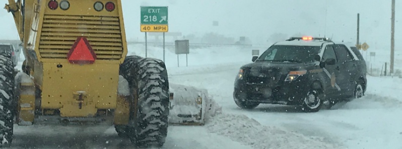
Image credit: NM State Police
Powerful Winter Storm "Eboni" marched through the United States this week, dropping heavy snow, causing slick roads and leaving 4 people dead. On its warm side, the storm brought flooding rains to the South, triggering flash flood emergencies and high water rescues, and leaving at least 2 people dead.
Wrecks and whiteouts prompted authorities to close a stretch of the I-70 from the Colorado border to Hays, TWC reports. The Minnesota State Patrol said it responded to 167 crashes, 259 spinouts and 13 jackknifed semis on December 27. The Kansas Highway Patrol said it responded to at least 29 crashed.
Whiteout conditions from the storm also forced the closure of portions of I-80 in Nebraska. The Nebraska Department of Transportation shut down westbound I-80 between North Platte and Grand Island because of blizzard conditions. Eastbound I-80 and Highway 30 were closed from North Platte to Lexington.
The storm also caused numerous flight delays and cancellations. Nearly all flights out of Fargo, North Dakota, were canceled.
In Oklahoma Panhandle, heavy snow caused closure of several highways, including state Highway 54 where several accidents took place.
Two highway patrol vehicles were involved in separate crashes on icy roads of Utah.
I-25 has closed since this video was taken as drivers are stuck, unable to make it up La Bajada Hill. https://t.co/UCAPSUS88P pic.twitter.com/VU06ilG1X0
— KOAT.com (@koat7news) December 26, 2018
According to data provided by TWC, a teenager died in a crash in Kansas on December 27. A second fatality linked to the storm occurred during a crash in Minnesota. Another driver was killed on a snow-covered road in North Dakota and a pedestrian was struck and killed by a pickup truck with a plow blade in Minnesota's Crow Wing County.
Eboni's warm side brought widespread flooding rains to the South, where a woman was killed when a tree fell on her camper. Another woman was killed when she fell into a creek near Chattanooga.
The storm triggered flood emergencies, street flooding and high water rescues.
Multiple rescues were conducted during the morning hours of December 28 from homes in areas just east of Hattiesburg.
Standing water closed numerous roads across Georgia where a woman and her 2-month-old child had due be rescued after their pickup truck ran of f the road and into a river near Atlanta.
At least 25 residents were evacuated from rising floodwaters in Mills River, North Carolina, TWC reports.
In Louisiana, more than a dozen homes were flooded in St. Charles Parish on December 27.
AccuWeather Senior Meteorologist Kristina Pydynowski said that visibility dropped down to 'one-quarter of a mile' (400 m) around Albuquerque, New Mexico where rare blizzard brought a 'shocking' amount of snow on December 27 and 28, causing extensive travel issues and shut down large areas of the state.
"The majority of the snow that fell around Albuquerque came on Thursday night, when two inches were reported at the airport but four to five inches [10 – 13 cm] in the far eastern heights of the city," Pydynowski said. "Then, strong winds increased on Friday morning and that shut the snow mostly off for the city. Those winds, however, blew the snow that fell around and dramatically reduced visibility."
#NMSP is highly encouraging everyone to avoid I40 between Albuquerque and Santa Rosa. Extreme winter weather and driving conditions. Seek alternative routes around the storm or find a local hotel to shelter. Tune in to local news for updates. pic.twitter.com/HdCztoUBvk
— NMSP (@NMStatePolice) December 28, 2018
On December 28, areas around the Manzano Mountains received up to 45.7 cm (18 inches) of snow. A 25.7 km (16-miles) stretch of US-82 was closed on the same day due to heavy snowfall and severe driving conditions.
Rudiso and Alto received 51 cm (20 inches) and 76 cm (30 inches), respectively.
A strong cold front currently moving through the Pacific Northwest will continue to drop southward and eastward today, NWS forecaster Fracasso noted Sunday, December 30.
This will bring windy conditions to much of the interior West from Montana southward to Wyoming through the day. Winds may gust as high as 112 km/h (70 mph) are possible in wind prone areas. Snow will follow along the path of the cold front today with several inches to over a foot possible in the mountains but much lighter amounts in valley locations.
Any rain or rain/snow mix will change over as colder air rushes in behind the front.
The precipitation will avoid California and most of Nevada given its trajectory from the north/northwest but cooler air will even spill over the Sierras by Monday, albeit to a lesser degree.
This system will continue sinking southward tomorrow, December 31 and bring yet another chance of snow to the Four Corners region, especially from the higher terrain of the Mogollon Rim/White Mountains in Arizona through New Mexico northward into Colorado (San Juan and Sangre de Cristo mountains).
To the north, lighter snow will spread eastward across the Dakotas into Minnesota along the arctic boundary.
Farther east, the weather will turn much milder and wetter as a storm system moves out of the western Gulf of Mexico later today through the lower Mississippi Valley.
Rainfall will expand in coverage an intensity today as a warm front heads north through Alabama/Georgia. Heavy rain is possible that could induce flash flooding in localized areas.
Otherwise, a large area of modest rain will spread northward with totals of 25 – 50 mm (1 – 2 inches) possible. Rainfall may be enhanced by thunderstorms, possibly severe, especially on Monday.
Rainfall will push into the Ohio Valley and then the Northeast as the surface low deepens on Monday as it tracks toward the eastern Great Lakes.
This could spell a rather wet though mild New Year's Eve by midnight for partygoers in the Northeast (e.g., New York City).
Farther south, much of Florida will remain protected from the rainfall to the north which will allow temperatures to rise to near record levels for the end of December – generally low to mid-80s (26 to 29 °C).
I'm a dedicated researcher, journalist, and editor at The Watchers. With over 20 years of experience in the media industry, I specialize in hard science news, focusing on extreme weather, seismic and volcanic activity, space weather, and astronomy, including near-Earth objects and planetary defense strategies. You can reach me at teo /at/ watchers.news.
Commenting rules and guidelines
We value the thoughts and opinions of our readers and welcome healthy discussions on our website. In order to maintain a respectful and positive community, we ask that all commenters follow these rules.