Active volcanoes in the world: February 22 – 28, 2017
New activity/unrest was reported for 3 volcanoes between February 22 and 28, 2017. During the same period, ongoing activity was reported for 14 volcanoes.
New activity/unrest: Etna, Sicily (Italy) | Pacaya, Guatemala | Piton de la Fournaise, Reunion Island (France).
Ongoing activity: Bagana, Bougainville (Papua New Guinea) | Bogoslof, Fox Islands (USA) | Cleveland, Chuginadak Island (USA) | Colima, Mexico | Dukono, Halmahera (Indonesia) | Ebeko, Paramushir Island (Russia) | Fuego, Guatemala | Kilauea, Hawaiian Islands (USA) | Langila, New Britain (Papua New Guinea) | Nevado del Ruiz, Colombia | Sabancaya, Peru | Sheveluch, Central Kamchatka (Russia) | Sinabung, Indonesia | Suwanosejima. Ryukyu Islands (Japan).
New activity/unrest
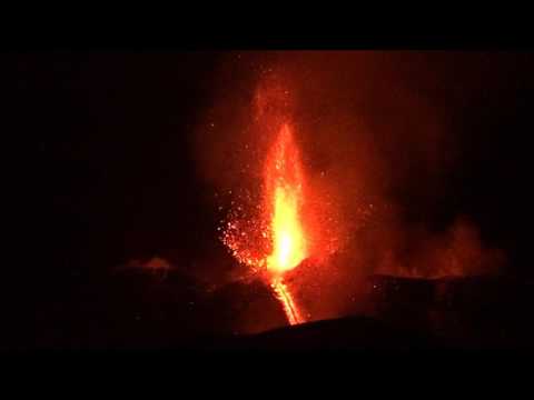
Etna, Sicily (Italy)
37.734°N, 15.004°E, Elevation 3330 m
INGV reported that Strombolian activity at Etna’s New Southeast Crater (NSEC) cone that began on 23 January gradually began to intensify at 1700 on 27 February. A lava flow quickly reached the base of the cone and traveled SW towards Monte Frumento Supino. Ash plumes drifted E and caused ashfall in Zafferana and Linguaglossa.
Geological summary: Mount Etna, towering above Catania, Sicily's second largest city, has one of the world's longest documented records of historical volcanism, dating back to 1500 BCE. Historical lava flows of basaltic composition cover much of the surface of this massive volcano, whose edifice is the highest and most voluminous in Italy. The Mongibello stratovolcano, truncated by several small calderas, was constructed during the late Pleistocene and Holocene over an older shield volcano. The most prominent morphological feature of Etna is the Valle del Bove, a 5 x 10 km horseshoe-shaped caldera open to the east. Two styles of eruptive activity typically occur at Etna. Persistent explosive eruptions, sometimes with minor lava emissions, take place from one or more of the three prominent summit craters, the Central Crater, NE Crater, and SE Crater (the latter formed in 1978). Flank vents, typically with higher effusion rates, are less frequently active and originate from fissures that open progressively downward from near the summit (usually accompanied by strombolian eruptions at the upper end). Cinder cones are commonly constructed over the vents of lower-flank lava flows. Lava flows extend to the foot of the volcano on all sides and have reached the sea over a broad area on the SE flank.
Pacaya, Guatemala
14.381°N, 90.601°W, Elevation 2552 m
INSIVUMEH reported that during 21-28 February weak Strombolian explosions at Pacaya’s Mackenney cone ejected material as high as 20 m above the crater rim. Lava flows traveled 150 m NW towards Cerro Chino cone, and 75 m W.
Geological summary: Eruptions from Pacaya, one of Guatemala's most active volcanoes, are frequently visible from Guatemala City, the nation's capital. This complex basaltic volcano was constructed just outside the southern topographic rim of the 14 x 16 km Pleistocene Amatitlán caldera. A cluster of dacitic lava domes occupies the southern caldera floor. The post-caldera Pacaya massif includes the ancestral Pacaya Viejo and Cerro Grande stratovolcanoes and the currently active Mackenney stratovolcano. Collapse of Pacaya Viejo between 600 and 1500 years ago produced a debris-avalanche deposit that extends 25 km onto the Pacific coastal plain and left an arcuate somma rim inside which the modern Pacaya volcano (Mackenney cone) grew. A subsidiary crater, Cerro Chino, was constructed on the NW somma rim and was last active in the 19th century. During the past several decades, activity has consisted of frequent strombolian eruptions with intermittent lava flow extrusion that has partially filled in the caldera moat and armored the flanks of Mackenney cone, punctuated by occasional larger explosive eruptions that partially destroy the summit of the growing young stratovolcano.
Piton de la Fournaise, Reunion Island (France)
21.244°S, 55.708°E, Elevation 2632 m
OVPF reported that during 25-26 February observers noted ejections of material from the active vent at Piton de la Fournaise. Lava was mainly transported through a lava tube, and a few branches coming from the end of the tube remained active. Late at night on 26 February tremor began to decline, and ceased at 1010 the next morning. Mid-day on 27 February observers confirmed that no material was being ejected from the vent, and that only white plumes were rising; gas emissions ceased at 1930.
Geological summary: The massive Piton de la Fournaise basaltic shield volcano on the French island of Réunion in the western Indian Ocean is one of the world's most active volcanoes. Much of its more than 530,000-year history overlapped with eruptions of the deeply dissected Piton des Neiges shield volcano to the NW. Three calderas formed at about 250,000, 65,000, and less than 5000 years ago by progressive eastward slumping of the volcano. Numerous pyroclastic cones dot the floor of the calderas and their outer flanks. Most historical eruptions have originated from the summit and flanks of Dolomieu, a 400-m-high lava shield that has grown within the youngest caldera, which is 8 km wide and breached to below sea level on the eastern side. More than 150 eruptions, most of which have produced fluid basaltic lava flows, have occurred since the 17th century. Only six eruptions, in 1708, 1774, 1776, 1800, 1977, and 1986, have originated from fissures on the outer flanks of the caldera. The Piton de la Fournaise Volcano Observatory, one of several operated by the Institut de Physique du Globe de Paris, monitors this very active volcano.
Ongoing activity
Bagana, Bougainville (Papua New Guinea)
6.137°S, 155.196°E, Elevation 1855 m
Based on analyses of satellite imagery, the Darwin VAAC reported that on 26 February a diffuse ash plume from Bagana rose to an altitude of 3 km (10,000 ft) a.s.l. and drifted ESE.
Geological summary: Bagana volcano, occupying a remote portion of central Bougainville Island, is one of Melanesia's youngest and most active volcanoes. This massive symmetrical cone was largely constructed by an accumulation of viscous andesitic lava flows. The entire edifice could have been constructed in about 300 years at its present rate of lava production. Eruptive activity is frequent and characterized by non-explosive effusion of viscous lava that maintains a small lava dome in the summit crater, although explosive activity occasionally producing pyroclastic flows also occurs. Lava flows form dramatic, freshly preserved tongue-shaped lobes up to 50 m thick with prominent levees that descend the flanks on all sides.
Bogoslof, Fox Islands (USA)
53.93°N, 168.03°W, Elevation 150 m
AVO reported that no significant volcanic activity at Bogoslof had been detected in seismic, infrasound, or mostly cloudy satellite data during 22-28 February. The Aviation Color Code remained at Orange and the Volcano Alert Level remained at Warning.
Geological summary: Bogoslof is the emergent summit of a submarine volcano that lies 40 km north of the main Aleutian arc. It rises 1500 m above the Bering Sea floor. Repeated construction and destruction of lava domes at different locations during historical time has greatly modified the appearance of this "Jack-in-the-Box" volcano and has introduced a confusing nomenclature applied during frequent visits of exploring expeditions. The present triangular-shaped, 0.75 x 2 km island consists of remnants of lava domes emplaced from 1796 to 1992. Castle Rock (Old Bogoslof) is a steep-sided pinnacle that is a remnant of a spine from the 1796 eruption. Fire Island (New Bogoslof), a small island located about 600 m NW of Bogoslof Island, is a remnant of a lava dome that was formed in 1883.
Cleveland, Chuginadak Island (USA)
52.825°N, 169.944°W, Elevation 1730 m
AVO reported that during 22-28 February no significant activity at Cleveland was observed in satellite and webcam views, nor in seismic or infrasound data. Slightly elevated surface temperatures were identified in a satellite image during 26-28 February, and minor steaming was visible in webcam images during 27-28 February. The Aviation Color Code remained at Orange and the Volcano Alert Level remained at Watch.
Geological summary: Beautifully symmetrical Mount Cleveland stratovolcano is situated at the western end of the uninhabited, dumbbell-shaped Chuginadak Island. It lies SE across Carlisle Pass strait from Carlisle volcano and NE across Chuginadak Pass strait from Herbert volcano. Cleveland is joined to the rest of Chuginadak Island by a low isthmus. The 1730-m-high Mount Cleveland is the highest of the Islands of the Four Mountains group and is one of the most active of the Aleutian Islands. The native name for Mount Cleveland, Chuginadak, refers to the Aleut goddess of fire, who was thought to reside on the volcano. Numerous large lava flows descend the steep-sided flanks. It is possible that some 18th-to-19th century eruptions attributed to Carlisle should be ascribed to Cleveland (Miller et al., 1998). In 1944 Cleveland produced the only known fatality from an Aleutian eruption. Recent eruptions have been characterized by short-lived explosive ash emissions, at times accompanied by lava fountaining and lava flows down the flanks.
Colima, Mexico
19.514°N, 103.62°W, Elevation 3850 m
On 24 February the Centro Universitario de Estudios e Investigaciones de Vulcanologia – Universidad de Colima reported low-intensity explosions at Colima during the previous week. The internal crater remained about 250 m in diameter and 50-60 m deep; previous lava domes had been destroyed in late September and mid-November 2016. Scientists who visited the terminus of a 4.5-km-long pyroclastic flow that had been emplaced on 8 January observed that the flow was blocky with very little ash, and that the local vegetation had not been burnt, suggesting that the flow was low-temperature. The Unidad Estatal de Protección Civil de Colima noted that the public should not enter the 8-km-radius exclusion zone, and also stay away from ravines.
Geological summary: The Colima volcanic complex is the most prominent volcanic center of the western Mexican Volcanic Belt. It consists of two southward-younging volcanoes, Nevado de Colima (the 4320 m high point of the complex) on the north and the 3850-m-high historically active Volcán de Colima at the south. A group of cinder cones of late-Pleistocene age is located on the floor of the Colima graben west and east of the Colima complex. Volcán de Colima (also known as Volcán Fuego) is a youthful stratovolcano constructed within a 5-km-wide caldera, breached to the south, that has been the source of large debris avalanches. Major slope failures have occurred repeatedly from both the Nevado and Colima cones, and have produced a thick apron of debris-avalanche deposits on three sides of the complex. Frequent historical eruptions date back to the 16th century. Occasional major explosive eruptions (most recently in 1913) have destroyed the summit and left a deep, steep-sided crater that was slowly refilled and then overtopped by lava dome growth.
Dukono, Halmahera (Indonesia)
1.693°N, 127.894°E, Elevation 1229 m
Based on analyses of satellite imagery, wind model data, and notices from PVMBG, the Darwin VAAC reported that during 22 and 24-28 February ash plumes from Dukono rose to altitudes of 2.1-2.4 km (7,000-8,000 ft) a.s.l. and drifted SW, W, and NW.
Geological summary: Reports from this remote volcano in northernmost Halmahera are rare, but Dukono has been one of Indonesia's most active volcanoes. More-or-less continuous explosive eruptions, sometimes accompanied by lava flows, occurred from 1933 until at least the mid-1990s, when routine observations were curtailed. During a major eruption in 1550, a lava flow filled in the strait between Halmahera and the north-flank cone of Gunung Mamuya. This complex volcano presents a broad, low profile with multiple summit peaks and overlapping craters. Malupang Wariang, 1 km SW of the summit crater complex, contains a 700 x 570 m crater that has also been active during historical time.
Ebeko, Paramushir Island (Russia)
50.686°N, 156.014°E, Elevation 1103 m
KVERT reported that, according to observers in Severo-Kurilsk (Paramushir Island) about 7 km E, explosions on 27 February at Ebeko produced an ash plume that rose to an altitude of 2 km (6,600 ft) a.s.l. and drifted about 6 km N. The Aviation Color Code was raised to Orange (the second highest level on a four-color scale).
Geological summary: The flat-topped summit of the central cone of Ebeko volcano, one of the most active in the Kuril Islands, occupies the northern end of Paramushir Island. Three summit craters located along a SSW-NNE line form Ebeko volcano proper, at the northern end of a complex of five volcanic cones. Blocky lava flows extend west from Ebeko and SE from the neighboring Nezametnyi cone. The eastern part of the southern crater contains strong solfataras and a large boiling spring. The central crater is filled by a lake about 20 m deep whose shores are lined with steaming solfataras; the northern crater lies across a narrow, low barrier from the central crater and contains a small, cold crescentic lake. Historical activity, recorded since the late-18th century, has been restricted to small-to-moderate explosive eruptions from the summit craters. Intense fumarolic activity occurs in the summit craters, on the outer flanks of the cone, and in lateral explosion craters.
Fuego, Guatemala
14.473°N, 90.88°W, Elevation 3763 m
INSIVUMEH reported that during 21-22 February there were 28 explosions detected at Fuego, and ash plumes that rose as high as 1 km above the crater rim and drifted E and NE. There were 32 explosions recorded during 23-24 February; ash plumes rose 650 m and drifted S and SW. Lava fountains rose 200 m high, and generated a 200-m-long lava flow that descended the Santa Teresa (W) drainage. A second lava flow descended the Las Lajas (SE) drainage. Seismicity increased on 24 February. On 25 February explosions generated ash plumes that rose as high as 1.3 km above the crater and drifted more than 25 km NW, N, NE, and E. Ash fell in Alotenango (8 km ENE), San Vicente Pacaya, El Rodeo, El Zapote, La Reunión, and Alotenango. Lava fountains rose 300 m, and material was ejected as far away as 500 m. The lava flows continued to advance, extending 1.2 km in the Santa Teresa drainage, 1.3 km in the Las Lajas drainage, and 1.6 km in the Ceniza (SSW) drainage. Weak-to-moderate explosions during 26-27 February produced ash plumes that rose at most 750 m and drifted 8 km W and SW.
Geological summary: Volcán Fuego, one of Central America's most active volcanoes, is one of three large stratovolcanoes overlooking Guatemala's former capital, Antigua. The scarp of an older edifice, Meseta, lies between 3763-m-high Fuego and its twin volcano to the north, Acatenango. Construction of Meseta dates back to about 230,000 years and continued until the late Pleistocene or early Holocene. Collapse of Meseta may have produced the massive Escuintla debris-avalanche deposit, which extends about 50 km onto the Pacific coastal plain. Growth of the modern Fuego volcano followed, continuing the southward migration of volcanism that began at Acatenango. In contrast to the mostly andesitic Acatenango, eruptions at Fuego have become more mafic with time, and most historical activity has produced basaltic rocks. Frequent vigorous historical eruptions have been recorded since the onset of the Spanish era in 1524, and have produced major ashfalls, along with occasional pyroclastic flows and lava flows.
Kilauea, Hawaiian Islands (USA)
19.421°N, 155.287°W, Elevation 1222 m
During 22-28 February HVO reported that the lava lake continued to rise and fall, circulate, and spatter in Kilauea’s Overlook vent. Webcams recorded incandescence from long-active sources within Pu'u 'O'o Crater and from a vent high on the NE flank of the cone. A pit on the W side of the crater contains a small lava pond. The 61G lava flow, originating from a vent on Pu'u 'O'o Crater's E flank, continued to enter the ocean at Kamokuna. Surface lava flows were active on the coastal plain, along the E side of 61G, less than 1 km upslope of the FEMA emergency road. Other surface flows streamed down the pali farther inland.
Geological summary: Kilauea volcano, which overlaps the east flank of the massive Mauna Loa shield volcano, has been Hawaii's most active volcano during historical time. Eruptions are prominent in Polynesian legends; written documentation extending back to only 1820 records frequent summit and flank lava flow eruptions that were interspersed with periods of long-term lava lake activity that lasted until 1924 at Halemaumau crater, within the summit caldera. The 3 x 5 km caldera was formed in several stages about 1500 years ago and during the 18th century; eruptions have also originated from the lengthy East and SW rift zones, which extend to the sea on both sides of the volcano. About 90% of the surface of the basaltic shield volcano is formed of lava flows less than about 1100 years old; 70% of the volcano's surface is younger than 600 years. A long-term eruption from the East rift zone that began in 1983 has produced lava flows covering more than 100 sq km, destroying nearly 200 houses and adding new coastline to the island.
Langila, New Britain (Papua New Guinea)
5.525°S, 148.42°E, Elevation 1330 m
Based on analyses of satellite imagery and wind data, the Darwin VAAC reported that on 24 February an ash plume from Langila rose to an altitude of 2.4 km (8,000 ft) a.s.l. and drifted N.
Geological summary: Langila, one of the most active volcanoes of New Britain, consists of a group of four small overlapping composite basaltic-andesitic cones on the lower eastern flank of the extinct Talawe volcano. Talawe is the highest volcano in the Cape Gloucester area of NW New Britain. A rectangular, 2.5-km-long crater is breached widely to the SE; Langila volcano was constructed NE of the breached crater of Talawe. An extensive lava field reaches the coast on the north and NE sides of Langila. Frequent mild-to-moderate explosive eruptions, sometimes accompanied by lava flows, have been recorded since the 19th century from three active craters at the summit of Langila. The youngest and smallest crater (no. 3 crater) was formed in 1960 and has a diameter of 150 m.
Nevado del Ruiz, Colombia
4.892°N, 75.324°W, Elevation 5279 m
Servicio Geológico Colombiano’s (SGC) Observatorio Vulcanológico y Sismológico de Manizales reported that during 21-27 February seismicity at Nevado del Ruiz continued to indicate unrest. Seismicity was highest during 23-26 February with earthquakes located at depths of 1.1-4 km, in areas SW of the volcano; the largest event was a local M 3.2. Signals indicating fracturing rock increased in both size and number as compared to the previous week. Significant amounts of water vapor and gas continued to be emitted. Gas, steam, and ash plumes rose 2 km above the crater rim on 25 February and drifted NW and SW. Thermal anomalies were identified on 21, 23, and 26 February. The Alert Level remained at III (Yellow; the second lowest level on a four-color scale).
Geological summary: Nevado del Ruiz is a broad, glacier-covered volcano in central Colombia that covers >200 sq km. Three major edifices, composed of andesitic and dacitic lavas and andesitic pyroclastics, have been constructed since the beginning of the Pleistocene. The modern cone consists of a broad cluster of lava domes built within the caldera of an older edifice. The 1-km-wide, 240-m-deep Arenas crater occupies the summit. The prominent La Olleta pyroclastic cone located on the SW flank may also have been active in historical time. Steep headwalls of massive landslides cut the flanks. Melting of its summit icecap during historical eruptions, which date back to the 16th century, has resulted in devastating lahars, including one in 1985 that was South America's deadliest eruption.
Sabancaya, Peru
15.78°S, 71.85°W, Elevation 5967 m
Based on webcam views and seismic data the Buenos Aires VAAC reported that during 22-26 and 28 February sporadic gas-and-ash puffs rose from Sabancaya, and during 24-28 February they rose to altitudes of 7-11.9 km (23,000-39,000 ft) a.s.l. Weather clouds often hindered observations of the volcano.
Geological summary: Sabancaya, located in the saddle NE of Ampato and SE of Hualca Hualca volcanoes, is the youngest of these volcanic centers and the only one to have erupted in historical time. The oldest of the three, Nevado Hualca Hualca, is of probable late-Pliocene to early Pleistocene age. The name Sabancaya (meaning "tongue of fire" in the Quechua language) first appeared in records in 1595 CE, suggesting activity prior to that date. Holocene activity has consisted of Plinian eruptions followed by emission of voluminous andesitic and dacitic lava flows, which form an extensive apron around the volcano on all sides but the south. Records of historical eruptions date back to 1750.
Sheveluch, Central Kamchatka (Russia)
56.653°N, 161.36°E, Elevation 3283 m
KVERT reported that during 17-24 February lava-dome extrusion onto Sheveluch’s N flank was accompanied by strong fumarolic activity, dome incandescence, ash explosions, and hot avalanches. Satellite images showed a daily thermal anomaly over the dome, and ash plumes that drifted 100 km NE on 18 February. Explosions on 20 February generated ash plumes that rose to an altitude of 5.5 km (18,000 ft) a.s.l. and drifted NW. The Aviation Color Code remained at Orange.
Geological summary: The high, isolated massif of Sheveluch volcano (also spelled Shiveluch) rises above the lowlands NNE of the Kliuchevskaya volcano group. The 1300 cu km volcano is one of Kamchatka's largest and most active volcanic structures. The summit of roughly 65,000-year-old Stary Shiveluch is truncated by a broad 9-km-wide late-Pleistocene caldera breached to the south. Many lava domes dot its outer flanks. The Molodoy Shiveluch lava dome complex was constructed during the Holocene within the large horseshoe-shaped caldera; Holocene lava dome extrusion also took place on the flanks of Stary Shiveluch. At least 60 large eruptions have occurred during the Holocene, making it the most vigorous andesitic volcano of the Kuril-Kamchatka arc. Widespread tephra layers from these eruptions have provided valuable time markers for dating volcanic events in Kamchatka. Frequent collapses of dome complexes, most recently in 1964, have produced debris avalanches whose deposits cover much of the floor of the breached caldera.
Sinabung, Indonesia
3.17°N, 98.392°E, Elevation 2460 m
Based on PVMBG observations, satellite and webcam images, and wind data, the Darwin VAAC reported that during 22 and 24-26 February ash plumes from Sinabung rose to altitudes of 3.3-5.2 km (11,000-17,000 ft) a.s.l. and drifted WNW, W, and SW.
Geological summary: Gunung Sinabung is a Pleistocene-to-Holocene stratovolcano with many lava flows on its flanks. The migration of summit vents along a N-S line gives the summit crater complex an elongated form. The youngest crater of this conical andesitic-to-dacitic edifice is at the southern end of the four overlapping summit craters. An unconfirmed eruption was noted in 1881, and solfataric activity was seen at the summit and upper flanks in 1912. No confirmed historical eruptions were recorded prior to explosive eruptions during August-September 2010 that produced ash plumes to 5 km above the summit.
Suwanosejima, Ryukyu Islands (Japan)
29.638°N, 129.714°E, Elevation 796 m
Based on JMA notices and satellite-image analyses, the Tokyo VAAC reported explosions at Suwanosejima during 27-28 February. Ash plumes rose to an altitude of 1.5 km (5,000 ft) a.s.l. and drifted SE on 28 February.
Geological summary: The 8-km-long, spindle-shaped island of Suwanosejima in the northern Ryukyu Islands consists of an andesitic stratovolcano with two historically active summit craters. The summit of the volcano is truncated by a large breached crater extending to the sea on the east flank that was formed by edifice collapse. Suwanosejima, one of Japan's most frequently active volcanoes, was in a state of intermittent strombolian activity from Otake, the NE summit crater, that began in 1949 and lasted until 1996, after which periods of inactivity lengthened. The largest historical eruption took place in 1813-14, when thick scoria deposits blanketed residential areas, and the SW crater produced two lava flows that reached the western coast. At the end of the eruption the summit of Otake collapsed forming a large debris avalanche and creating the horseshoe-shaped Sakuchi caldera, which extends to the eastern coast. The island remained uninhabited for about 70 years after the 1813-1814 eruption. Lava flows reached the eastern coast of the island in 1884. Only about 50 people live on the island.
Source: GVP
Nice for up to date
Yeah.