
Large earth fissure discovered in Arizona
Featured image: A newly discovered fissure in Arizona. Credit: Arizona Geological Survey, 2017
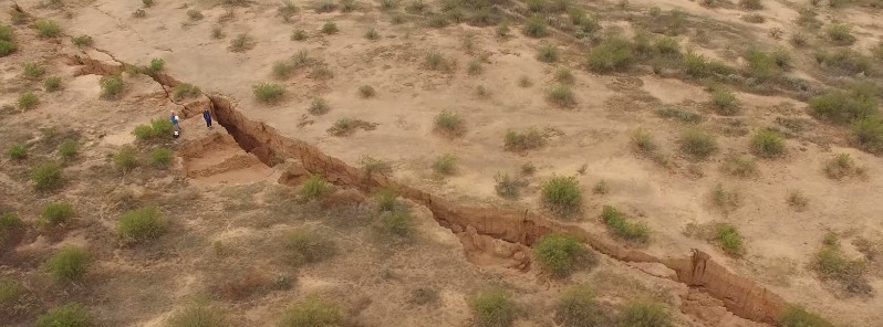
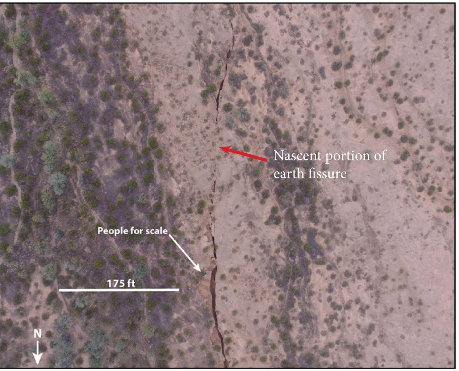
A new earth fissure, about 3.2 km (2 miles) long, was discovered 16 km (10 miles) SSW of Picacho Peak State Park of Arizona Trust Land in southern Pinal County, Arizona this month.
The new fissure is oriented roughly north-south, and it parallels other fissures in the Tator Hills Earth Fissure Study Area. Fissures at Tator Hills were first observed in 1977, and by 2009 over 17.7 km (11 miles) of fissures were mapped there.
Video courtesy Arizona Geological Survey
The width and depth of the new fissure varies dramatically along its length; from a narrow, inch-wide crack to a shallow crevice up to 3 m (10 feet) wide and 7.6 – 10.6 m (25 – 30 feet) deep, according to the Arizona Geological Survey.
At 2.9 km (1.8 miles) in length, this newest fissure is more than 800 m (0.5 miles) longer than other area fissures. Unlike older fissures in the Tator Hills, this fissure is free of vegetation, commensurate with having formed over just the past several years.
Credit: Arizona Geological Survey
Comparing dated Google Earth imagery, AZGS Earth Fissure program manager, Joe Cook, determined the fissure began to form between March 2013 and December 2014.
The onset of fissuring began in the north before extending southward and may have coincided with heavy rains in fall 2014. The southern portion of the fissure postdates the December 2014 imagery.
Video courtesy Arizona Geological Survey
Earth fissures in Arizona result from basin subsidence that accompanies extensive ground water withdrawal in the Sonoran Desert.
In Arizona, fissures first appeared near Eloy in 1929 and are now identified and mapped in basins in Cochise, La Paz, Maricopa, Pima and Pinal Counties.
Source: Arizona Geological Survey
The Watchers team and our contributors bring the latest on extreme weather, earthquakes, volcanic eruptions, space weather, and all things science. We're all about making sense of the natural world and keeping you informed on what’s happening. Got a tip or a question? Hit us up using the form at newstips!
I live not to far from this crack and have heard many noises coming from it moans
Nuevo pangeo?