
Tropical cyclones “Olwyn” and “Nathan” threatening Australia
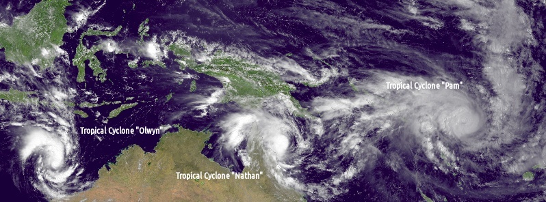
Image credit: NOAA/JMA. Annotation: The Watchers
Two tropical cyclones are currently threatening Australia, Tropical Cyclone "Olwyn" and "Nathan".
While Olwyn is expected to make landfall early Friday, March 13 (local time), "Nathan" is making a cyclonic loop near the eastern coast of Queensland's Cape York Peninsula which means it will stop heading toward the Cape York Peninsula and move away from it in an easterly direction.
Tropical Cyclone "Olwyn"
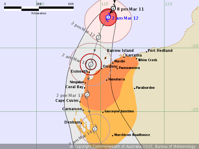
Tropical Cyclone "Olwyn" forecast track by BOM issued 19:02 UTC on March 11, 2015.
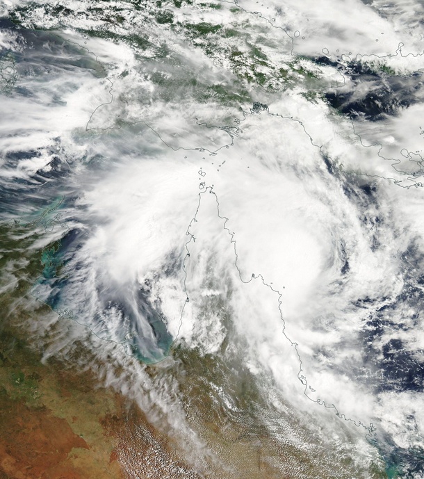
Tropical Cyclone "Olwyn" is currently a Category 2 storm on Australian tropical cyclone intensity scale with sustained winds near the center of 95 km/h (59 mph) and wind gusts to 130 km/h (80.7 mph)
Its location is estimated to be 370 km (229 miles) north northwest of Karratha and 505 km (313 miles) north northeast of Exmouth, Western Australia. The system is moving south southwest at 13 km/h (8 mph).
Olwyn continues to intensify as it moves towards the west Pilbara coast. It will be near the west Pilbara coast early on Friday morning (local time) with landfall expected between Exmouth and Mardie and there is the possibility that Olwyn intensifies to a severe tropical cyclone before landfall, Australian Bureau of Meteorology (BOM) said. The system will weaken as it continues to move towards the south, taking heavy rain and squally winds into southern parts of Western Australia.
Gales with gusts to 100 km/h (62.1 mph) are expected to develop between Karratha and Exmouth during Thursday afternoon. Should the system take a more southerly track during Thursday then gales may extend as far east as Whim Creek. From late Thursday, gales may extend inland to Pannawonica and Nanutarra.
VERY DESTRUCTIVE winds with gusts to 170 km/h (105.6 mph) could develop near the west Pilbara coast late Thursday evening or early Friday morning as the cyclone approaches the coast. DESTRUCTIVE winds may extend to Coral Bay for a period during Friday morning then Cape Cuvier later on Friday.
Residents between Mardie and Exmouth are specifically warned of the potential of a DANGEROUS STORM TIDE as the cyclone center crosses the coast. Tides are likely to rise significantly above the normal high tide mark with DAMAGING WAVES and DANGEROUS FLOODING.
Heavy rainfall is likely to develop over the western Pilbara and northern Gascoyne during Thursday and continue into Friday. Heavy rainfall will extend further southwards on Saturday. (BOM – WA – Warnings)
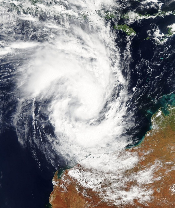
Tropical Cyclone "Olwyn" on March 11, 2015. Image credit: NASA Terra/MODIS.
Tropical Cyclone "Nathan"
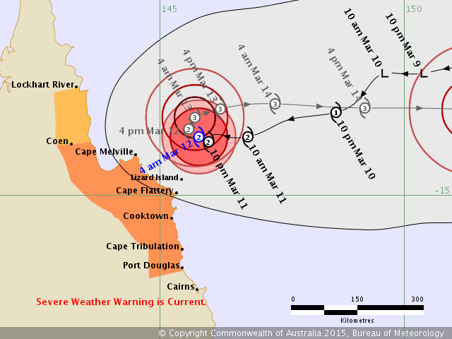
Tropical Cyclone "Nathan" forecast track by BOM issued 18:08 UTC on March 11, 2015.
Tropical Cyclone "Nathan" is also a Category 2 storm, with sustained winds near the center of 95 km/h (59 mph) and wind gusts to 130 km/h (80.7 mph).
Its location is estimated to be 105 km (65.2 miles) north northeast of Lizard Island and 195 km (121 miles) north northeast of Cooktown, Queensland.
Nathan is moving slowly to the west southwest at 5 km/h (3.10 mph), towards the coast near Cape Flattery. It is expected to slow this movement on Thursday (local time) and ultimately change direction to the east-northeast away from the coast over the next 24 hours.
GALES extend out to approximately 160 km (99 miles) from the center and could develop about coastal and island areas between Coen and Port Douglas on Thursday. GALES could extend north to Lockhart River during Friday, depending on the track the cyclone takes.
VERY DESTRUCTIVE WINDS are expected to develop within 45 km (27.9 miles) of the center overnight tonight (Thursday, local time) and could begin to affect coastal and island areas between Cape Flattery and Cape Melville.
DESTRUCTIVE WINDS extend out to 70 km (43.4 miles) from the center and could develop about the coast and islands between Cooktown and Cape Melville, including Lizard Island.
Areas of heavy rain, which may lead to flash flooding, are expected across parts of the North Tropical Coast and Tablelands and Peninsula districts throughout Thursday. A separate Severe Weather Warning for heavy rainfall and damaging winds is current for parts of these districts.
Abnormally high tides could develop about coastal areas between Coen and Cape Tribulation during Thursday with large waves possibly leading to minor flooding along the foreshore if the cyclone takes a more westward track closer to the coast. People living in areas that could be affected by this flooding should take measures to protect their property as much as possible and be prepared to help their neighbors in case this scenario occurs. (BOM – QLD – Warnings)
Tropical Cyclone "Nathan" on March 11, 2015. Image credit: NASA Terra/MODIS.
The following image was taken by the JMA MTSAT-2 satellite at 03:30 UTC on March 11, 2015.
From left to right: Tropical Cyclone Olwyn in the Indian Ocean heads south for landfall near Learmonth on the west coast of Australia, Tropical Cyclone Nathan meanders northeast of Cooktown, Queensland, Australia in the Coral Sea, Tropical Cyclone Pam tracks due south heading for the islands of Vanuatu in the southern Pacific Ocean and Tropical Depression 3 heads west-northwest towards Guam in the northern Pacific Ocean.
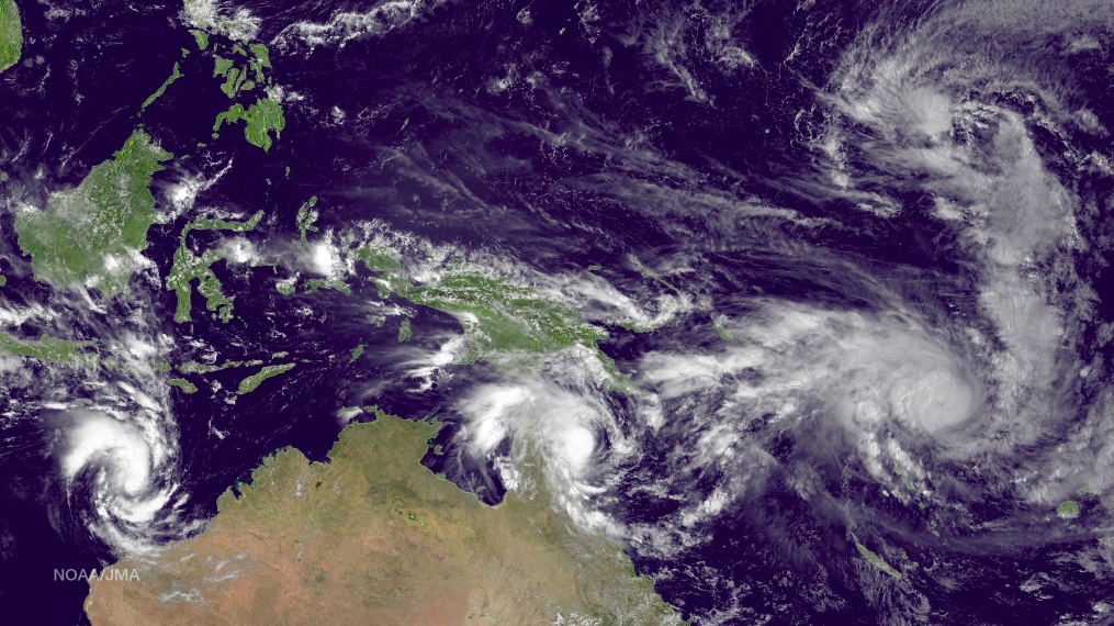
Image credit: NOAA/JMA.
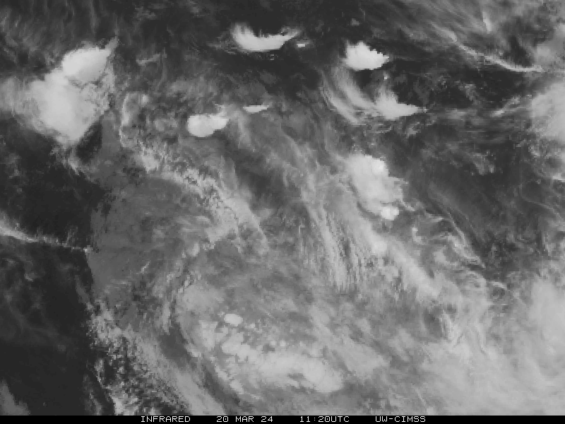
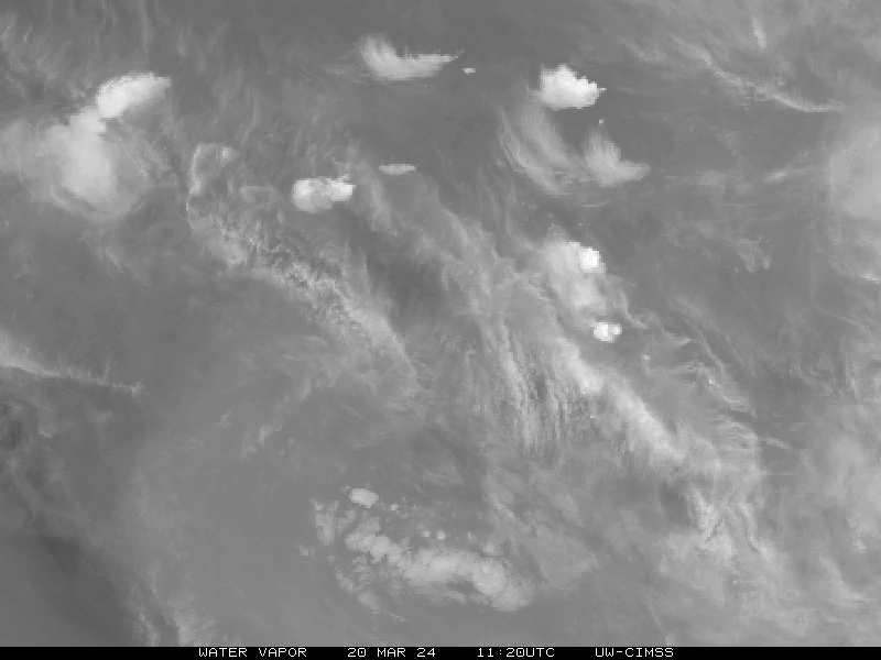
Satellite animations – Tropical Cyclone "Olwyn"
- Storm-Centered Infrared (MTSAT; NOAA/SSD)
- Storm-Centered Infrared (Aviation Color Enhancement) (MTSAT; NOAA/SSD)
- Storm-Centered Water Vapor (MTSAT; NOAA/SSD)
- Storm-Centered Visible (MTSAT; NOAA/SSD)
- Storm-Centered Visible (Colorized) (MTSAT; NOAA/SSD)
- Storm-Centered Infrared (MTSAT; CIMSS)
- Storm-Centered Enhanced Infrared (MTSAT; CIMSS)
- Storm-Centered Water Vapor (MTSAT; CIMSS)
- Storm-Centered Visible (MTSAT; CIMSS)
- MTSAT Infrared (MTSAT; CIMSS)
- MTSAT Infrared (Color Background) (MTSAT; CIMSS)
- MTSAT Infrared (NHC Color Enhancement (MTSAT; CIMSS)
- MTSAT Water Vapor (MTSAT; CIMSS)
- MTSAT Water Vapor (Color Background) (MTSAT; CIMSS)
- Meteosat 7 Infrared (Meteosat 7; CIMSS)
- Meteosat 7 Infrared (Color Background) (Meteosat 7; CIMSS)
- Meteosat 7 Infrared (NHC Color Enhancement) (Meteosat 7; CIMSS)
- Meteosat 7 Water Vapor (Meteosat 7; CIMSS)
- Meteosat 7 Water Vapor (Color Background) (Meteosat 7; CIMSS)
Satellite animations – Tropical Cyclone "Nathan"
- Storm-Centered Infrared (MTSAT; NOAA/SSD)
- Storm-Centered Infrared (Aviation Color Enhancement) (MTSAT; NOAA/SSD)
- Storm-Centered Water Vapor (MTSAT; NOAA/SSD)
- Storm-Centered Visible (MTSAT; NOAA/SSD)
- Storm-Centered Visible (Colorized) (MTSAT; NOAA/SSD)
- Storm-Centered Infrared (Meteosat 7; CIMSS)
- Storm-Centered Enhanced Infrared (Meteosat 7; CIMSS)
- Storm-Centered Water Vapor (Meteosat 7; CIMSS)
- Storm-Centered Visible (Meteosat 7; CIMSS)
- Southwest Pacific Infrared (MTSAT; NOAA)
- Southwest Pacific Enhanced Infrared (MTSAT; NOAA)
- Southwest Pacific Water Vapor (MTSAT; NOAA)
I'm a dedicated researcher, journalist, and editor at The Watchers. With over 20 years of experience in the media industry, I specialize in hard science news, focusing on extreme weather, seismic and volcanic activity, space weather, and astronomy, including near-Earth objects and planetary defense strategies. You can reach me at teo /at/ watchers.news.
Commenting rules and guidelines
We value the thoughts and opinions of our readers and welcome healthy discussions on our website. In order to maintain a respectful and positive community, we ask that all commenters follow these rules.