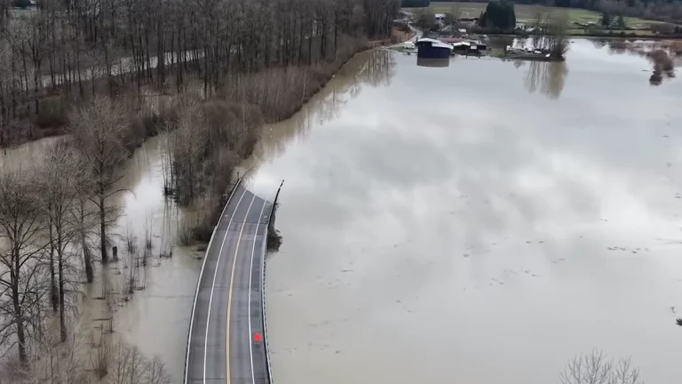
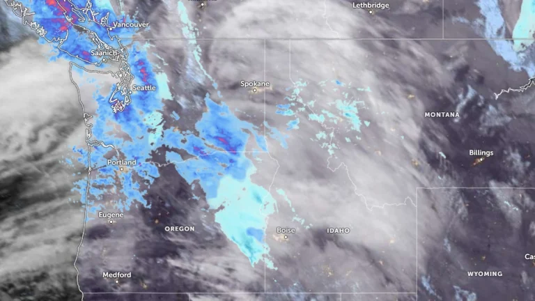
• Heavy lake-effect snow creates whiteout conditions, disrupts travel south of Chicago

    Powerful bands of lake-effect snow brought traffic on parts of Interstate 57 (I-57) south of Chicago, Illinois, to a standstill amid whiteout conditions on the morning of November 10, 2025. The National Weather Service (NWS) warned drivers to use extreme caution as snowfall rates exceeded 7 cm/h (3 in/h) in localized bands, producing near-zero visibility and hazardous travel across portions of northeastern Illinois.

  • Early-season lake-effect snow blankets Chicago and Great Lakes states

    The season’s first measurable snow reached Chicago early Monday, November 10, 2025, as Arctic air swept across the Great Lakes, producing intense lake-effect snow bands over Lakes Michigan, Erie, and Ontario. Travel warnings were issued from Illinois to western New York, with authorities urging drivers to avoid non-essential travel.

  • Atmospheric river forecast to bring heavy precipitation to California from November 12 to 15

    A developing low-pressure system over the Northeast Pacific is forecast to direct a strong atmospheric river (AR) toward California between November 12 and 15, 2025. The Center for Western Weather and Water Extremes (CW3E) indicates a high probability of moderate to strong AR conditions in Northern and Central California, with heavy precipitation possible in the Sierra Nevada and coastal ranges.

  • First October tornado on record in Wyoming confirmed near Alta

    An EF1 tornado confirmed near Alta, Wyoming, in the Teton Canyon area of the Caribou–Targhee National Forest on October 15, 2025, was officially verified on October 28. It is the third tornado ever recorded in Teton County and the first October tornado on record in Wyoming.

  • Flood Watch issued for Mason County, Washington

    A Flood Watch is in effect for Mason County, Washington, from Thursday afternoon through Saturday morning, November 6-8, 2025. Due to persistent rain, the Skokomish River is expected to rise above flood stage.