Severe storms and heavy rainfall across Texas and Oklahoma
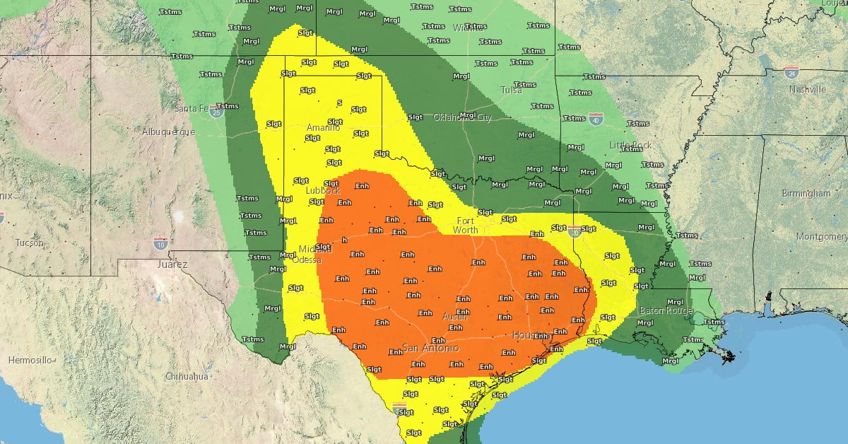
Severe weather is anticipated across Texas and southern Oklahoma on Tuesday, May 28, 2024, with strong storms expected to bring damaging winds, large hail, and the risk of flash flooding. The National Weather Service has issued an Enhanced Risk (Level 3 of 5) for central Texas, warning residents to stay alert and prepared for severe conditions.
- Widespread strong to severe storms are expected over much of Texas and southern Oklahoma on Tuesday, May 28, 2024.
- An Enhanced Risk (level 3 of 5) has been issued for central Texas.
- There’s a threat that excessive rainfall could create localized areas of flash and urban flooding across Texas and southern Oklahoma from Tuesday into Wednesday.
“The Lone Star State will be the focus for active weather today as strong thunderstorms develop along a southern High Plains dryline and lingering stationary front,” NWS forecaster Snell noted, adding that ample atmospheric moisture and instability will likely result in storms producing significant damaging wind gusts and very large hail.
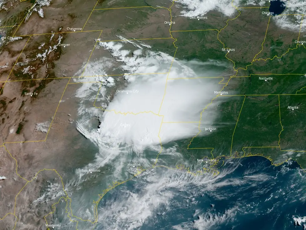
Thunderstorms currently active along the Red River Valley of the South are expected to persist through the morning, with additional storms developing across western and north-central Texas by the afternoon.
These storms, particularly those forming into clusters and merging cells, are anticipated to bring intense rainfall capable of causing flash floods, especially in areas just west of Dallas-Fort Worth and north of Austin.
The broader region at risk of scattered flash flooding and severe thunderstorms extends from the Texas Panhandle to the western Gulf Coast. Overnight, the intensity of heavy rain and severe weather is forecast to diminish as it shifts eastward within Texas.
“Residents and visitors are reminded to remain weather aware, have numerous ways to receive warnings and never drive across flooded roadways,” Snell said.
While the extreme heat affecting much of the Gulf Coast and southern Texas is easing, parts of southern Texas will still experience high heat indices up to 46 °C (115 °F) today. Additionally, temperatures are expected to remain above average, nearing daily record highs in the central and southern Florida Peninsula over the coming days.
References:
1 Short Range Forecast Discussion – NWS WPC – 346 AM EDT Tue May 28 2024
Featured image credit: NWS
Commenting rules and guidelines
We value the thoughts and opinions of our readers and welcome healthy discussions on our website. In order to maintain a respectful and positive community, we ask that all commenters follow these rules.