
Interactively explorable Earth’s topographic changes since 1984
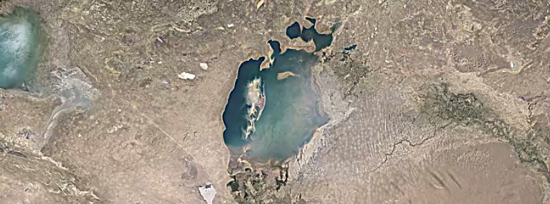
Featured image: The Aral Sea in 1984. Credit: USGS/NASA Landsat
In a global, zoomable and interactively explorable timelapse, Google's Earth Engine has finally made available over 5 million satellite images acquired over the past three decades by 5 different satellites.
You can search, pan, or zoom around to begin exploring the new timelapse, or check out their YouTube highlights below to see the power of the new tool. You can also create a timelapse tour that moves from one destination to another over time or even join Earth Engine developers to gain access to its application programming interface (API).
Timelapse is an example that illustrates the power of Earth Engine’s cloud-computing model, which enables users such as scientists, researchers, and journalists to detect changes, map trends, and quantify differences on the Earth's surface using Google’s computational infrastructure and the multi-petabyte Earth Engine data catalog.
The majority of the images come from Landsat, a joint USGS/NASA Earth observation program that has observed the Earth since the 1970s. For 2015 and 2016, it combined Landsat 8 imagery with imagery from Sentinel-2A, part of the European Commission and European Space Agency's Copernicus Earth observation program.
See the Timelapse embedded below.
It begins with Aral Sea in 1984, but you can zoom out and find any other place you like.
- The source is available at earthengine.google.com
The Watchers team and our contributors bring the latest on extreme weather, earthquakes, volcanic eruptions, space weather, and all things science. We're all about making sense of the natural world and keeping you informed on what’s happening. Got a tip or a question? Hit us up using the form at newstips!
Commenting rules and guidelines
We value the thoughts and opinions of our readers and welcome healthy discussions on our website. In order to maintain a respectful and positive community, we ask that all commenters follow these rules.