Strong and shallow M6.3 earthquake hits Colombia
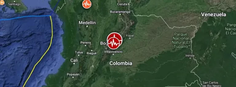
A strong and shallow earthquake registered by the USGS as M6.3 hit central Colombia at 17:04 UTC (12:04 LT) on August 17, 2023. The agency is reporting a depth of 10 km (6.2 miles). EMSC is reporting the same magnitude and depth.