Hurricane “Beryl” rapidly strengthening as it races toward Windward Islands, devastating damage expected in landfall area

Hurricane “Beryl” is racing toward Windward Islands while rapidly intensifying. It is expected to become a dangerous major hurricane before it reaches the land on Monday, July 1, 2024. Devastating wind damage is expected where the eyewall of Beryl moves through portions of the Windward Islands.
- A Hurricane Warning is in effect for Barbados, St. Lucia, St. Vincent and the Grenadine Islands, and Grenada. A Tropical Storm Warning is in effect for Martinique and Tobago, while a Tropical Storm Watch has been issued for Dominica.
- Hurricane conditions are expected in the hurricane warning area beginning early on Monday. Devastating wind damage is expected where the eyewall of Beryl moves through portions of the Windward Islands.
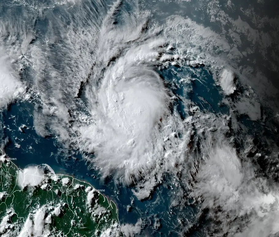
Beryl formed at 03:00 UTC on June 29 as the second named storm of the 2024 Atlantic hurricane season and reached hurricane status at around 21:00 UTC on the same day, with its center located about 1 160 km (720 miles) ESE of Barbados. The system had a minimum central pressure of 992 hPa and was moving W at a speed of 35 km/h (22 mph), according to the National Hurricane Center (NHC).
By 06:00 UTC on June 30, Beryl had maximum sustained winds of 150 km/h (90 mph) and a minimum central pressure of 983 hPa. It was located 850 km (530 miles) ESE of Barbados.
Beryl is racing westward at 31 km/h (20 mph) while rapidly intensifying. A continued quick westward to west-northwestward motion is expected during the next few days.
On the forecast track, the center of Beryl is expected to move across the Windward Islands early on Monday, July 1 (LT), and across the southeastern Caribbean Sea on Monday night and Tuesday.

Rapid strengthening is forecast over the next day or so, and Beryl is expected to become a dangerous major hurricane before it reaches the Windward Islands.
Hurricane-force winds extend outward up to 30 km (15 miles) from the center and tropical-storm-force winds extend outward up to 110 km (70 miles).
Hurricane conditions are expected in the hurricane warning area beginning early on Monday. Devastating wind damage is expected where the eyewall of Beryl moves through portions of the Windward Islands.
Tropical storm conditions are expected in the tropical storm warning area starting tonight, making outside preparations difficult or dangerous. Tropical storm conditions are possible within the watch area starting tonight.

A life-threatening storm surge will raise water levels by as much as 2.1 to 2.4 m (5 to 7 feet) above normal tide levels in areas of onshore flow near where Beryl makes landfall in the hurricane warning area. Near the coast, the surge will be accompanied by large and destructive waves.
Beryl is expected to produce rainfall totals of 75 to 150 mm (3 to 6 inches) across Barbados and the Windward Islands tonight into Monday, according to NHC This rainfall may cause flooding in vulnerable areas.

Swells generated by Beryl are expected to reach the Windward and southern Leeward Islands by this evening. These swells are likely to cause life-threatening surf and rip current conditions.
Residents living in Hurricane Warning areas should rush their preparations to protect life and property. Interests elsewhere in the Lesser Antilles should closely monitor the progress of this hurricane as additional watches and warnings may be required later.
References:
1 Hurricane Beryl Intermediate Advisory Number 6A – NWS/NHC – 06:00 UTC on June 30, 2024
Featured image credit: Tropical Cyclone “Beryl” at 20:20 UTC on June 29, 2024. Credit: NOAA/GOES-East, RAMMB/CIRA, The Watchers
Commenting rules and guidelines
We value the thoughts and opinions of our readers and welcome healthy discussions on our website. In order to maintain a respectful and positive community, we ask that all commenters follow these rules.