High-level eruption at Manam volcano, ash to 15.2 km (50 000 feet) a.s.l., P.N.G.
A new high-level eruption took place at Papua New Guinea's Manam volcano at around 04:25 UTC on January 11, 2019. The Aviation Color Code is Red.
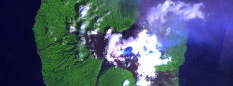
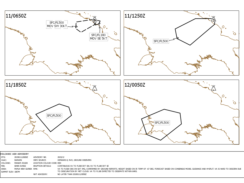
According to the Darwin VAAC, the eruption produced a column of ash rising up to 15.2 km (50 000 feet) above sea level. The volcanic ash was observed on satellite imagery and confirmed by ground reports.
Volcanic ash is hard to discern due to obscuration by meteorological cloud, the center said 06:51 UTC. Volcanic ash to 5.5 km (18 000 feet) a.s.l. is expected to dissipate within 6 hours.
Another powerful eruption was detected at the volcano around 21:00 UTC on January 7, 2019. Volcanic ash rose to 16.7 (55 000 feet) a.s.l.
It was the highest plume produced by the volcano since 2015 when VA rose to 19.8 km (65 000 feet) a.s.l.
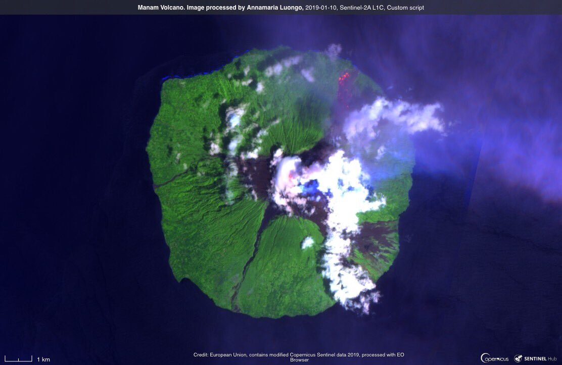
Image via annamaria
The Rabaul Volcano Observatory's assistant director Ima Itikarai said the eruption on January 7th came from Manam's southern crater. "While the observatory is monitoring the eruption remotely, an eye-witness has confirmed plumes of ash and scoria, and a lava flow from the crater to the coast."
"Two villages on the south-east of the island were showered in scoria rocks of 2 cm (0.8 inches) in diameter," Itikarai said, adding that the situation on the island is volatile and there is a risk of activity intensifying.
If monitoring equipment indicated a severe eruption it would be difficult to get a timely warning to Manam, Itikarai said, as reported by Radio New Zealand.
"And that is one problem that we have experienced in the country is that we send out information to the authorities. But the challenge is for that information all going down to the affected communities and in this case Manam."
It is up to the provincial administration to ensure people on Manam had the information they need to avoid eruptions, he said.
RVO urged residents and tourists to stay away from the four main valleys where lava flow, pyroclastic flow, could be channeled into. He also warned of the potential for mudslides given the ash and scoria fall mixing with current heavy rains.
Manam has previously experienced similar mudslides which have destroyed houses.
Geological summary
The 10-km-wide (6.2 miles) island of Manam, lying 13 km (8 miles) off the northern coast of mainland Papua New Guinea, is one of the country's most active volcanoes. Four large radial valleys extend from the unvegetated summit of the conical 1 807-m-high (5 928 feet) basaltic-andesitic stratovolcano to its lower flanks.
These "avalanche valleys" channel lava flows and pyroclastic avalanches that have sometimes reached the coast. Five small satellitic centers are located near the island's shoreline on the northern, southern, and western sides.
Two summit craters are present; both are active, although most historical eruptions have originated from the southern crater, concentrating eruptive products during much of the past century into the SE valley.
Frequent historical eruptions, typically of mild-to-moderate scale, have been recorded since 1616. Occasional larger eruptions have produced pyroclastic flows and lava flows that reached flat-lying coastal areas and entered the sea, sometimes impacting populated areas. (GVP)
Featured image: Manam volcano on January 10, 2019 as seen by Sentinel-2A satellite. Image processed by Annamaria Luongo
Commenting rules and guidelines
We value the thoughts and opinions of our readers and welcome healthy discussions on our website. In order to maintain a respectful and positive community, we ask that all commenters follow these rules.