Super Typhoon “Chaba” slams Okinawa, over 8 000 urged to evacuate Kume Island, Japan
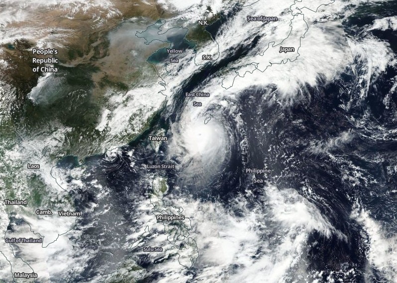
Typhoon "Chaba" has exploded in intensity during its last hours of approach to the Japanese Okinawa Islands and became a super typhoon. As of 12:00 UTC, Chaba was expected to pass dangerously close or over the Kume Island in Okinawa Prefecture with maximum sustained winds of 268 km/h (166 mph) and gusts to 324 km/h (201 mph).
Over 8 000 people were recommended to evacuate earlier today, Kume Island authorities said in a statement.
Exceptionally strong winds, dangerous storm surge and very heavy rainfall are now affecting the region.
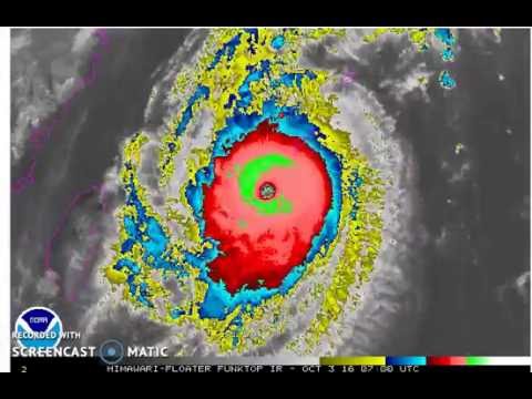
Video courtesy Robert Speta, WestPacWX
Chaba became a Category 5 hurricane equivalent at 06:00 UTC on October 3, with maximum sustained winds of 268 km/h (166 mph) and gusts to 324 km/h (201 mph).
The typhoon is expected to continue intensifying and peak around 18:00 UTC today with maximum sustained winds of 278 km/h (172 mph) and gusts to 333 km/h (207 mph).
It will then start to weaken and have maximum sustained winds near 200 km/h (124 mph) by 18:00 UTC on Tuesday, October 4, when it is expected to start its track between South Korea and Japan.
Japan could see large rainfall totals with the risk of flooding and landslides as Chaba moves along the country.
This is happening while most of the public attention is focused on Hurricane "Matthew," an extremely dangerous hurricane now approaching Haiti and Cuba.
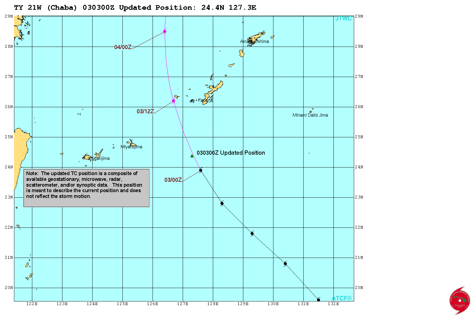
Super Typhoon "Chaba" updated position by JTWC at 03:00 UTC on October 3, 2016
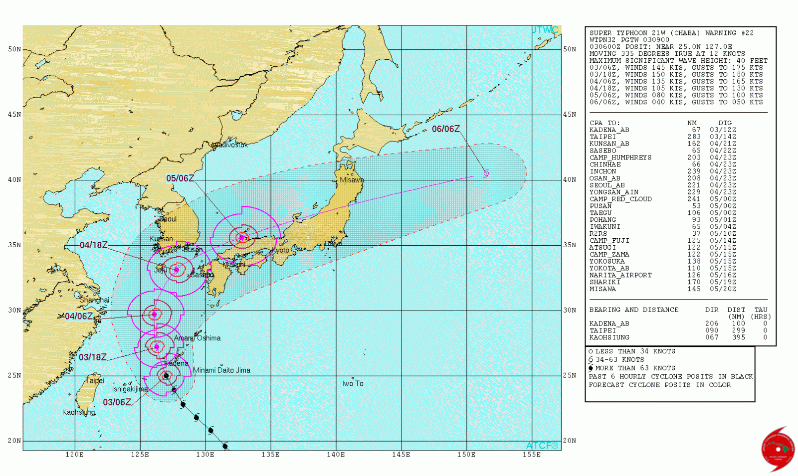
Super Typhoon "Chaba" forecast track by JTWC at 09:00 UTC on October 3, 2016
Super Typhoon "Chaba" on October 3, 2016. Credit: NASA/NOAA/DoD Suomi NPP/VIIRS
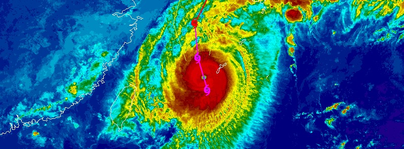
Featured image: Super Typhoon "Chaba" over Okinawa at 11:30 UTC on October 3, 2016. Credit: UW-CIMSS
Commenting rules and guidelines
We value the thoughts and opinions of our readers and welcome healthy discussions on our website. In order to maintain a respectful and positive community, we ask that all commenters follow these rules.