Satellite images show hot lava at Anak Krakatau, Indonesia
The activity at Indonesia’s Anak Krakatau volcano has calmed down after an intense eruption on April 24, 2022, ejected ash up to 6 km (20 000 feet) above sea level. The Alert Level remains at 3.
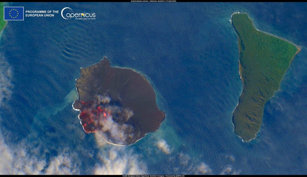
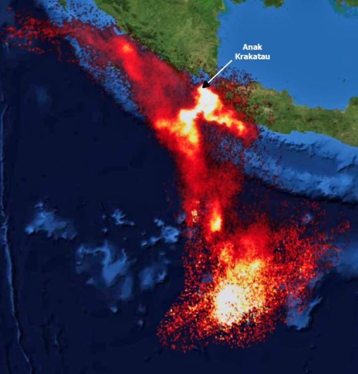
The latest satellite image acquired by Sentinel-2 at 03:28 UTC on April 27 shows the thermal signature of the lava flow in the crater area, covering approximately 1/5th of the island.
Thanks to PVMBG, we have the latest overflight video recorded on April 28.
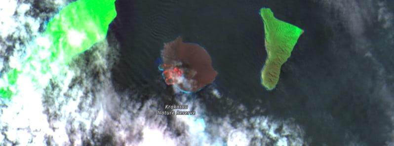
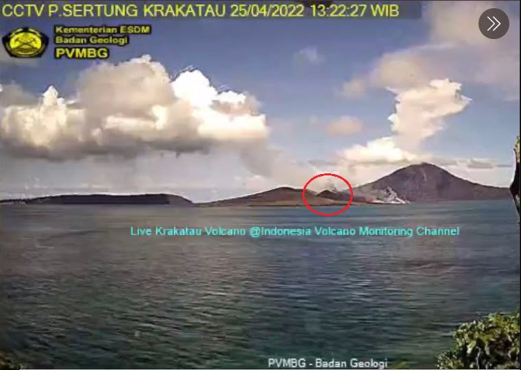
A surveillance webcam image acquired on April 25, one day after the intense eruption, appears to show a new spatter cone has formed at the volcano.
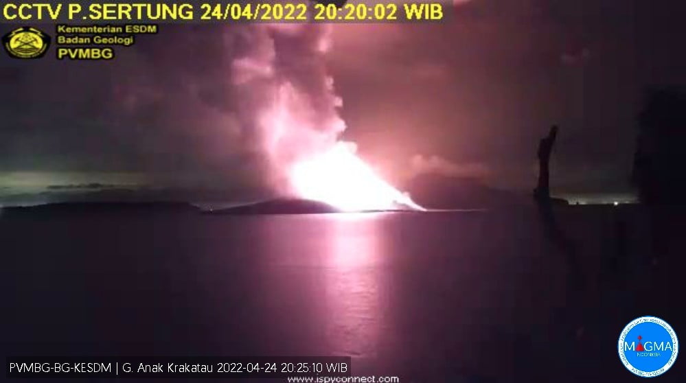
The eruption on Sunday, April 24, 2022, took place at 05:00 UTC, ejecting ash up to 3.1 km (10 100 feet) above sea level, according to the Anak Krakatau Volcano Observatory.1
The Darwin VAAC estimated volcanic ash cloud top at 6 km (20 000 feet) a.s.l. at 13:40 UTC.
The volcano has erupted at least 21 times in recent weeks but Sunday’s eruption was the largest yet.
Geological summary
The renowned volcano Krakatau (frequently misstated as Krakatoa) lies in the Sunda Strait between Java and Sumatra. The collapse of the ancestral Krakatau edifice, perhaps in 416 CE, formed a 7 km (4.3 miles) wide caldera.
Remnants of this ancestral volcano are preserved in Verlaten and Lang Islands; subsequently Rakata, Danan and Perbuwatan volcanoes were formed, coalescing to create the pre-1883 Krakatau Island. Caldera collapse during the catastrophic 1883 eruption destroyed Danan and Perbuwatan volcanoes and left only a remnant of Rakata volcano.
This eruption, the 2nd largest in Indonesia during historical time, caused more than 36 000 fatalities, most as a result of devastating tsunamis that swept the adjacent coastlines of Sumatra and Java. Pyroclastic surges traveled 40 km (25 miles) across the Sunda Strait and reached the Sumatra coast.
After a quiescence of less than a half-century, the post-collapse cone of Anak Krakatau (Child of Krakatau) was constructed within the 1883 caldera at a point between the former cones of Danan and Perbuwatan. Anak Krakatau has been the site of frequent eruptions since 1927.2
References:
1 Intense explosive eruptions at Anak Krakatau, Alert Level raised to 3, Indonesia – The Watchers – April 24, 2022
2 Krakatau – Geological summary – GVP
Featured image: Anak Krakatau on April 27, 2022. Credit: Copernicus EU/Sentinel-2, The Watchers
The slight decrease in the activity is just the calm before the storm. The activity of all hot spot volcanoes around the globe is increasing and will increase further. The reason has to do with the current state of the magnetic field of the earth and the changing sun. Now even moderate solar flares have noticeable effect on earth’s magnetic field. So, you can imagine what will happen when the activity of the sun will increase and the peak of solar maximum will be reached.
Lies, Lies and More Lies About Earthquakes At Yellowstone Super Volcano
https://www.youtube.com/watch?v=C54b3-fqDL8