Intense explosive eruptions at Anak Krakatau, Alert Level raised to 3, Indonesia
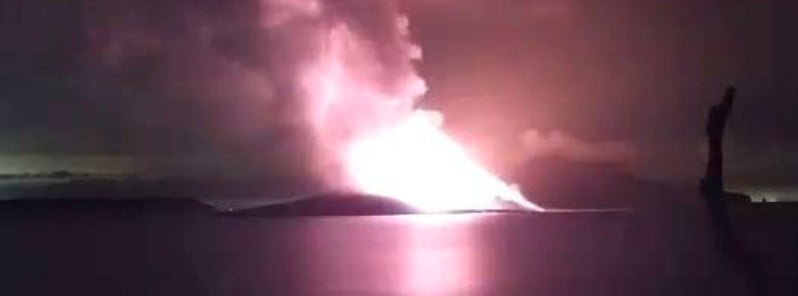
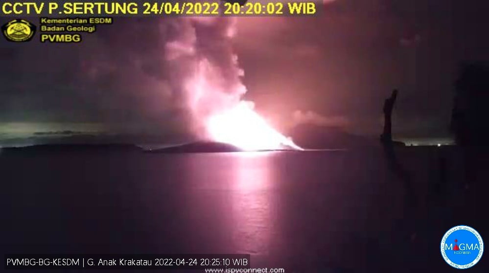
Activity at Indonesia’s Anak Krakatau volcano increased over the past 10 days, forcing authorities to raise the alert level from Level 2 to 3 on April 24, 2022. The volcano has erupted at least 21 times in recent weeks but today’s eruption was the largest yet.
Seismicity at the volcano increased sharply on April 5, followed by notable deformation starting on April 18 and even more pronounced since April 22.
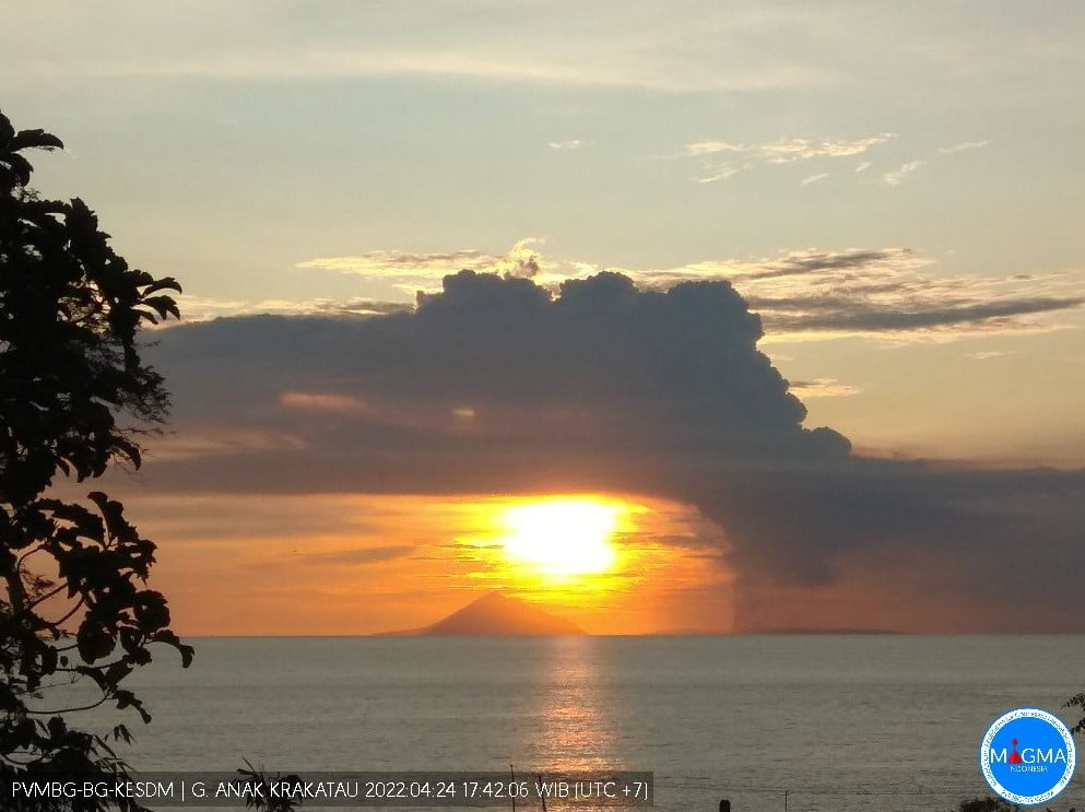
The volcano is in a continuous eruptive period with changes from predominantly ash-dominant eruption to strombolian type, producing incandescent lava on April 17. Lava flow was observed entering the sea at around 12:19 LT on April 23.1
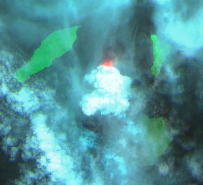
The eruption on April 24 took place at 05:00 UTC, ejecting ash up to 3.1 km (10 100 feet) above sea level, according to the Anak Krakatau Volcano Observatory.
The Darwin VAAC estimated volcanic ash cloud top at 6 km (20 000 feet) a.s.l. at 13:40 UTC. On April 23, the center raised the Aviation Color Code for the volcano from Orange to Red.
“We are still recording continuous eruptions with thick clouds towering at between 500 to 3 000 m (1 640 to 9 800 feet) from the peak,” Deny Mardiono of Indonesia’s Geological Agency told AFP on April 24.
Anak Krakatau has erupted at least 21 times in recent weeks but Sunday’s eruption was the largest yet, Mardiono said.
SO2 emission data based on monitoring satellite Sentinel-5 (Tropomi) shows SO2 emissions began to be observed on April 14 with 28.4 tons/day.
SO2 emission increased to 68.4 tons/ day on April 15, to 181.1 tons/day on April 17, and then drastically to 9 219 tons/day on April 23.
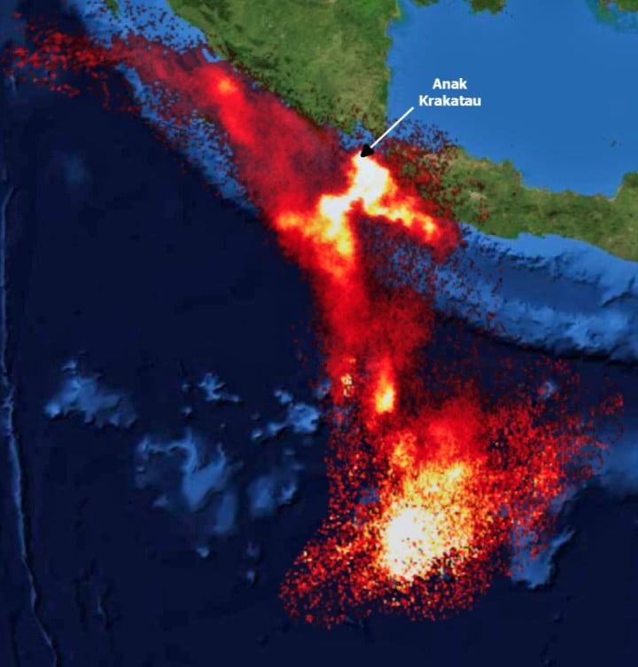
A significant increase in SO2 indicates a new magma supply and magmatic material that comes out to the surface in the form of ejection of incandescent material followed by lava flows.
The amount of SO2 since April 14 reached 9.2 kilotons. In the 2018 eruption period, namely June-August 2018, the SO2 amount reached 12.4 kilotons, and from September to October 19.4 kilotons.
Based on visual and instrumental monitoring data as well as SO2 emission monitoring, the activity of the volcano has an increasing trend and has not shown a decrease in volcanic activity, PVMBG said.
Map of Disaster Prone Areas (KRB) shows that almost the entire body of Mount Krakatau with a diameter of ± 2 km (1.2 miles) is a disaster-prone area.
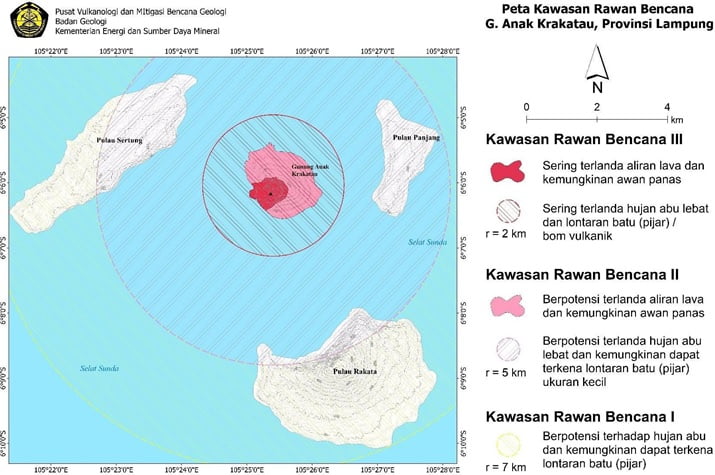
Based on visual and instrumental data, the potential hazard from the current activity is the ejection of incandescent material within a radius of 2 km from the center of the eruption, but it is possible that the material reaches even longer distances.
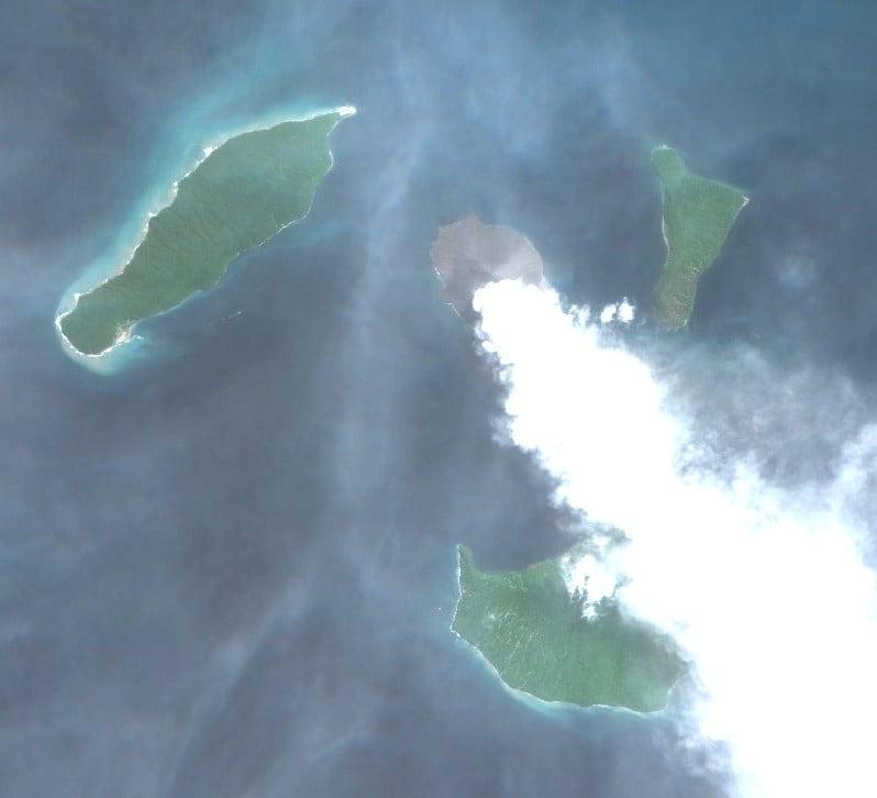
While the distribution of volcanic ash depends on the direction and speed of the wind, ash can reach more distant areas.
The public, including visitors, tourists and climbers are not allowed to approach Anak Krakatau within a 5 km (3.1 miles) radius.
Geological summary
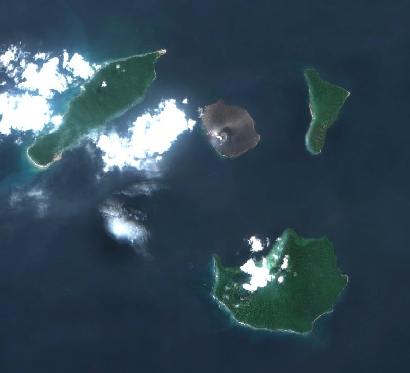
The renowned volcano Krakatau (frequently misstated as Krakatoa) lies in the Sunda Strait between Java and Sumatra. The collapse of the ancestral Krakatau edifice, perhaps in 416 CE, formed a 7 km (4.3 miles) wide caldera.
Remnants of this ancestral volcano are preserved in Verlaten and Lang Islands; subsequently Rakata, Danan and Perbuwatan volcanoes were formed, coalescing to create the pre-1883 Krakatau Island. Caldera collapse during the catastrophic 1883 eruption destroyed Danan and Perbuwatan volcanoes and left only a remnant of Rakata volcano.
This eruption, the 2nd largest in Indonesia during historical time, caused more than 36 000 fatalities, most as a result of devastating tsunamis that swept the adjacent coastlines of Sumatra and Java. Pyroclastic surges traveled 40 km (25 miles) across the Sunda Strait and reached the Sumatra coast.
After a quiescence of less than a half-century, the post-collapse cone of Anak Krakatau (Child of Krakatau) was constructed within the 1883 caldera at a point between the former cones of Danan and Perbuwatan. Anak Krakatau has been the site of frequent eruptions since 1927.2
References:
1 MAGMA Indonesia – Press release – April 24, 2022
2 Anak Krakatau – Geological summary – GVP
Featured image credit PVMBG
In physical reality, and not according to current science, the final stage in the reversal process of earth’s magnetic field is always-and has to be- accompanied by the eruption of so many volcanoes, particularly those volcanoes that are linked to deep mantle plumes. When the energy at the core of the earth reached a threshold level and that happens during the final phase of the reversal process, the mantle plumes will reach the surface and will be released in a form of huge volcanic eruption. In fact, this process is identical to the reversal process of the solar magnetic field although the time scale is different of course. The sun’s magnetic field changes polarity at the peak of each solar cycle (when the excess is released). However, since current science does not know what causes the earth and the sun to change their magnetic fields, scientists are puzzled about the current events that are taking place on our planet.
Volcanoes and blobs: Earth’s interior is more mobile than we thought https://bigthink.com/hard-science/blobs-in-earths-mantle/
The Earth’s magnetic field is weakening and scientists don’t know why https://www.ctvnews.ca/sci-tech/the-earth-s-magnetic-field-is-weakening-and-scientists-don-t-know-why-1.4986480