Aviation Color Code for Semisopochnoi volcano raised to Orange, Alaska

A high-resolution satellite image acquired on February 7, 2021, shows a second small ash deposit extending at least 3 km (1.8 miles) to the northeast from North Cerberus Crater on Semisopochnoi Island, similar to the first observed on February 6.
Clouds obscured views into the crater and the southern side of the volcano.
Any ash clouds associated with these deposits have not been observed and are likely low-level (below 3 km (10 000 feet)) and short-duration, the Alaska Volcano Observatory (AVO) said.
Because of evidence for continued low-level ash emissions, AVO has raised the Aviation Color Code to ORANGE and the Volcano Alert Level to WATCH at 23:11 UTC on February 8.
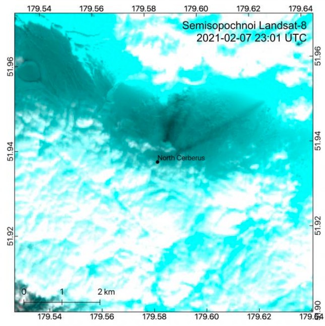
Narrow dark streaks of ash on top of snow extend >3 km (1.8 miles) from the crater of North Cerberus on Semisopochnoi Island. Clouds obscure much of the area in this image captured on 23:01 UTC on February 7, 2021, but these ash streaks reveal that low-level explosive activity is taking place in the crater of North Cerberus. Credit: USGS/AVO/Landsat-8, Hannah Dietterich
Small eruptions producing minor ash deposits within the vicinity of the volcano are typical of activity during unrest at Semisopochnoi since September 2018.
New explosions could occur at any time with no warning.
Semisopochnoi is monitored remotely by satellite and lightning sensors.
An infrasound array on Adak Island could detect explosive emissions from Semisopochnoi with a 13-minute delay if atmospheric conditions permit.
Geological summary
Semisopochnoi, the largest subaerial volcano of the western Aleutians, is 20 km (12.4 miles) wide at sea level and contains an 8 km wide (5 miles) caldera. It formed as a result of the collapse of a low-angle, dominantly basaltic volcano following the eruption of a large volume of dacitic pumice.
The high point of the island is 1221 m high (4 005 feet) Anvil Peak, a double-peaked late-Pleistocene cone that forms much of the island's northern part.
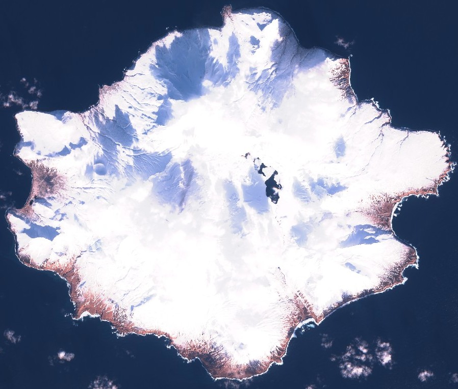
Semisopochnoi on February 6, 2021. Credit: Copernicus EU/Sentinel-2, TW
The three-peaked 774 m high (2 539 feet) Mount Cerberus volcano was constructed during the Holocene within the caldera. Each of the peaks contains a summit crater; lava flows on the northern flank of Cerberus appear younger than those on the southern side.
Other post-caldera volcanoes include the symmetrical 855 m high (2 903 feet) Sugarloaf Peak SSE of the caldera and Lakeshore Cone, a small cinder cone at the edge of Fenner Lake in the NE part of the caldera.
Most documented historical eruptions have originated from Cerberus, although Coats (1950) considered that both Sugarloaf and Lakeshore Cone within the caldera could have been active during historical time.
This volcano is located within the Aleutian Islands, a UNESCO Biosphere Reserve property.
Featured image credit: USGS/AVO/Landsat-8, Hannah Dietterich
Commenting rules and guidelines
We value the thoughts and opinions of our readers and welcome healthy discussions on our website. In order to maintain a respectful and positive community, we ask that all commenters follow these rules:
We reserve the right to remove any comments that violate these rules. By commenting on our website, you agree to abide by these guidelines. Thank you for helping to create a positive and welcoming environment for all.